Estimated reading time: 13 minutes
Last updated: 4 September 2026
Do You Need a Permit to Climb Mount Pico?
Yes — every climber must register in advance at Casa da Montanha, the control post at the trailhead, and carry a mandatory GPS tracker. Registration costs €25 to reach the summit cone (Piquinho) or €15 for the crater only. Portugal’s highest peak at 2,351 metres, Mount Pico is a tough 6–8-hour round trip over steep volcanic scree, so a certified guide is required for anyone without solid mountaineering experience.
Research Behind This Guide
This guide draws from Portugal’s official tourism resources, hiking trail data, and weather records current as of publication. Since conditions on Mount Pico change seasonally, we recommend checking local hiking forums and the Pico Island visitor center for the latest trail updates before planning your climb.
Want to see the summit for yourself? Watch our Mount Pico climb in 4K Ultra HD.
The Mount Pico hike is one of the most challenging and great climbs in Portugal. Period. You’re not strolling through vineyards here. This is a full-day alpine push up loose volcanic rock with no shade and weather that changes every twenty minutes.
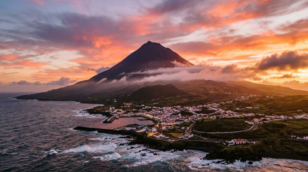
Mount Pico rises 2,351 meters above the Atlantic Ocean on Pico Island in the Azores archipelago. According to the Portuguese Geographic Institute, this makes it not just Portugal’s highest point but also the third-tallest mountain in the Atlantic when measured from the seafloor. The mount pico volcano last erupted in 1720, and the IPMA Volcanic Monitoring system tracks its activity continuously. It’s still classified as active.
The summit crater sits at the top of a near-perfect volcanic cone. On clear days, you can see neighboring islands across open water. Most days aren’t clear. Clouds roll in from nowhere, temperatures drop fifteen degrees in ten minutes, and the wind tries to shove you sideways. Azores Regional Government data shows roughly 5,000 climbers attempt the summit annually. Not all of them make it.
This is a demanding climb. You’ll need proper boots, layers, food, and either a licensed guide or solid mountain experience. Visit Azores recommends starting before sunrise to avoid afternoon cloud cover. The trail is steep, the footing is loose, and the altitude hits harder than you expect on an island. But if you want to stand on top of Portugal, this is where you do it.
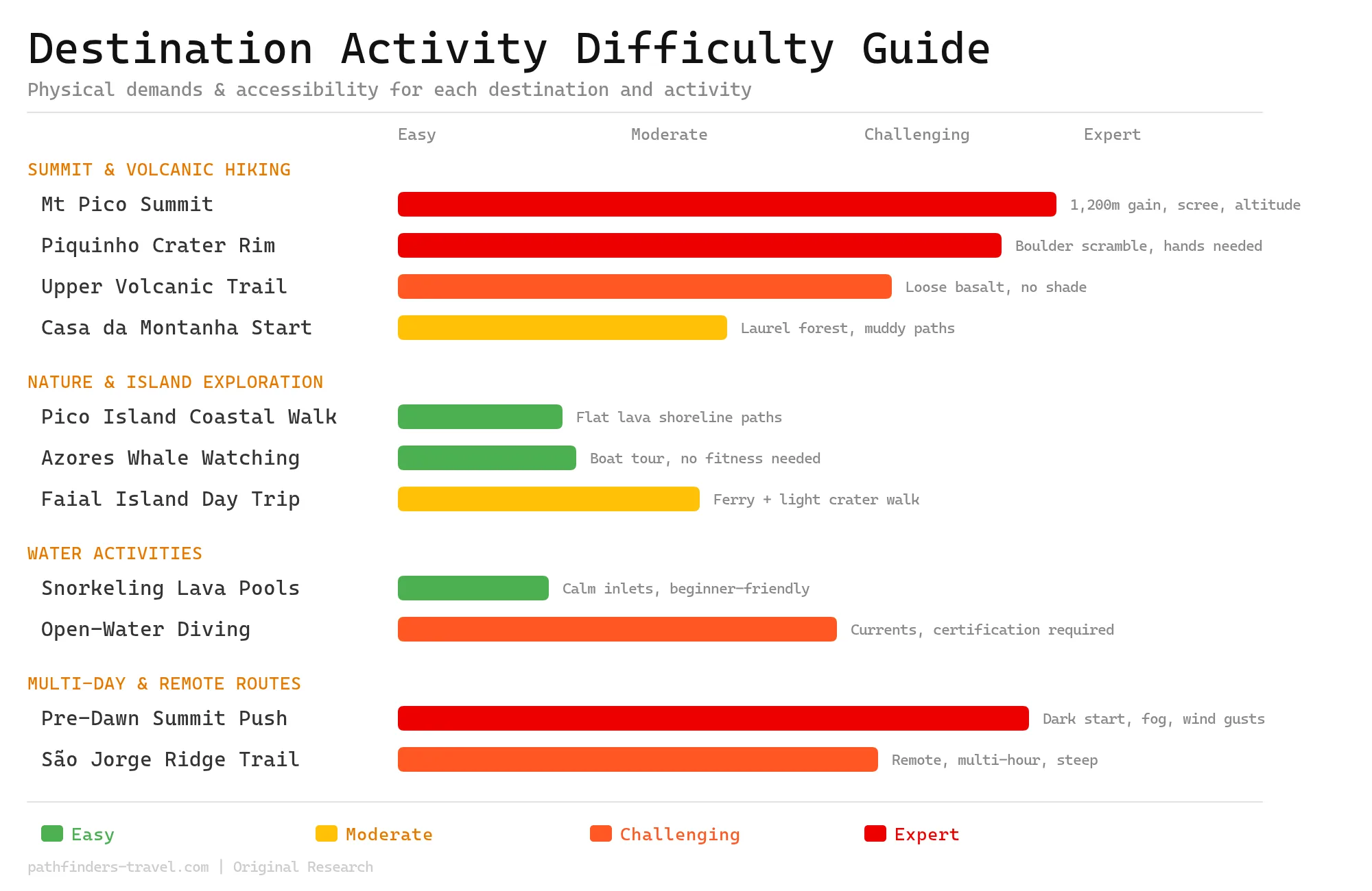
Activity Difficulty Guide
Mount Pico demands serious preparation, its 2,351-metre volcanic summit is rated expert level, with loose scree, unpredictable Atlantic weather, and technical scrambling near the top. While the island also offers gentle coastal walks and easy snorkelling pools, most visitors come specifically for the summit challenge, so the overall difficulty skews high. Assess your fitness honestly and build in buffer days for weather windows before attempting the climb.
The Mount Pico Summit Experience
The Mount Pico climb covers 7.6 kilometers round-trip with 1,200 meters of elevation gain, typically taking 6-8 hours with summit views extending across the entire Azores archipelago.
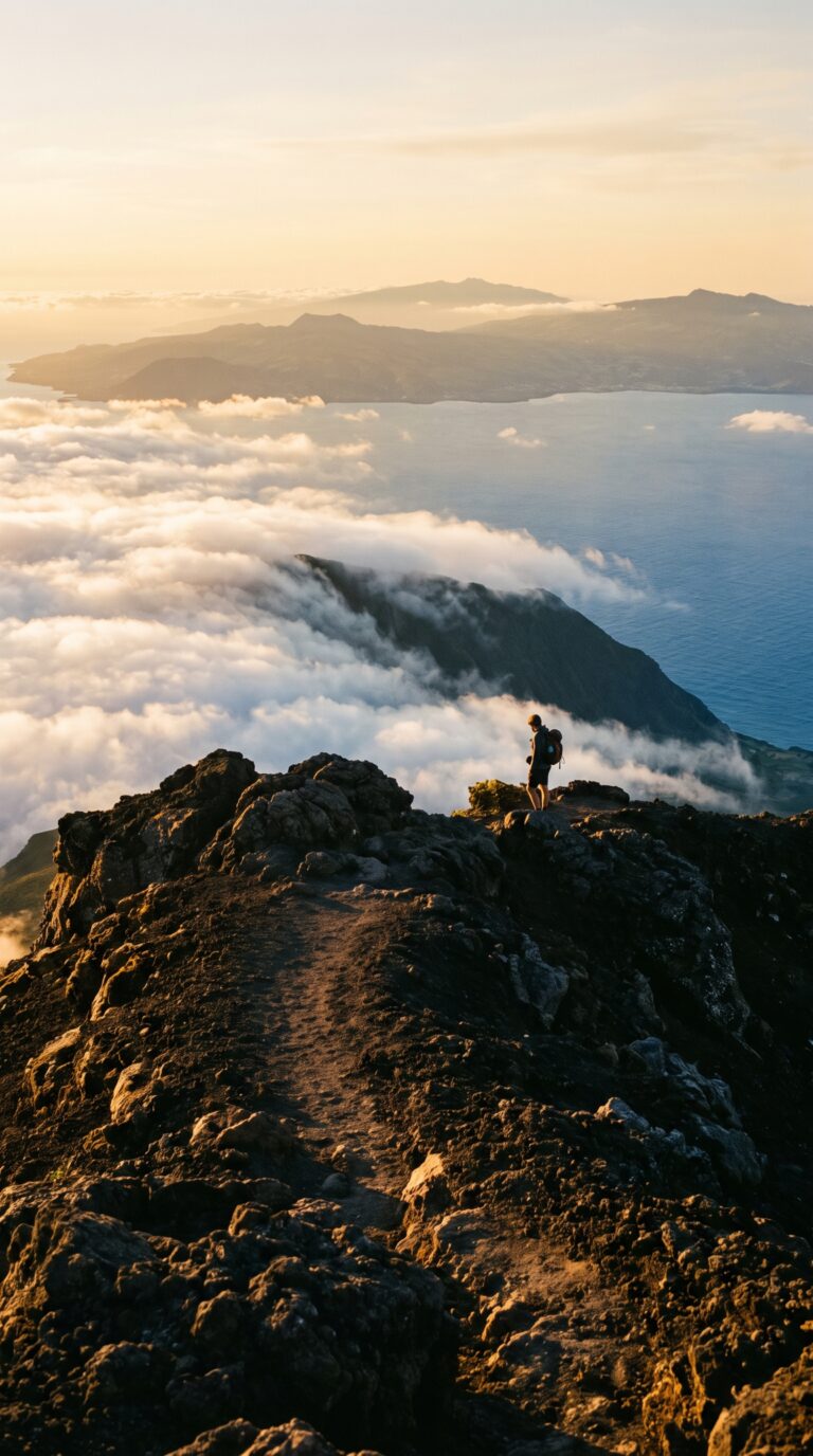
The trail starts at Casa da Montanha (Mountain House) at 1,200 meters elevation. You begin in a laurel forest section. Dense vegetation. Muddy when it rains. This part lasts maybe 30 minutes.
Then the trees disappear. Mount Pico turns into volcanic scree, loose black rocks that slide under your boots. The slope steepens. You’re climbing on sharp basalt chunks the size of your fist. No shade. Wind picks up.
According to the Official Mount Pico trail map, the mount pico hike distance measures exactly 7.6 kilometers round-trip with 1,200 meters of elevation gain from the trailhead. Most climbers take 3-4 hours going up. Coming down takes 2-3 hours if you don’t slip on the scree.
The upper sections get technical. Exposed ridges with drop-offs on both sides. Handholds required. The final push to Piquinho, the actual summit cone, involves scrambling over boulders. You use your hands. The altitude hits around 2,200 meters. Some people feel lightheaded.
Weather changes fast when hiking mount pico azores. Clouds roll in from the Atlantic within minutes. Temperature drops 10 degrees. Wind gusts reach 60 km/h at the exposed sections. You might start in sunshine and finish in fog.
The summit itself is a volcanic crater. Piquinho rises as a small cone inside the larger caldera. Steam vents, fumaroles, hiss from cracks in the rock. The ground feels warm near these vents. You can smell sulfur. Some climbers heat their lunch over the steam.
The mount pico summit delivers 360-degree views on clear days. You see Faial Island 7 kilometers west. São Jorge Island stretches to the north. Terceira sits 50 kilometers away. On exceptional days, you spot five other Azores islands. The Atlantic Ocean extends in every direction, dark blue water meeting lighter blue sky.
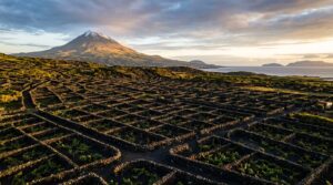
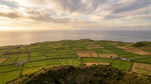
Below, Pico Island’s UNESCO-protected vineyards form geometric black stone patterns along the coast. The lava rock walls look like maze lines from this height. Towns appear as white dots. Boats in the harbors look like toys.
The volcanic features tell the mountain’s story. Piquinho last erupted in 1720. The summit cone formed during that eruption. Lava flows created the scree fields you climbed through. The fumaroles prove the volcano remains active, just sleeping, not dead.
Climbing mount pico demands fitness. The altitude affects even trained hikers. The loose rock tests your ankles. The technical sections near the top require confidence with exposure. Park management reports a 75% summit success rate during summer months, per 2025 data from the Azores Regional Government. Weather turns back most unsuccessful attempts.
The descent punishes your knees. The scree slides underfoot. You half-run, half-slide down sections. Your quads burn. Trekking poles help. Most people reach the base station exhausted but satisfied. The mount pico view from the top makes the leg pain worthwhile.
Getting to Mount Pico and Pico Island
Pico Island is reached by direct flights to Pico Airport from Lisbon or inter-island ferries from São Miguel’s Ponta Delgada, with the Mount Pico trailhead a 30-minute drive from Madalena town.
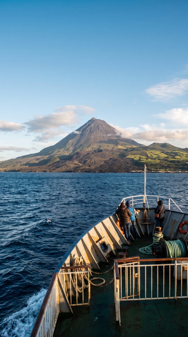
Where is Mount Pico located? It sits on Pico Island, smack in the middle of the Azores archipelago. Getting there requires two steps: reach the island, then drive to the mountain.
Flights land at Pico Airport (João Paulo II Airport). SATA Air Açores inter-island flights run direct from Lisbon in about 2 hours 15 minutes, according to SATA’s official schedule. You can also fly from São Miguel if you’re island-hopping. Book early in summer, seats fill fast.
Ferries offer a cheaper route. Atlânticoline ferry schedule and booking shows crossings from Horta on Faial Island to Madalena in just 30 minutes. Longer routes run from Ponta Delgada on São Miguel, taking around 3 hours per Atlânticoline’s timetable. Seas can get rough. Pack motion sickness pills.
Rent a car in Madalena. You need wheels. The Casa da Montanha base station sits about 30 minutes inland on winding roads. GPS coordinates work better than addresses here. Parking at the trailhead is free but fills up by 6 AM in peak season.
Registration is mandatory before you climb. Stop at Casa da Montanha to check in and pay the trail fee. Most climbers sleep in Madalena the night before, hotels there outnumber options near the mountain.
Exploring the Azores Beyond Mount Pico
Pico Island’s location in the central Azores provides ferry access to Faial’s Capelinhos Volcano, Terceira’s Algar do Carvão lava tube, and São Miguel’s Sete Cidades and Furnas within 30-90 minutes.
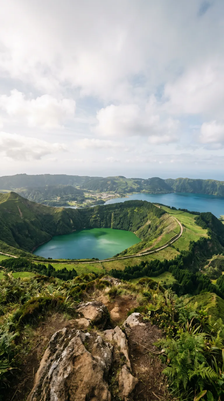
Pico sits in the middle of the archipelago. This makes island-hopping easy. You can reach five other islands without flying.
Start with Pico itself. The UNESCO World Heritage Centre – Pico Island Vineyard Culture listing recognizes the black lava stone walls that crisscross the island’s lowlands. These currais protect vines from salt spray and wind. Walk through them near Madalena. Lajes do Pico offers year-round whale watching, sperm whales feed in the deep channels between islands. Coastal lava pools at Cachorro and Calheta das Nesquim provide free swimming spots carved by volcanic rock.
Faial Island sits 30 minutes away by ferry. Horta marina displays painted murals from visiting sailors, over 3,000 at last count. The Capelinhos Volcano erupted in 1957 and buried a lighthouse in ash. The interpretation center sits half-underground at the site. Caldeira do Faial crater hike takes two hours around the rim, look for endemic plants in the caldera below.
São Miguel requires a longer ferry (several hours) or a 30-minute flight. Sete Cidades twin lakes fill a volcanic crater, one appears blue, one green, depending on light and algae. Furnas valley steams with hot springs. Locals cook cozido stew underground using geothermal heat. Lagoa do Fogo crater lake sits at 575 meters elevation. Nordeste region packs 32 waterfalls into 100 square kilometers. Ponta da Ferraria thermal pools mix ocean water with volcanic heat, best visited at low tide. Caldeira Velha hot springs charge €10 entry for warm waterfall pools (€3 to visit without bathing). Gorreana Tea Plantation grows Europe’s only tea on volcanic soil. Mosteiros black sand beach faces offshore rock formations. Ilhéu de Vila Franca do Campo nature reserve allows 400 daily visitors to swim in a flooded crater.
Terceira Island holds Angra do Heroísmo, a UNESCO historic center with 16th-century fortifications. Algar do Carvão lava tube descends 90 meters to an underground lake. Serra do Cume viewpoint overlooks a patchwork of stone-walled fields.
Remote islands require more planning. Flores Island claims the title of westernmost point in Europe. Corvo Island holds 430 residents. Santa Maria Island offers the warmest water temperatures. Graciosa Island features Furna do Enxofre cave with a sulfur lake. São Jorge Island‘s recognizable fajãs, flat coastal platforms formed by landslides, create isolated farming communities accessible only by steep trails.
The Visit Azores site lists current ferry schedules. Atlânticoline operates inter-island routes year-round.
Essential Planning: Permits, Guides, and Conditions
Mount Pico requires advance registration at Casa da Montanha and a mandatory GPS tracker; the fee is €25 to the summit (€15 to the crater only), with 6am starts in summer and certified guides mandatory for inexperienced climbers and recommended for all.
Registration is mandatory. You can’t just show up and start climbing. Book your permit through the Casa da Montanha official reservation system at least 48 hours before your planned climb. Summer weekends fill up weeks ahead. The €25 summit fee (€15 for the crater only) includes access to the trail and basic safety monitoring. According to the Azores Regional Government, approximately 12,000 climbers register annually, with 85% attempting the summit between June and September when weather windows are most reliable.
Guides are mandatory if you lack mountaineering experience. Casa da Montanha defines this as previous high-altitude hiking above 2,000 meters. Even if you qualify to climb solo, hiring a certified guide costs €40-60 per person for group climbs. They know when to turn around. Weather shifts in 20 minutes on this mountain. Fog erases the trail markers. A guide has climbed Pico 200+ times and reads conditions you’ll miss.
Technically, experienced climbers can go without a guide. You must demonstrate previous alpine experience during registration. The volcanic scree is loose. Navigation gets tricky above 2,000 meters when clouds roll in. Most solo climbers still hire guides for their first attempt. The mountain doesn’t care about your ego.
June through September offers the best weather. Summer climbs start at 6am to avoid afternoon clouds. Winter starts push to 8am but snow can cover the summit from November through March. Check IPMA weather forecasts for Pico the night before. Wind speeds above 40 km/h make the summit dangerous. Fog below 1,500 meters means you’ll see nothing. Turn back if conditions deteriorate.
Planning Tip
Pack sturdy hiking boots with ankle support. The volcanic rock shreds running shoes in an hour. Layered clothing is non-negotiable: base layer, fleece, windproof jacket. The summit sits 15°C colder than the base even in July. Bring 2+ liters of water. No refills exist above Casa da Montanha. Add high-energy snacks, sun protection, and a headlamp for pre-dawn starts. Trekking poles help on the descent when your knees are screaming.
Good cardiovascular fitness is essential. This isn’t a casual day hike. Previous experience on steep, loose terrain helps. Some climbers feel altitude effects above 2,000 meters. Headaches and dizziness mean you need to descend.
Stay on the marked trail. The fumaroles at the summit release steam hot enough to burn skin. Respect the volcanic environment. If weather turns, retreat immediately. Pride kills climbers. The mountain will still be here tomorrow.
Best Time to Visit
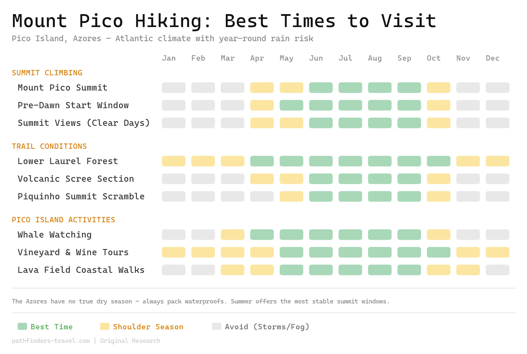
Mount Pico’s climbing season is tightly anchored to summer, with June through September offering the most stable weather windows and the lowest chance of dangerous summit fog. The Azores receive rainfall year-round, so even peak-season climbers should plan for rapidly changing conditions, afternoon clouds can obliterate summit visibility within minutes. Spring and autumn shoulder months (April, May and October) are viable for experienced hikers willing to gamble on weather, while winter storms make the upper volcanic scree genuinely dangerous.
Frequently Asked Questions
How long does it take to hike Mount Pico?
Plan for 6 to 8 hours round trip. The ascent takes 3 to 4 hours to reach the summit. The descent back down requires 2 to 3 hours. Summer season climbs start at 6am and return around 3pm. Winter season climbs start at 8am and return around 5pm. Arrive at Casa da Montanha 15 minutes before your scheduled start time to check in and get final weather updates.
How hard is Mount Pico to climb?
Mount Pico is rated challenging to difficult. You gain 1,200 meters of elevation over a 3.8-kilometer ascent. The trail crosses steep volcanic scree slopes with loose rock underfoot. You need good fitness and previous hiking experience. Altitude and weather increase the difficulty. The final summit scramble up Piquinho is technical. Beginners shouldn’t attempt this climb without a guide.
Can you climb Mount Pico without a guide?
Experienced mountaineers can legally climb solo. Guides are mandatory for inexperienced climbers. Guides are highly recommended for everyone due to rapid weather changes. The trail becomes difficult to follow in fog. Guides provide safety, navigation, and local knowledge about conditions. Solo climbing requires self-sufficiency and mountain experience. You must be comfortable with route-finding in poor visibility.
Is Mount Pico active?
Mount Pico is an active stratovolcano. The last eruption occurred in 1720, over 300 years ago. Fumaroles (steam vents) remain active at the summit. Portuguese authorities continuously monitor the volcano through the CIVISA Volcano Monitoring System. Mount Pico is considered dormant but not extinct. There’s no current eruption risk, and the mountain is safe to climb.
What is the height of Mount Pico?
Mount Pico stands at 2,351 meters (7,713 feet) above sea level. It’s Portugal’s highest mountain. It’s also the highest point in the entire mid-Atlantic ridge. The summit cone, called Piquinho, adds the final 70 meters to the climb. The mountain rises directly from sea level, making it visually dramatic from all angles.