Estimated reading time: 14 minutes
Last updated: 18 September 2026
Why Is Capelinhos Volcano Famous?
Capelinhos is famous as the Azores‘ youngest land, born from a dramatic 13-month eruption between September 1957 and October 1958 that buried a lighthouse to its second floor and added 2.4 square kilometres to Faial Island. Today an award-winning underground interpretation centre and a moon-like field of black ash draw geology lovers and history travellers to Faial’s western tip.
Want to see Faial’s volcanic landscape for yourself? Watch our complete Capelinhos exploration in 4K.
On September 27, 1957, fishermen off Faial’s coast watched the Atlantic Ocean boil. Steam columns shot 4,000 meters into the sky. The Capelinhos Volcano eruption had begun. For 13 straight months, explosions rocked the island. Ash buried homes. The lighthouse disappeared up to its second floor. When the eruption finally stopped in October 1958, Faial’s western tip looked like another planet.
This is the Azores’ youngest land. According to the Azores Geopark, the eruption created 2.4 square kilometers of new territory, though the Atlantic has since reclaimed about half of it. You can walk on ground that didn’t exist when Eisenhower was president.
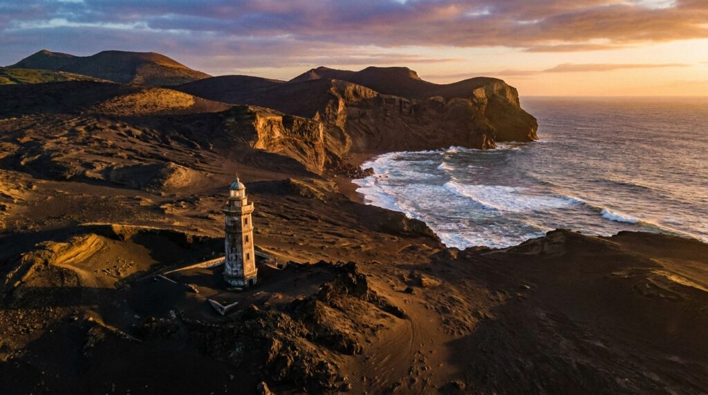
The landscape looks nothing like the rest of Faial. No green pastures. No hydrangeas. Just black ash, volcanic bombs the size of cars, and a half-buried red lighthouse standing in the wasteland. It’s the closest you’ll get to walking on the moon without leaving Earth.
The interpretation center dug into the hillside tells the whole story. You descend through volcanic layers, watching film footage of the actual eruption. Islanders evacuated. Buildings collapsed under ash. Thousands emigrated to America, mostly to California and Massachusetts, because their farms were destroyed.
Geology enthusiasts treat Capelinhos like a pilgrimage site. It’s textbook volcanism you can touch. But you don’t need a science degree to appreciate standing on land that exploded out of the ocean within living memory. This is raw Earth-building in action, frozen at the moment it stopped.
Research Sources
This guide draws from geological records, Portuguese tourism archives, and documented accounts of the 1957 eruption. All facts were verified as of writing, check with local visitor centers or Faial tourism for the latest site conditions and access details.
What to See and Do at Capelinhos Volcano
The Capelinhos Volcano Interpretation Centre features a 15-room underground museum documenting the 1957-58 eruption, plus access to climb the half-buried lighthouse for wide views.
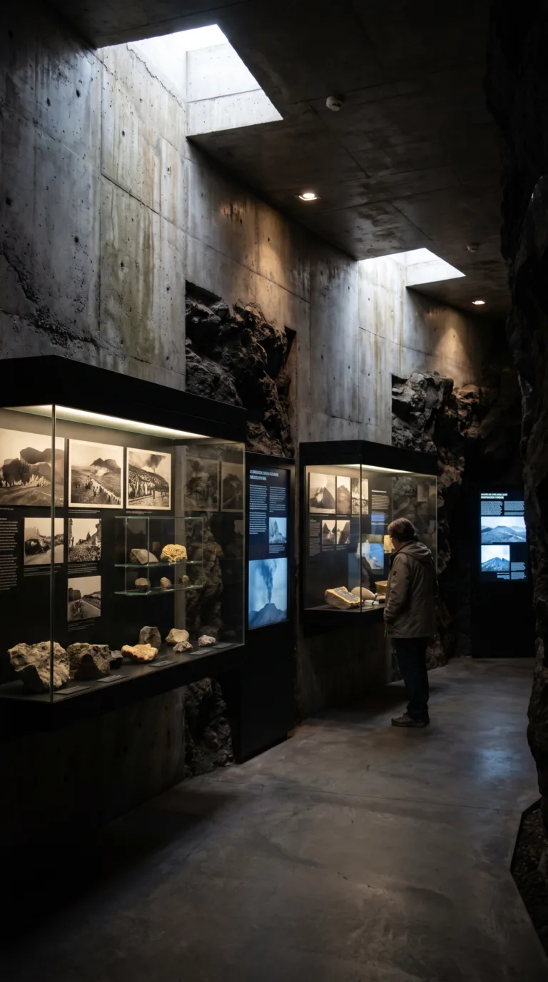
The Capelinhos Volcano Interpretation Centre sits underground, carved into the volcanic landscape. This award-winning museum doesn’t waste time with vague geological concepts. It shows you exactly what happened.
Fifteen exhibition rooms walk you through the eruption month by month. Photographs from 1957 show fishing boats fleeing ash clouds. Seismic readings spike across display screens. Survivor testimonies play on loop. You see the village of Capelo buried under meters of ash. You see families evacuating with whatever they could carry.
The multimedia displays hit hard. One room projects footage of the eruption onto the walls. Another reconstructs the sound of the explosions. The museum doesn’t romanticize the disaster. It documents it.
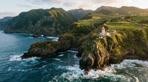
After the museum, climb the Farol dos Capelinhos lighthouse. The structure stands 20 meters tall with 183 steps to the top. Ash buried the lighthouse up to its mid-section during the eruption. Now it’s half-swallowed by black volcanic debris.
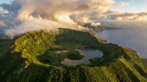
From the top, you get 360-degree views. The Atlantic crashes against the volcanic peninsula. The ash fields stretch toward the horizon. On clear days, you can see Caldeira do Faial, the island’s massive crater, to the east.
The real draw is walking the ash fields themselves. This is a monogenetic volcanic field. Capelinhos Volcano erupted once. It will never erupt again. The cone is dead.
Marked trails from the Azores Geopark – Capelinhos Volcano lead across the black terrain. The ground crunches under your feet. No vegetation. No life. Just volcanic rock and ash.
It feels like the moon. Some visitors say Mars. The landscape is completely alien. Black earth meets blue ocean in a sharp line.
The peninsula is eroding. The sea is slowly reclaiming the land. Winter storms tear chunks off the coastline each year. What you see today won’t look the same in 20 years.
Photography opportunities are everywhere. The half-buried lighthouse makes for dramatic shots. The ash fields create stark compositions. Coastal views show the violent contrast between land and sea. Weather changes fast here. Fog rolls in. Sun breaks through. Light shifts constantly.
Bring a wide-angle lens. The landscape demands it. Bring layers. Wind cuts across the exposed terrain. Bring sturdy shoes. The volcanic rock is sharp.
Most visitors spend two hours here. One hour in the museum. One hour walking the ash fields and climbing the lighthouse. That’s enough to understand what happened and see the aftermath up close.
Getting to Capelinhos Volcano
Capelinhos Volcano is located 30 kilometers west of Horta on Faial Island, accessible via a 30-minute drive along the ER1-1ª coastal road with free parking at the interpretation center.
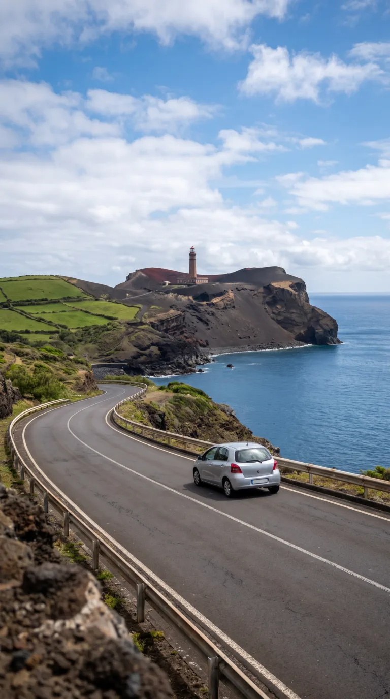
Rent a car. It’s the only practical way to reach Capelinhos and explore the rest of Faial without waiting around. Several rental agencies operate around Horta Marina.
The drive takes 30 minutes. Head west from Horta on the ER1-1ª coastal road. The pavement is smooth. Signs point the way clearly. You’ll pass green pastures before the landscape turns black and lunar near the volcano.
Park for free at the interpretation center. No fees. No hassle.
No public bus runs to Capelinhos. Taxis from Horta work if you don’t want to drive, just arrange a pickup time for the return trip. Expect to pay around €40 each way.
Organized tours bundle Capelinhos with Caldeira do Faial and other stops around the island. They’re convenient if you’re short on time. Most leave from Horta in the morning. Check Visit Azores – Faial Island for current operators.
Practical Information for Visiting
The Capelinhos Volcano Interpretation Centre opens daily 10:00–18:00 from June to September, and Tuesday–Friday 10:00–17:00 plus weekends and holidays 14:00–17:30 the rest of the year (closed Mondays), with adult tickets €10 including lighthouse access.
The centre keeps extended summer hours, open daily 10:00–18:00 from June 1 to September 30. From October through May it runs Tuesday to Friday 10:00–17:00 and weekends and holidays 14:00–17:30, and is closed Mondays. Adult admission is €10 (juniors and seniors €5, under-7s free, family ticket €20) per the Azores Natural Parks website, and covers both the underground museum and the lighthouse tower.
Block out two hours minimum. The interpretation center takes 45 minutes if you read everything. The lighthouse climb adds another 20 minutes. Walking the ash fields takes however long you want.
Morning visits offer the best light for photography and smaller crowds. Late afternoon delivers dramatic sunset conditions when golden light hits the black landscape. Check Visit Faial for current weather before heading out.
Capelinhos sits completely exposed to Atlantic winds. Bring a windproof jacket even in July. The wind here is relentless. Wear sturdy closed-toe shoes with good grip. Volcanic ash and loose rocks make sandals a bad idea. Layer your clothing because conditions shift fast.
The black terrain absorbs heat intensely during summer months. What looks like a cool, cloudy day can feel scorching when you’re standing on dark volcanic rock. Pack sunscreen and a hat.
The interpretation center is wheelchair accessible with ramps and elevators. The outdoor volcanic landscape is not. Uneven ash fields and rocky terrain make wheelchair navigation nearly impossible beyond the paved areas.
A small café operates inside the interpretation center serving coffee and light snacks. The gift shop sells volcano-themed souvenirs and books. Restrooms are available on-site.
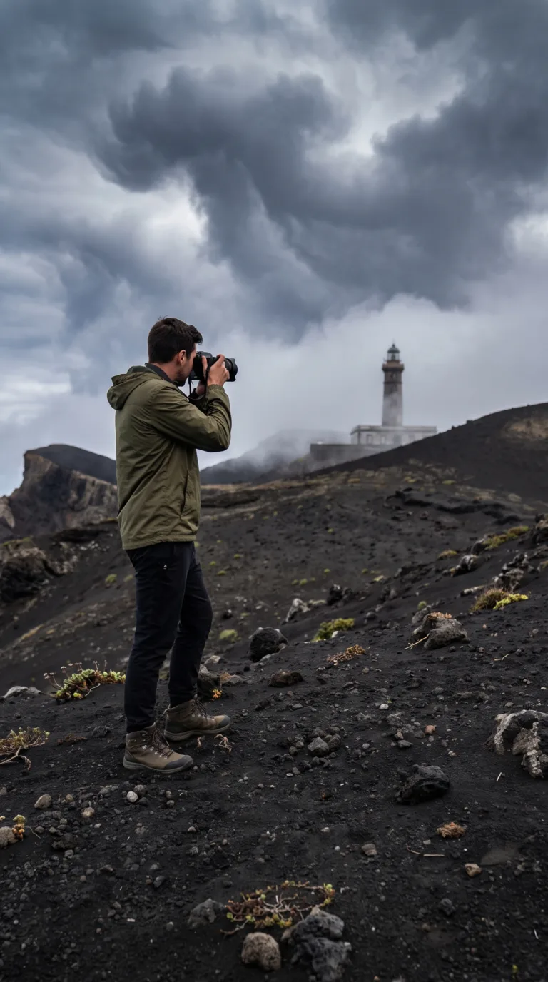
May through September offers the most reliable weather, but Capelinhos looks dramatic under storm clouds any time of year. The lighthouse photograph works best when clouds stack up behind it.
Day Trips from Capelinhos
Faial Island can be explored in one day from Capelinhos, with Caldeira do Faial crater 20 minutes away and Horta’s marina 30 minutes east, while Pico Island is accessible via 30-minute ferry from Horta.
Most visitors combine Capelinhos with other Faial attractions in a full-day island tour. The island is small. You can drive from one end to the other in under an hour.
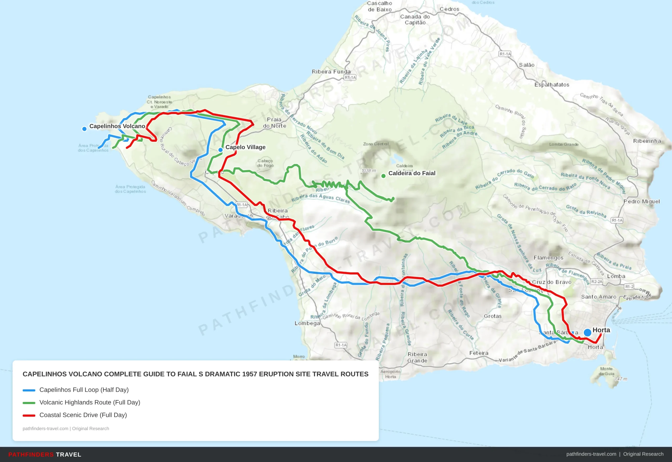
| # | Stop | Highlights | Drive Time |
|---|---|---|---|
| 1 | Horta | Start at Faial’s capital. Visit the famous marina with painted boat murals, grab coffee at Café Sport, and pick up a rental car for the drive west. | Start |
| 2 | Feteira | Small coastal village on the EN1-1A road with sea views. Quick stop to stretch legs and photograph the rugged western coastline before the volcanic landscape begins. | 20 min from Horta |
| 3 | Capelo Village | The village most affected by the 1957 eruption. See ash-buried ruins, visit the village church, and speak to locals whose families were evacuated during the disaster. | 20 min from Feteira |
| 4 | Capelinhos Volcano | The main event. Explore the 15-room underground Interpretation Centre, climb the half-buried Farol dos Capelinhos lighthouse for 360° views, and walk the black ash fields on Geopark trails. | 10 min from Capelo |
| # | Stop | Highlights | Drive Time |
|---|---|---|---|
| 1 | Horta | Morning departure from Horta marina. Fuel up at a local café and head north toward the caldeira before descending west to Capelinhos. | Start |
| 2 | Caldeira do Faial | Faial’s massive 2km-wide summit caldera at 1,043m elevation. Walk the 7km rim trail for sweeping views of the crater lake and hydrangea-lined paths. Allow 2–3 hours. | 30 min from Horta |
| 3 | Capelo Village | Descend through the highlands to this eruption-affected village. Lunch stop with local restaurants serving traditional Azorean cozido and fresh fish. | 25 min from Caldeira |
| 4 | Capelinhos Volcano | Afternoon visit to the Interpretation Centre and lighthouse. The afternoon light on the black ash fields makes for dramatic photography. Sunset from the lighthouse top is spectacular. | 10 min from Capelo |
| # | Stop | Highlights | Drive Time |
|---|---|---|---|
| 1 | Horta | Begin at Horta marina. Visit the Museu da Horta for island history context before heading east along the southern coast road. | Start |
| 2 | Praia do Almoxarife | Faial’s best black-sand beach with calm waters and views across to Pico Island and its towering volcano. Short swim stop or beachside coffee. | 15 min from Horta |
| 3 | Feteira | Coastal village with lava-rock shoreline pools. The EN1-1A road here offers dramatic sea cliffs. Stop at the miradouro for photos of the rugged western coast. | 20 min from Almoxarife |
| 4 | Capelo Village | Lunch in Capelo at local restaurants. Explore the eruption memorial and see original structures still half-buried under volcanic ash from 1957. | 25 min from Feteira |
| 5 | Capelinhos Volcano | End the day at the Interpretation Centre (allow 90 min), lighthouse climb, and ash field walk. The drive back to Horta via the north coast offers different coastal scenery. | 10 min from Capelo |
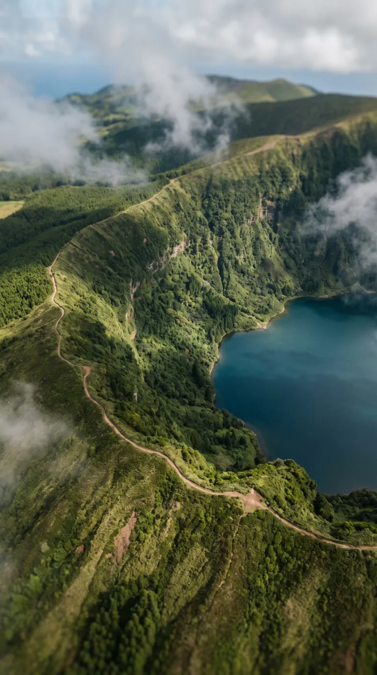
Caldeira do Faial sits in the island’s center, 20 minutes from Capelinhos. This massive volcanic crater measures 2 kilometers across and drops 400 meters deep. A hiking trail circles the rim. On clear days, you see straight across to Pico. The crater floor is carpeted in native vegetation. No swimming allowed, the lake is a protected ecosystem.
Horta is Faial’s capital, 30 minutes east of Capelinhos. The marina walls are covered in paintings left by visiting sailors, thousands of them, dating back decades. Peter Café Sport is the legendary sailor’s hangout. The gin and tonic is strong. The harbor is genuinely charming, with colorful buildings and fishing boats bobbing in the water.
A typical Faial day trip route: start in Horta, drive up to Caldeira do Faial for a rim hike, then continue west to Capelinhos for sunset. This covers the island’s volcanic highlights in one loop.
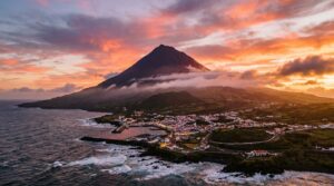
Mount Pico dominates the view from Capelinhos on clear days. Portugal’s highest mountain sits on neighboring Pico Island, just 7 kilometers across the channel. The Atlanticoline official ferry schedule shows crossings every few hours from Horta, 30 minutes each way, according to the ferry company’s timetable. Climbing Pico takes 4–6 hours round trip. Start before dawn if you’re attempting it.
Pico Island Vineyards are UNESCO-listed. The vines grow in tiny plots surrounded by black lava walls. The wine is volcanic, mineral-heavy, nothing like mainland Portuguese wines. Several wineries offer tastings. The landscape looks otherworldly, black stone grids stretching to the ocean.
Inter-island ferries connect Faial to Pico and São Jorge, making multi-island exploration possible. Check the Visit Azores official guide for current schedules. Weather cancels ferries frequently.
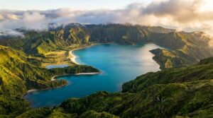
For longer stays, São Miguel’s highlights require a separate trip. Sete Cidades has the famous twin lakes, one blue, one green. Lagoa do Fogo is a crater lake with hiking trails. Furnas offers hot springs and geothermal cooking. These are the Azores’ most famous attractions. Ponta Delgada is the archipelago’s main hub, accessible by short flight from Faial. Most international visitors fly into São Miguel first, then island-hop to Faial.
Frequently Asked Questions
Will Capelinhos volcano erupt again?
No. Capelinhos is a monogenetic volcano, it erupted once and is now extinct. Monogenetic volcanoes form from a single eruption episode and don’t erupt again. The vent that created Capelinhos is permanently sealed. The Azores remain volcanically active, though. Other vents could open elsewhere on Faial or neighboring islands. Portuguese authorities monitor seismic activity across the archipelago 24/7 through the Portuguese Institute for Sea and Atmosphere (IPMA). You’re safe visiting Capelinhos itself.
When did Capelinhos volcano last erupt?
The eruption lasted from September 27, 1957 to October 24, 1958, 13 months total. It was a Surtseyan eruption, meaning an underwater volcano broke the surface and built new land. The eruption added 2.4 square kilometers to Faial’s western tip. It caused significant damage to nearby villages and prompted thousands of Faialenses to emigrate to the United States, particularly to New England and California. The eruption buried homes and farmland under ash. It’s the most recent major eruption in the Azores.
Is it safe to visit Capelinhos volcano?
Yes. The volcano is extinct and continuously monitored. The main hazards are natural: strong Atlantic winds, uneven volcanic terrain, and coastal erosion along the cliffs. Wear sturdy shoes with ankle support. The black sand gets hot in summer. Bring a windbreaker even on sunny days, gusts can reach 40 km/h. The Azores Regional Civil Protection and Fire Service (SRPCBA) maintains a volcanic monitoring system for the entire archipelago. You’ll see seismographs and GPS stations around the islands tracking ground deformation.
How much time do you need at Capelinhos?
Planning Tip
Budget 1.5 to 2 hours minimum. Spend 45 to 60 minutes in the interpretation center, 20 to 30 minutes climbing the lighthouse, and 30 to 45 minutes walking the ash fields and coastline. Allow 3 hours if you want to hike further west or take photos during golden hour. Most visitors combine Capelinhos with other Faial attractions, Caldeira, Horta Marina, Peter Café Sport, in a half-day or full-day loop.
What is the Azores volcano risk today?
The Azores are volcanically active but closely monitored. The last significant eruption was Capelinhos in 1957-58. Since then, underwater volcanic activity has occurred, like the 1998-2000 Serreta submarine eruption near Terceira, which produced seismic swarms but no surface eruption. The Portuguese Institute for Sea and Atmosphere monitors seismic activity 24/7 using a network of seismographs, GPS stations, and gas sensors. Volcanic risk is low. Tourism is completely safe. You’re more likely to face flight delays from fog than volcanic disruption.