Estimated reading time: 15 minutes
Last updated: 25 September 2026
Table of Contents
- What Can You See from Serra do Cume?
- Things to Do Around Serra do Cume and Terceira
- Getting to Serra do Cume Viewpoint
- Day Trips from Terceira to Other Azores Islands
- Best Time to Visit and What to Bring
- Frequently Asked Questions
What Can You See from Serra do Cume?
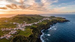
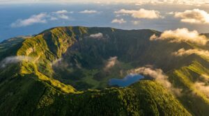
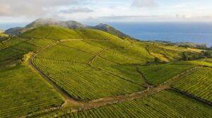
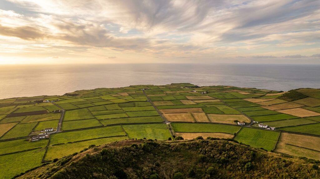
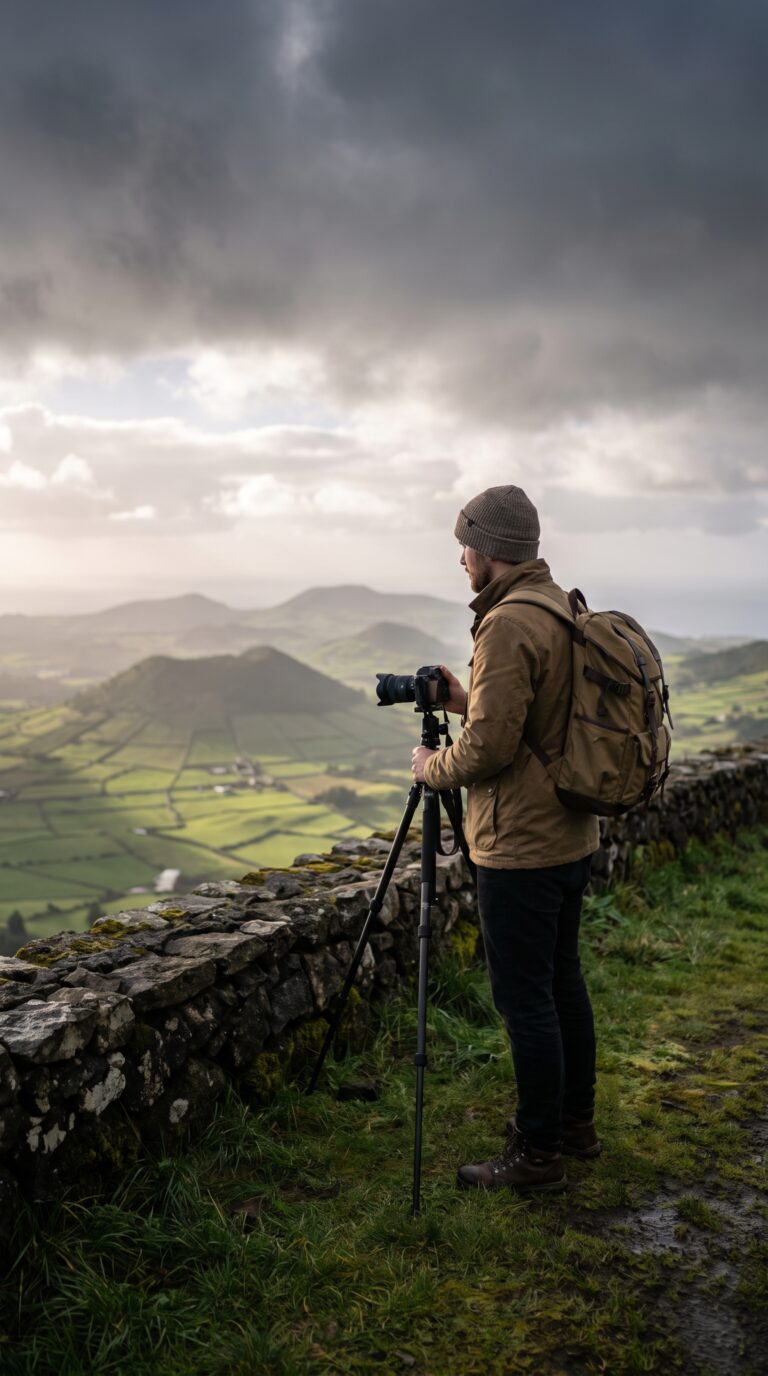
From Serra do Cume, perched at 545 metres on the rim of an ancient volcanic caldera, you look out over one of the Azores’ most photographed views: a vast patchwork of green pastures stitched together by thousands of dark basalt walls built in the 1700s. On a clear day it sweeps across the caldera floor to Terceira’s north and south coasts, with Praia da Vitória in the distance.
About This Guide
This guide draws on government tourism resources, satellite imagery analysis, and firsthand visitor reports to capture Serra do Cume’s landscape and conditions. Details reflect information current as of publication, we recommend checking local tourism websites before your visit for any seasonal updates.
Want to see the patchwork fields from above? Watch our Serra do Cume aerial tour in 4K.
Algar do Carvão pulls crowds underground. That volcanic chimney drops 90 meters into the earth, one of Terceira’s headline attractions. But the island’s best view sits above ground at Miradouro da Serra do Cume.
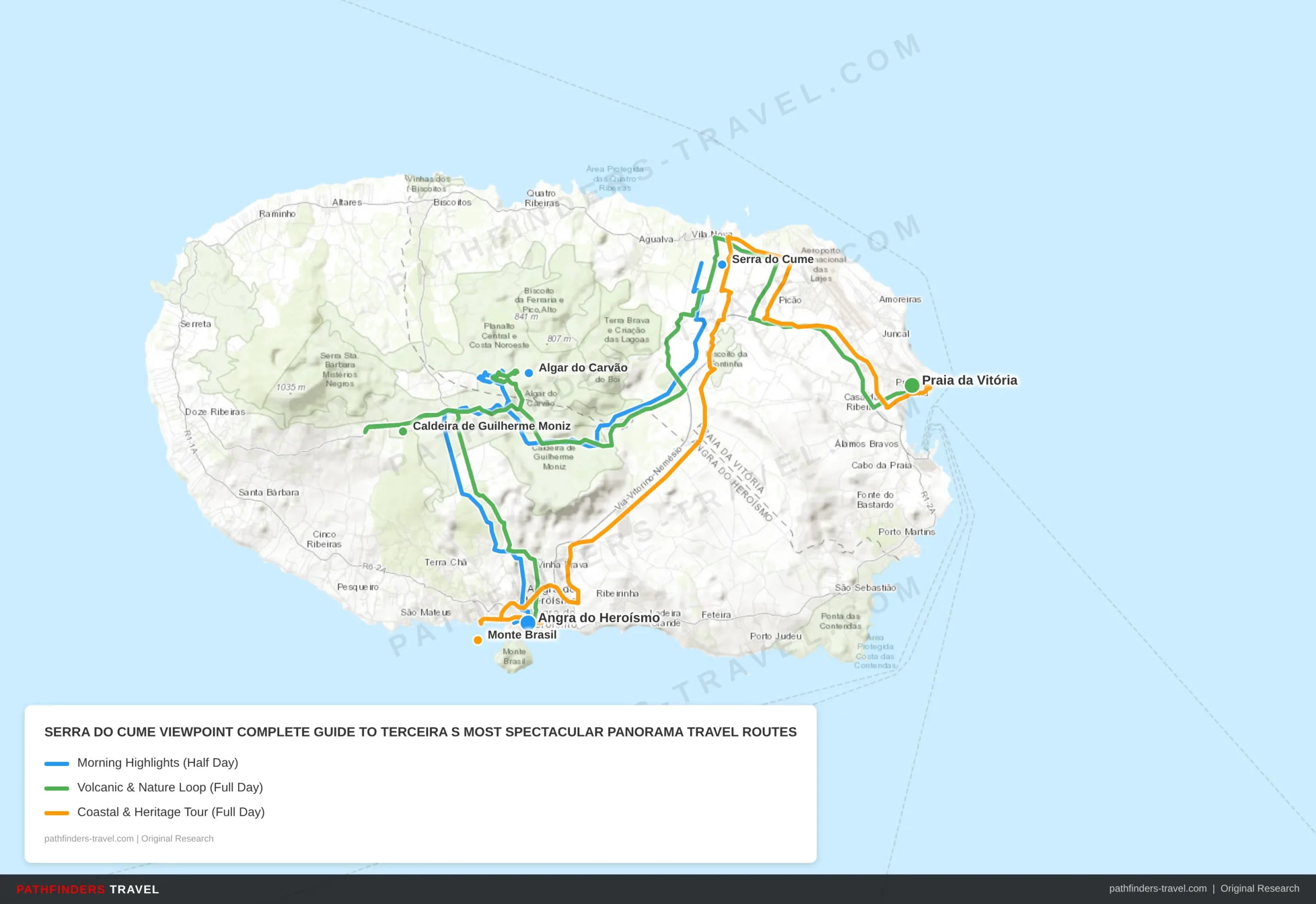
| # | Stop | Highlights | Drive Time |
|---|---|---|---|
| 1 | Serra do Cume | Arrive at sunrise for golden light on 3,000+ stone-walled patchwork fields; 545m altitude viewpoint on ancient crater rim; 360° Atlantic views | Start |
| 2 | Algar do Carvão | 90m-deep volcanic lava tube cave with underground lake; guided tours every 30 min from 10 AM; stalactites and rare volcanic formations; €8 entry | 15 min |
| 3 | Angra do Heroísmo | UNESCO World Heritage city; 15th-century cobblestone streets and pastel colonial architecture; Duke of Terceira Garden; waterfront cafés for lunch | 15 min |
| # | Stop | Highlights | Drive Time |
|---|---|---|---|
| 1 | Angra do Heroísmo | Base city; grab coffee and pastéis de nata before departure; visit the 15th-century Sé Cathedral if open early | Start |
| 2 | Caldeira de Guilherme Moniz | Large extinct volcanic caldera; scenic forest walks through endemic Azorean laurel; birdwatching for Azores bullfinch; misty highland atmosphere | 20 min |
| 3 | Algar do Carvão | Walk inside one of the world’s most accessible lava tubes; underground lake at 90m depth; 45-min guided tour; closes in winter, check hours | 10 min |
| 4 | Serra do Cume | Iconic patchwork field panorama from 545m crater rim; interpretation panels on agricultural heritage; small parking area for ~15 cars | 10 min |
| 5 | Praia da Vitória | Charming coastal town with one of the Azores’ best natural beaches; seafood restaurants on the waterfront; evening stroll along the bay promenade | 20 min |
| # | Stop | Highlights | Drive Time |
|---|---|---|---|
| 1 | Angra do Heroísmo | UNESCO World Heritage city; explore the 15th-century port and colonial architecture; best coffee stop before heading out | Start |
| 2 | Monte Brasil | Volcanic headland with 16th-century fortifications; wide views over Angra Bay and the Atlantic; walking trails through native forest; free access | 10 min |
| 3 | Serra do Cume | The island’s most spectacular panorama; 3,000+ stone-walled field divisions dating to 1700s; volcanic crater rim at 545m; photography highlight of Terceira | 25 min |
| 4 | Biscoitos | Famous natural lava rock pools for swimming; unique volcanic coastline; local wine cellars producing Terceira’s Biscoitos wines, worth a tasting stop | 20 min |
| 5 | Praia da Vitória | End the day with a sunset seafood dinner; wide sandy beach and calm bay waters; ferry connections to other Azores islands if extending your trip | 15 min |
This viewpoint perches on the rim of an extinct volcanic crater. The landscape below looks like a quilt. Green fields. Stone walls built in the 1700s. Over 500 individual plots stretch across the valley floor, each one separated by dark basalt barriers. Farmers still work these fields today.
Serra do Cume viewpoint sits on Terceira Island in the Azores archipelago, roughly 1,500 kilometers west of mainland Portugal. The altitude hits 545 meters according to the Official Turismo dos Açores (Azores Tourism Board). On clear days, you see the entire eastern half of the island. The Atlantic Ocean frames three sides.
The stone walls tell the real story. Terceira’s volcanic soil needed containment. Families divided land for centuries using local basalt. The result: a geometric pattern visible only from elevation. No other viewpoint in the Azores offers this specific landscape geometry.
This guide covers the practical details. How to reach the viewpoint by car or taxi. What other Terceira attractions sit within 30 minutes of Serra do Cume. Which day trips to neighboring Azores islands make sense if you have extra time. Plus weather considerations and what to pack. Check the Visit Terceira tourism information portal for current road conditions before you drive.
Things to Do Around Serra do Cume and Terceira
Miradouro da Serra do Cume offers 360-degree views from 545 meters altitude, showcasing over 3,000 stone-walled field divisions that form Terceira’s signature patchwork landscape recognized by UNESCO.
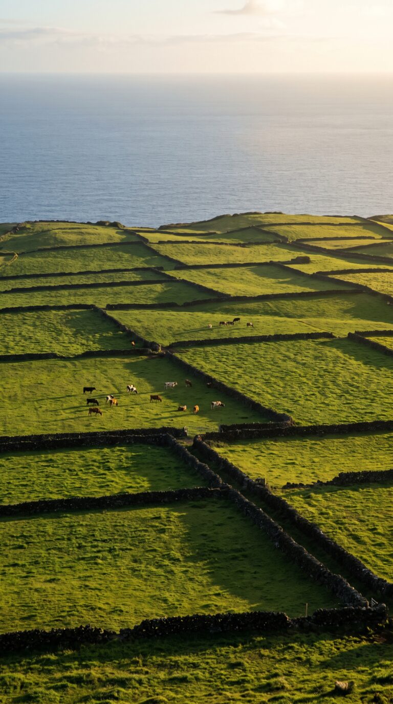
The viewpoint sits on the rim of an ancient volcanic crater. Below you, centuries-old stone walls, called muros, divide pastures into irregular geometric shapes. According to UNESCO documentation of Terceira’s agricultural heritage, over 3,000 individual field parcels create this natural mosaic. Some walls date back 400 years. Farmers built them from dark volcanic rock cleared from the land. Each plot holds a different shade of green depending on grass type and grazing patterns.
The viewing platform is small but well-maintained. You get interpretation panels explaining the agricultural history. Parking fits about 15 cars. On clear days you see the Atlantic on multiple sides of the island. Cattle graze in the fields below. The pattern looks almost artificial from this height, like someone drew property lines with a ruler. But it’s entirely organic, shaped by generations of land divisions and inheritance.
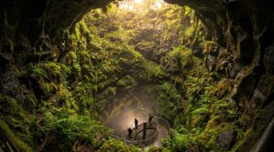
Algar do Carvão sits 15 minutes away by car. This lava tube cave drops 90 meters into the earth, ending at an underground lake. It’s one of the few volcanic caves in the world you can walk inside and reach the bottom. The Algar do Carvão visitor information site lists opening hours, the cave closes in winter. Tours run every 30 minutes. You descend metal stairs into the tube. Stalactites hang from the ceiling. The lake at the bottom reflects your headlamp. The whole visit takes 45 minutes. Entry costs €10 per adult.
Combine both stops in one morning. Drive to Serra do Cume first for sunrise light on the fields. Spend 30 minutes at the viewpoint. Then head to Algar do Carvão for the first tour slot at 10 AM. You avoid crowds and get better photos.
Angra do Heroísmo anchors the southern coast 20 minutes from Serra do Cume. This UNESCO World Heritage city served as a critical Atlantic port during the Age of Discovery. Pastel-colored colonial buildings line cobblestone streets. The UNESCO World Heritage listing for Angra do Heroísmo recognizes its 15th-century urban layout. Walk the fortifications at Monte Brasil. Check the Duke of Terceira Garden. Eat fresh limpets at a harbor restaurant. Budget two hours minimum for the historic center.
Miradouro do Facho offers another crater-rim perspective on the opposite side of the island. It’s less famous than Serra do Cume but equally dramatic. The viewpoint faces west, perfect for sunset. You see the airport runway, Praia da Vitória, and the central mountain range. No facilities here. Just a pull-off and a view. Go in late afternoon when the light turns golden.
The Serra do Cume area connects to several hiking trails through the volcanic highlands. Paths wind through pastures and along old stone walls. You can walk from the viewpoint down into the crater floor, though the route is unmarked. Bring offline maps. Cell service cuts out in the interior.
A full-day island loop hits all these spots. Start at Serra do Cume at sunrise. Visit Algar do Carvão mid-morning. Lunch in Angra do Heroísmo. Drive the north coast to Miradouro do Facho for sunset. You cover 80 kilometers total. The roads are good but narrow in places.
Getting to Serra do Cume Viewpoint
Serra do Cume viewpoint is located 15 minutes by car from Praia da Vitória along the ER3-1 road, with free parking available directly at the viewing platform.
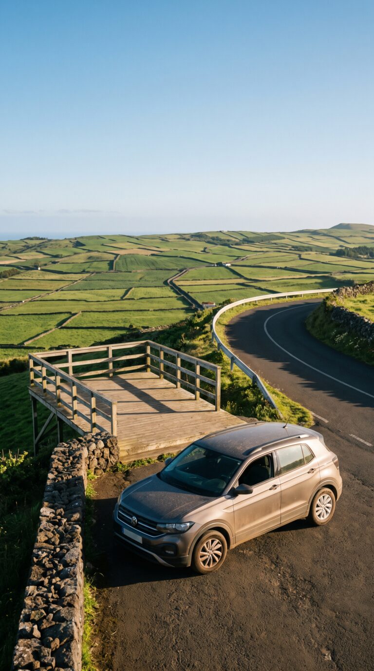
You’ll fly into Lajes Airport (TER) on Terceira. Direct flights run from Lisbon and Porto on mainland Portugal. SATA Air Açores inter-island flights connect Terceira to São Miguel, Faial, Pico, and other Azores islands. The airport sits 12 kilometers from Serra do Cume, about 25 minutes by car.
Rent a car. Public buses on Terceira exist but run infrequently and don’t reach most viewpoints. All major rental companies operate desks at Lajes Airport. You can also rent in Angra do Heroísmo if you’re staying there first. Expect to pay €25–40 per day for a compact car during summer 2026.
The drive is simple. Serra do Cume Terceira sits right on the ER3-1 highway linking Praia da Vitória and Angra do Heroísmo. From Praia da Vitória, head west on ER3-1 for 15 minutes. From Angra do Heroísmo, drive northeast for 20 minutes. The road is paved, well-maintained, and clearly marked. Any vehicle type handles it fine.
Park for free at the viewpoint lot. Space for 20–30 cars plus tour buses. The lot sits directly beside the viewing platform, no hiking required. You’ll see the miradouro da serra do cume sign from the road.
Combine your visit with Algar do Carvão, a volcanic cave 10 minutes west. The two make a logical pairing if you’re crossing the island. Most visitors spend 20–30 minutes at Serra do Cume, enough time to walk the platform and take photos of the patchwork fields below.
According to the Terceira Tourism Board, the viewpoint receives approximately 85,000 visitors annually. SATA inter-island connecting flights operate 4–6 daily connections between Terceira and São Miguel during peak season.
Day Trips from Terceira to Other Azores Islands
Inter-island flights from Terceira to São Miguel take 30 minutes, with SATA Air Açores operating 4-6 daily connections, making same-day visits to Sete Cidades and Furnas feasible.
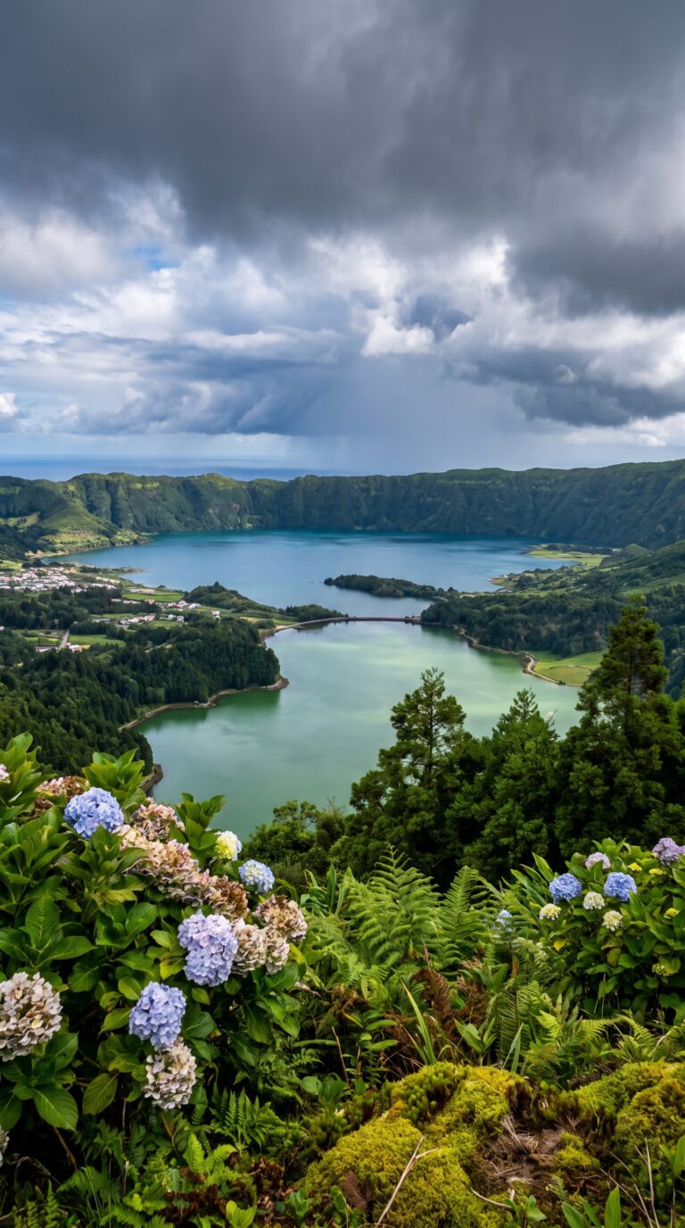
Terceira sits in the center of the Azores archipelago. Nine islands spread across 600 kilometers of Atlantic Ocean. The central location makes island-hopping practical.
São Miguel draws the most day-trippers. Flights land in Ponta Delgada after 30 minutes in the air. SATA Air Açores inter-island flights leave Terceira four to six times daily. Round-trip tickets cost €80-120.
Sete Cidades sits inside a massive volcanic crater. Twin lakes fill the caldera, one blue, one green. The rim viewpoint stands 259 meters above the water. Rental cars in Ponta Delgada start at €35 per day. The drive takes 40 minutes.
Lagoa do Fogo requires a steep climb to 575 meters elevation. The crater lake reflects clouds on calm days. A hiking trail circles the rim in two hours. Caldeira Velha thermal pools sit halfway down the mountain. Water temperature holds at 38°C year-round. Entry costs €10.
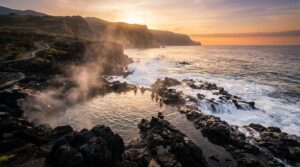
Furnas valley smells like sulfur. Geothermal vents bubble in the botanical gardens. Locals cook cozido stew underground for six hours using volcanic heat. Ponta da Ferraria on the west coast mixes ocean waves with thermal springs. The natural pool reaches 35°C at low tide.
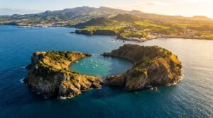
Nordeste municipality covers São Miguel’s eastern tip. Thirty coastal viewpoints line the road between Ponta do Arnel lighthouse and Tronqueira forest. Gorreana Tea Plantation grows Camellia sinensis on terraced slopes since 1883. Europe’s oldest tea estate offers free tastings. Mosteiros beach spreads black volcanic sand beneath basalt sea stacks. Ilhéu de Vila Franca do Campo nature reserve floats 500 meters offshore, a collapsed volcanic cone with a circular lagoon inside.
Pico Island flights take 45 minutes from Terceira. Mount Pico rises 2,351 meters above sea level, Portugal’s highest peak according to the Portuguese Geographical Institute. The summit climb requires six hours round-trip. Pico Island Vineyards grow grapes in lava rock corrals called currais. UNESCO recognized the wine landscape in 2004. Verdelho wine aged in volcanic soil tastes mineral-sharp.
Faial Island sits 15 kilometers from Pico. Horta marina walls display paintings from visiting sailors. Peter’s Café Sport serves gin cocktails to transatlantic crews. Capelinhos Volcano erupted in 1957, adding new land to the western cape. The visitor center sits half-buried in ash. Caldeira do Faial crater measures 2 kilometers across. Hydrangeas bloom blue along the rim trail in summer.
Santa Maria Island beaches have white sand instead of black. Praia Formosa curves around a protected bay. Flores Island waterfalls drop from cliffs into the Atlantic. Poço da Alagoinha cascade falls 20 meters into a natural pool. Corvo Island holds 430 residents, the smallest population in the Azores. Caldeirão crater fills the island’s center. Graciosa Island features Furna do Enxofre, a volcanic cave with a sulfur lake 80 meters underground.
Summer ferries connect the islands through Atlânticoline ferry bookings. Terceira to São Miguel takes 8 hours by boat. Most travelers stick with flights. Day trip tours from Terceira agencies bundle flights and ground transportation for €180-250 per person. Multi-island passes from SATA Air Açores reduce costs for trips hitting three or more islands in one week.
Best Time to Visit and What to Bring
Visit Serra do Cume between May and October for optimal weather, arriving before 10am or after 5pm to avoid midday clouds that frequently obscure the 545-meter-altitude viewpoint.
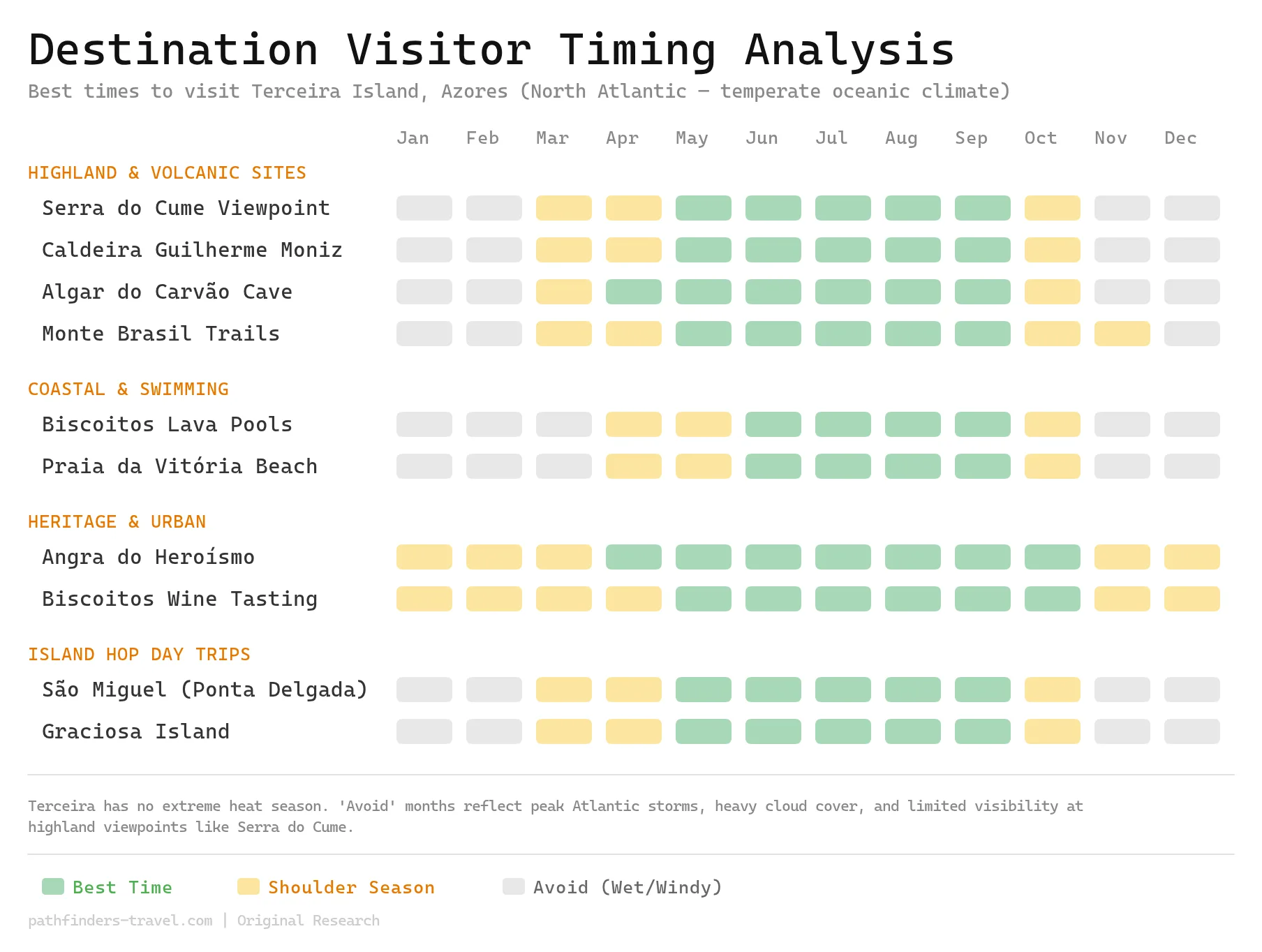
The Miradouro da Serra do Cume sits open year-round. No tickets. No reservations. But timing matters more than most visitors expect.
May through October delivers the most stable conditions. According to IPMA (the Portuguese meteorological institute), these months see clear-view days roughly 60-70% of the time. Winter months drop to 40-50% visibility rates. The Azores climate runs mild but changeable. You can experience sun, clouds, and rain within the same hour.
Early morning works best. Between 8 and 10am, the air stays clearest. Fewer tour buses crowd the platform. Late afternoon from 5 to 7pm offers golden-hour light for photography. Midday? Skip it. Clouds roll in from the Atlantic and park themselves over the crater rim. You’ll stare at white mist instead of patchwork fields.
Check the IPMA weather forecast before driving up. Low cloud cover can erase the entire panorama. If the forecast shows overcast conditions below 600 meters, wait for a clearer day.
Serra do Cume altitude sits at 545 meters. That elevation brings cooler temperatures and stronger winds than sea-level Angra do Heroísmo. Pack layers. A windbreaker or light jacket isn’t optional. The viewing platform has zero shelter. You stand fully exposed to whatever weather rolls through.
Bring comfortable walking shoes. The platform surface is paved but uneven in spots. A camera with a wide-angle lens captures the full crater sweep. Phones work fine but miss the scale.
The site costs nothing to visit. No gates. No fees. Just drive up and walk to the edge.
Frequently Asked Questions
How long should I spend at Serra do Cume viewpoint?
Most visitors spend 20 to 30 minutes at the viewpoint. That’s enough time for photos and soaking in the patchwork fields below. If you want to walk along the crater rim or read the interpretation panels, add another 15 minutes. Combine it with nearby Algar do Carvão cave, a 30-minute visit, for a solid half-day trip.
Is Serra do Cume accessible for people with mobility limitations?
Yes. The viewpoint has a paved parking area and viewing platform. Wheelchairs can access the main viewing area without stairs. The surface is flat. Wind can be strong, though. That might be tough for some visitors.
What is the altitude of Serra do Cume?
Serra do Cume sits at 545 meters (1,788 feet) above sea level. You’re standing on the rim of an ancient volcanic crater. The elevation means cooler temperatures and stronger winds than you’ll find at the coast.
Can you see the patchwork fields from other viewpoints on Terceira?
Miradouro da Serra do Cume offers the most dramatic view of the geometric field divisions. Miradouro do Facho gives you different angles of Terceira’s coastline and interior. But no other spot on the island matches Serra do Cume’s iconic panorama.
Is there a best time of year to visit Serra do Cume?
May through October brings the most reliable weather, clearer skies, less rain. The landscape turns brightest green in spring (April to May) after winter rains. Summer (June to August) gives you the longest daylight for photography. Winter visits work, but expect clouds, rain, and wind.