Estimated reading time: 17 minutes
Last updated: 2 September 2026
Table of Contents
- When Is the Best Time to Visit Lagoa do Fogo?
- What to See and Do at Lagoa do Fogo
- Getting to Lagoa do Fogo
- Nearby Attractions and Day Trips
- Planning Your Visit: Weather, Timing & Essentials
- Frequently Asked Questions
When Is the Best Time to Visit Lagoa do Fogo?
The best time to visit Lagoa do Fogo is early morning, ideally before 10am, when the crater is most likely to be clear of the fog that often swallows the lake by midday. This São Miguel nature reserve sits at 575 metres with no facilities and limited parking that fills fast in summer, so arriving early also secures a space at the Miradouro viewpoint. Late afternoon is a good second choice.
Research Sources
This guide pulls from government tourism resources, environmental studies, and visitor experiences documented across reliable travel platforms. All facts were current when published, we’d recommend checking local tourism websites before your trip since conditions and access details can shift seasonally.
Want to see Lagoa do Fogo’s crater lake in person? Watch our complete São Miguel travel guide in 4K.
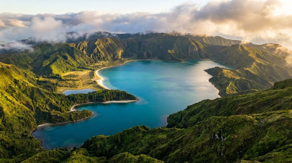
Fire Lake. That’s the literal translation of Lagoa do Fogo, and the name fits. This crater formed during a violent 1563 eruption that tore open São Miguel’s central volcanic ridge. Today the caldera holds one of the Azores‘ cleanest bodies of water, no development, no boat traffic, just raw geology and protected wilderness.
The Reserva Natural da Lagoa do Fogo covers 1,291 hectares according to the Azores regional natural park authority. That makes it one of the island’s largest protected zones. The reserve exists to safeguard endemic plant species and nesting seabirds that use the crater slopes. You won’t find restaurants or tour boats here. Just trails, a single beach, and viewpoints.
Most visitors hit the main lookout point first. The Visit Azores Tourism board lists the Miradouro da Lagoa do Fogo as a priority stop on the central São Miguel circuit. From there you see the entire crater, steep green walls dropping to turquoise water, with the Atlantic visible beyond the rim. Clear days reveal the full 575-meter elevation drop from viewpoint to lake surface.
The beach sits at the bottom of a rough dirt road. It’s the only access point to the shoreline. Hikers use the rim trail to circle the crater, though fog can shut down visibility for days at a time. Pack layers. Weather shifts fast at this altitude.
What to See and Do at Lagoa do Fogo
The Miradouro da Lagoa do Fogo viewpoint sits at 575 meters elevation, while the PRC02 SMI hiking trail covers 7.7 miles with 1,000 feet of elevation gain to reach the clean beach.
The Miradouro da Lagoa do Fogo is your first stop. Pull off EN5-1A at the marked parking area. The viewpoint sits 575 meters above sea level. You get a full panorama of the crater lake, the surrounding ridgeline, and the Atlantic beyond. Most visitors spend 15 minutes here snapping photos. The view orients you to the lake’s scale, it’s 1.4 miles across at the widest point. On clear mornings, you can see the beach far below, a white crescent against turquoise water.
The viewpoint has no facilities. No bathrooms, no food stalls. Bring water. Parking fills up by 11 a.m. in summer. Arrive before 9 a.m. or after 4 p.m. to avoid tour buses.
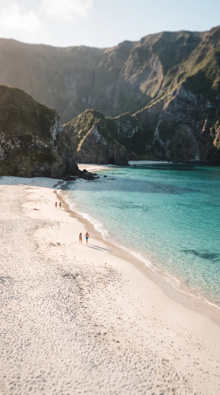
Praia da Lagoa do Fogo is the main attraction. This beach sits at the crater’s southern edge. The sand is white volcanic ash, fine as flour. The water is clear enough to see the bottom at 15 feet. Swimming here feels like floating in a mountain lake, cold, clean, no waves. Water temperature reaches 68°F (20°C) in July and August, according to Azores environmental monitoring data. May through September offers the best swimming conditions. October through April, the water drops to 59°F (15°C).
The beach has zero facilities. No lifeguards, no bathrooms, no snack bars. Pack everything in. Pack everything out. The sand gets crowded on weekends in July. Weekdays see maybe 20 people total.
Getting to the beach requires hiking. The shorter descent trail starts from the Miradouro da Lagoa do Fogo parking area. This path drops 1,000 feet in 1.2 miles. It’s steep. Loose gravel in sections. Switchbacks cut through dense vegetation. The descent takes 30 minutes. The climb back up takes 45 minutes. Your knees will feel it.
The PRC02 SMI Lagoa do Fogo trail is the official long route. It covers 7.7 miles with 1,000 feet of elevation gain, per the Azores Trails – Official Regional Network. The trailhead sits near Água d’Alto on the south coast. The route climbs through laurel forest, crosses open ridgeline, and descends to the beach. Total time runs 4 to 5 hours. You get coastal views, volcanic rock formations, and lake access. The trail is well-marked with red-and-yellow blazes. AllTrails: PRC02 SMI – Lagoa do Fogo Beach shows GPS data and recent trail conditions.
Hikers rate this trail moderate. The elevation gain is steady, not brutal. Footing is uneven in spots. Wear boots with ankle support. Bring 2 liters of water per person. No water sources on the trail. No shade after the first mile.
Walking around the entire lake is not possible. The northern and western shores have no maintained trails. Dense vegetation and steep slopes block access. You can walk about 0.6 miles along the southern shore from the beach. The path is informal, rocky, and ends at a lava field.
If you’re driving across São Miguel from Ponta Delgada to Furnas, stop at Gorreana Tea Plantation. It’s 15 minutes north of the Lagoa do Fogo turnoff. Europe’s oldest tea plantation offers free tours and tastings. The detour adds 30 minutes to your trip. The tea fields are photogenic, terraced green rows against the ocean.
Swimming safety: the lake has no lifeguards. The water is calm, but the bottom drops off quickly. Stay within 50 feet of shore if you’re not a strong swimmer. No motorboats are allowed. The lake sits inside a nature reserve. Fishing is prohibited. Camping is prohibited. Leave no trace.
Planning Tip
Best time to visit: June through September for warm weather and calm water. Mornings offer the calmest conditions. Afternoons bring wind and clouds. The lake sits at 575 meters elevation, weather changes fast. Pack a rain jacket even on sunny days.
Getting to Lagoa do Fogo
Lagoa do Fogo is 32 kilometers from Ponta Delgada via EN1-1A, requiring approximately 45 minutes by car, with free parking available at the Miradouro viewpoint.
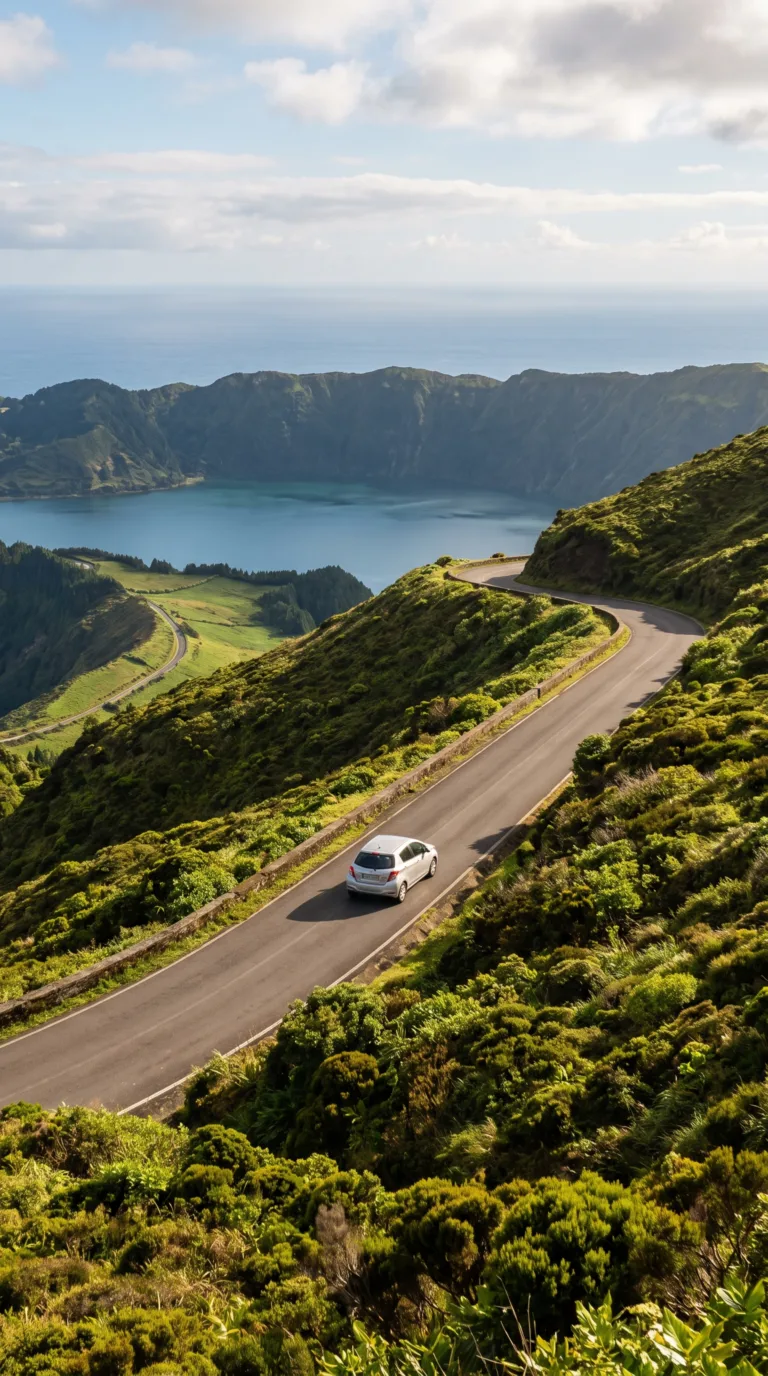
Yes, you can drive to Lagoa do Fogo. The lake sits in São Miguel’s central highlands, accessible by paved road from any direction.
From Ponta Delgada, take EN1-1A east toward Ribeira Grande. After about 25 kilometers, turn south onto the marked access road for Lagoa do Fogo. The route climbs steadily through pastures and cryptomeria forests. Total drive time runs 45 to 50 minutes in normal conditions.
Road conditions are good. The pavement is maintained year-round. Fog can reduce visibility above 500 meters elevation, especially mornings and late afternoons. Drive cautiously on the final ascent, the road narrows and curves sharply.
Parking at Miradouro da Lagoa do Fogo is free. The lot holds approximately 30 vehicles. It fills by 11 AM during July and August. Arrive before 9 AM or after 5 PM to guarantee a spot. Overflow parking lines the roadside, but space is limited and not always legal.
No shuttle service operates to Lagoa do Fogo as of 2026. Tour operators offer half-day excursions from Ponta Delgada for €40 to €60 per person, but these are guided tours, not simple shuttles.
Public bus service does not reach the lake. The closest stop is in Água de Pau, 8 kilometers downhill. Renting a car remains the only practical independent option.
The access road closes occasionally for maintenance or severe weather. Check current status with the Azores regional road authority before driving. Closures typically last a few hours, rarely a full day. No alternative vehicle access exists during closures, you’d need to hike from lower elevations.
Trailhead parking for the PRC02 SMI hiking trail shares the same Miradouro lot. No separate parking area exists.
Nearby Attractions and Day Trips
Caldeira Velha thermal springs are located 5 kilometers from Lagoa do Fogo, while Sete Cidades crater lakes are 35 kilometers west, both easily combined in a full-day São Miguel itinerary.
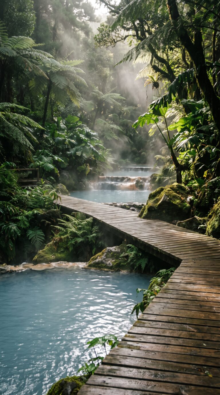
Caldeira Velha sits just 10 minutes down the mountain from the crater lake. This thermal spring complex charges €10 entry for bathing (€3 to visit without bathing, as of 2026 according to the Caldeira Velha Environmental Interpretation Centre). The water temperature hovers at 38°C year-round. You get changing rooms, lockers, and boardwalks through dense fern forests. The pairing works because you’ll be cold and damp after hiking the crater rim, then you soak in hot springs for a hour.
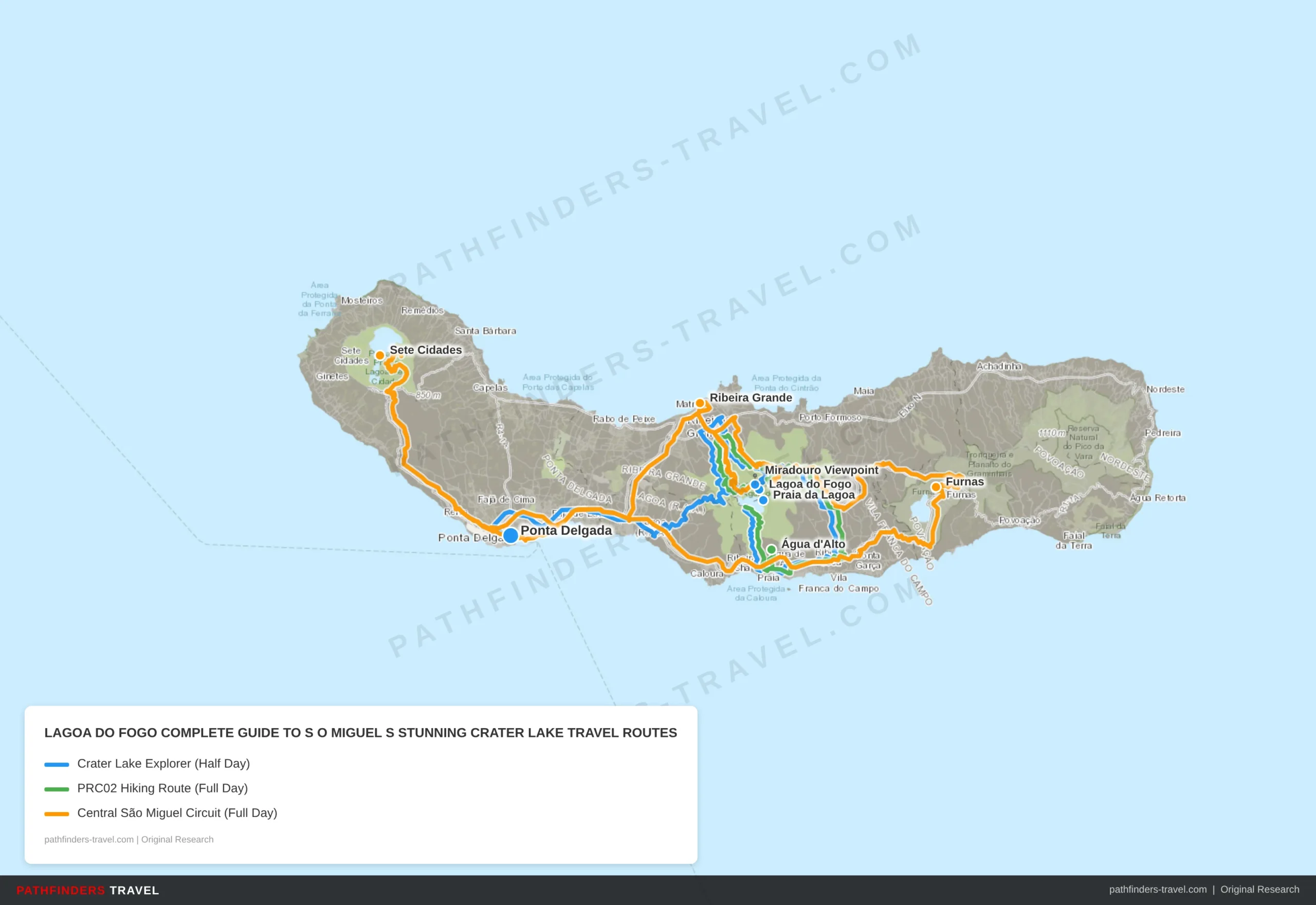
| # | Stop | Highlights | Drive Time |
|---|---|---|---|
| 1 | Ponta Delgada | Start here, capital city, ferry terminal, car rental hub. Stock up on supplies; no facilities at the lake. | Start |
| 2 | Miradouro Viewpoint | First stop at 575m elevation on EN5-1A. Full panorama of crater, ridgeline, and Atlantic. Arrive before 9am to beat tour buses. | 30m from Ponta Delgada |
| 3 | Lagoa do Fogo | The crater lake itself, 1.4 miles wide, formed in the 1563 eruption. No development, no boat traffic. Pure volcanic wilderness. | 5m from viewpoint |
| 4 | Praia da Lagoa | White volcanic sand beach at crater’s southern edge. Clear water to 15 feet, no waves. Steep 1.2-mile descent (30 min down, 45 min back up). Pack all food and water. | 30, 45 min hike from viewpoint |
| # | Stop | Highlights | Drive Time |
|---|---|---|---|
| 1 | Água d’Alto | Official PRC02 SMI trailhead on the south coast. Park here and begin the 7.7-mile marked trail. Red-and-yellow blazes throughout. | Start |
| 2 | Praia da Lagoa | Trail midpoint, the crater beach reward. Coastal views, laurel forest, and volcanic rock formations passed en route. Swimming possible Jul, Sep (68°F). | 2, 2.5h hike from trailhead |
| 3 | Lagoa do Fogo | Crater rim crossing with full lake views. Open ridgeline with endemic plant species and seabird nesting zones in the 1,291-hectare reserve. | 30m hike from beach |
| 4 | Miradouro Viewpoint | Trail exit point at EN5-1A parking area. 575m elevation panorama, the ideal final view before descending. Total hike: 4, 5 hours. | 1h hike from crater |
| # | Stop | Highlights | Drive Time |
|---|---|---|---|
| 1 | Ponta Delgada | Gateway hub. Early morning departure recommended. Grab breakfast and fuel before heading west. | Start |
| 2 | Sete Cidades | Twin crater lakes (blue and green) on the island’s western end. One of São Miguel’s most iconic viewpoints. Worth 1, 2 hours. | 40m from Ponta Delgada |
| 3 | Ribeira Grande | Northern coast town with lunch options and local market. Break the drive along the coast road. | 45m from Sete Cidades |
| 4 | Miradouro Viewpoint | Lagoa do Fogo viewpoint at 575m. wide crater views. Arrive mid-afternoon when tour buses have cleared. | 25m from Ribeira Grande |
| 5 | Lagoa do Fogo | The Fire Lake. Optional beach descent if energy allows. Nature reserve with no facilities, stay on marked trails. | 5m from viewpoint |
| 6 | Furnas | Eastern caldeira village with hot springs, fumaroles, and Lagoa das Furnas. Terra Nostra Garden nearby. End day with a thermal soak. | 30m from Lagoa do Fogo |
Sete Cidades competes for the title of São Miguel’s most photographed spot. Twin lakes fill a massive volcanic crater, one green, one blue. The drive from Lagoa do Fogo takes 50 minutes. Visit Sete Cidades first in the morning when fog is less likely. Hit Lagoa do Fogo on the return trip in early afternoon. Sete Cidades has more developed infrastructure and easier access to the water. Lagoa do Fogo feels wilder.
Furnas occupies the eastern side of the island. You’ll need a full day to combine it with Lagoa do Fogo. The geothermal valley offers botanical gardens, boiling mud pools, and the famous cozido stew cooked underground. Prioritize Furnas if you want hot springs over hiking. Choose Lagoa do Fogo if you prefer altitude and solitude.
Mosteiros delivers black sand beaches and natural tidal pools on the north coast. The coastal drive from Lagoa do Fogo takes 40 minutes through rural farmland. Ponta da Ferraria on the west coast mixes Atlantic waves with volcanic hot water, best visited at low tide. Nordeste in the far east requires multiple days to explore properly. The region contains 30+ miradouros and several waterfalls. Visit Azores provides detailed multi-day itineraries combining these sites.
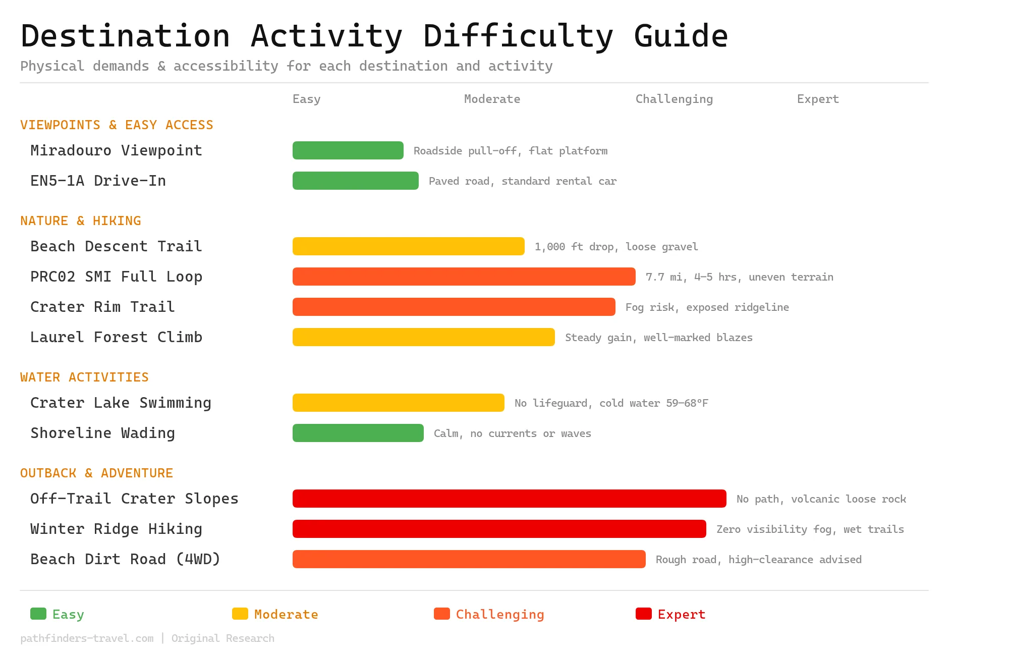
Activity Difficulty Guide
Lagoa do Fogo spans a wide difficulty spectrum, from a drive-up roadside viewpoint accessible to all visitors, to expert-level off-trail scrambles on unstable volcanic slopes blanketed in unpredictable fog. The flagship PRC02 SMI trail sits comfortably in the challenging category, great fit hikers with crater lake access after 7+ miles of varied terrain. Most visitors will encounter at least moderate exertion here; this is an active volcanic wilderness, not a manicured park.
Planning Your Visit: Weather, Timing & Essentials
Lagoa do Fogo sits at 575 meters elevation where temperatures average 5-7°C cooler than coastal areas, with the clearest conditions typically occurring between 8-11 AM during summer months.
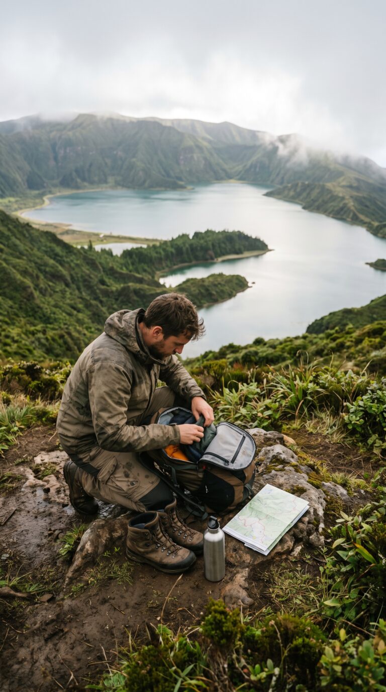
The lagoa do fogo altitude creates its own microclimate. Fog rolls in fast at 575 meters. You’ll feel the temperature drop the moment you start climbing from the coast. Ponta Delgada might be 22°C. The crater rim? 15°C. Pack accordingly.
Check the Lagoa do Fogo Live Webcam before you drive up. Visibility changes by the hour. A clear morning can turn into complete whiteout by noon. The webcam shows you exactly what you’ll see. No point driving 30 minutes if clouds have swallowed the viewpoint.
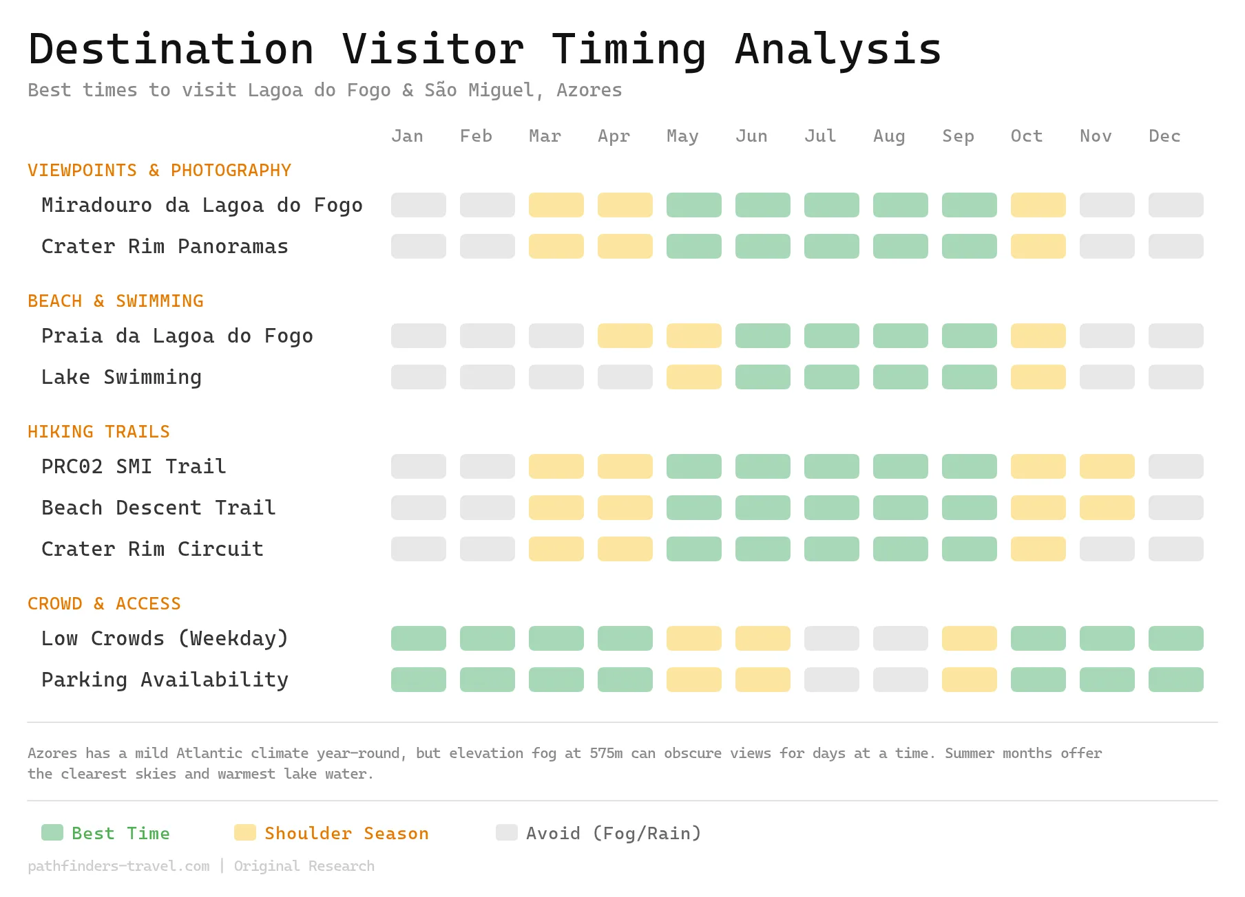
Summer months (June through September) offer the warmest water and clearest skies. Early morning beats midday for two reasons: fewer tour buses and better visibility. The IPMA Weather Forecast provides official forecasts for São Miguel. Shoulder season (April, May, October) means cooler water and more unpredictable lagoa do fogo weather, but you’ll have the trails to yourself.
Pack layers. A waterproof jacket is mandatory. Hiking shoes with grip for the trails. Swimwear if you’re hitting the beach. Sun protection (the altitude intensifies UV). Water and snacks. There are no facilities at the lake. Zero.
Mobile coverage is spotty at best. Download offline maps before you go. GPS coordinates for the main viewpoint: 37.7697° N, 25.4764° W. The lagoa do fogo map from the tourism office in Ponta Delgada shows all official trails, but cell service won’t save you if you wander off route.
Best Time to Visit
Lagoa do Fogo sits at 575 meters elevation on São Miguel’s central volcanic ridge, making its weather highly variable year-round. The best window for clear views, warm lake swimming, and dry trail conditions is June through September, with July and August offering the most reliable sunshine but also peak crowds at the viewpoint parking area. Shoulder months of May and October strike a good balance between decent weather and manageable visitor numbers.
Frequently Asked Questions
Is Lagoa do Fogo worth it?
Yes. Lagoa do Fogo ranks among São Miguel’s most clean natural attractions. The lake sits inside a protected nature reserve, which keeps crowds thinner than Sete Cidades while delivering equally dramatic scenery. The crater setting is raw and unspoiled. The beach has zero development. Hikers get excellent trails. Photographers capture volcanic landscapes without tourist clutter. Beach lovers find crystal-clear water and white sand. Nature enthusiasts spot endemic plants and seabirds. One catch: fog blocks visibility roughly 40% of the time. Check the Lagoa do Fogo webcam before driving up. If clouds cover the crater, reschedule. On clear days, the lake delivers views that justify the trip.
How long is the Lagoa do Fogo hike?
The PRC02 SMI trail measures 7.7 miles (12.4 kilometers) with roughly 1,000 feet of elevation gain. Hikers with moderate fitness complete the full loop in 2 hours. Add beach time and you’re looking at 3 to 4 hours total. Most visitors skip the full loop. They park at Miradouro da Lagoa do Fogo, then take the steep descent trail straight to the beach. That route drops 20 to 30 minutes downhill. The climb back up takes 30 to 40 minutes. It’s shorter but punishing on the knees. According to official trail registry data, the average duration to complete PRC02 SMI is 2.5 hours without stops. Factor in photo breaks, lunch on the beach, and a swim. Budget 4 hours if you want the full experience.
Can you walk around Lagoa do Fogo?
No maintained trail circles the entire lake. The PRC02 SMI trail covers the eastern and southern sections. The descent trail with the viewpoint and the beach is the most popular walking route. Western and northern shores remain inaccessible due to steep crater walls and protected reserve status. You can’t bushwhack through, it’s illegal and dangerous. For the most complete walking experience, tackle the PRC02 SMI. It gives you the best accessible portions of the shoreline. The full circumnavigation isn’t an option here.
Can I drive to Lagoa do Fogo?
Yes. You can drive directly to Miradouro da Lagoa do Fogo via paved road EN1-1A. The drive from Ponta Delgada takes approximately 45 minutes. Parking exists at the viewpoint, but it fills up fast during peak season. Arrive before 10 a.m. or after 4 p.m. to snag a spot. You cannot drive down to the beach. That requires hiking. The road occasionally closes for maintenance or severe weather. Check current status before leaving your hotel. The route is well-maintained and suitable for all vehicle types. No 4×4 needed. Standard rental cars handle it fine.
Can you swim in Lagoa do Fogo?
Yes. Swimming is allowed at Praia da Lagoa do Fogo beach. The water is crystal clear and cold, even in summer. July through September offer the warmest temperatures, though “warm” is relative. Expect refreshing, not bathwater. No facilities exist down there. No lifeguards. No snack bars. No restrooms. Bring everything: towel, water shoes for rocky patches, sun protection, drinking water. The beach stays clean and uncrowded precisely because it lacks amenities. Can you swim in Lagoa do Fogo? Absolutely. Just prepare for a completely natural experience with zero services.