Estimated reading time: 9 minutes
Last updated: August 2026
Is Pittsburgh Worth Visiting?
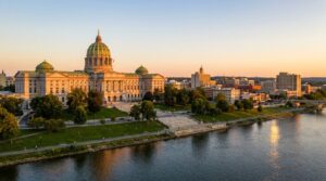
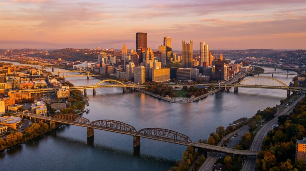
Yes — Pittsburgh is one of America’s most underrated city breaks. Set where three rivers meet, the former Steel City now blends a riverfront skyline, 446 bridges, and the dramatic Mount Washington overlook reached by historic inclines. Add world-class museums (the Andy Warhol and the Carnegie), the buzzing Strip District food scene, walkable neighbourhoods, passionate Steelers and Penguins fans, and low prices, and it easily earns a visit.
Want to see Pittsburgh’s rivers and bridges in action? Watch our complete Pittsburgh travel guide in 4K.
The city proper holds around 303,000 residents, according to U.S. Census Bureau Pittsburgh population data. That number dropped from its 1950 peak of 677,000. Steel mills closed. People left. But the metro area tells a different story, 2.4 million spread across Allegheny County and beyond. Young professionals moved in. Tech companies opened offices. Universities expanded.
Where is Pittsburgh located? Southwestern Pennsylvania, roughly 300 miles west of Philadelphia and 185 miles north of Washington, D.C. The Allegheny River flows from the northeast. The Monongahela comes from the southeast. They meet at Point State Park to form the Ohio River, which heads west toward the Mississippi. This Y-shaped confluence defines the city’s entire layout.
Rivers carved valleys. Neighborhoods climbed the hills between them. Pittsburgh claims 446 bridges, more than Venice, according to city records. Some connect downtown to the North Shore. Others link hilltop communities you can’t reach without crossing water or tunneling through rock. No grid system here. Streets follow the topography.
The Official Visit Pittsburgh tourism website markets the transformation from steel to tech. Fair enough. Google, Uber, and Carnegie Mellon’s robotics labs occupy former industrial sites. But you still see the bones of the old city, inclines hauling commuters up Mount Washington, row houses stacked on slopes, railyards along the Monongahela.
This guide covers the neighborhoods worth your time, the practical details that trip up first-time visitors, and the questions people actually ask before booking flights. No fluff about renaissance narratives. Just what you need to know before you go.
How We Researched Pittsburgh
Information for this guide comes from Pittsburgh’s tourism board, city government records, and verified visitor experiences. Everything was accurate when written, but we recommend confirming details with official sources before you go, as opening hours and prices can shift.
Pittsburgh’s Neighborhoods
Pittsburgh comprises 90 distinct neighborhoods organized across the city’s North Side, South Side, East End, and West End, each shaped by the city’s three rivers and dramatic hillside topography.
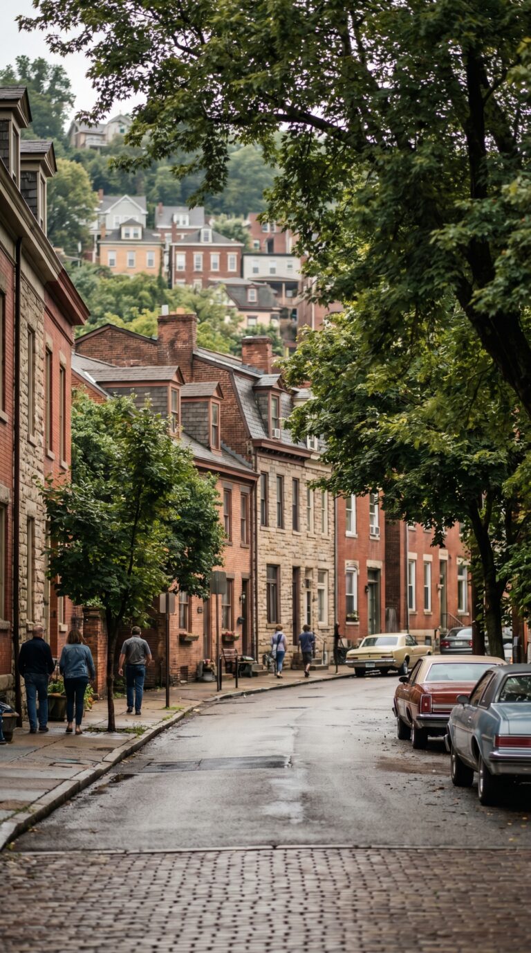
The city divides into 90 official neighborhoods. That’s not a random number. According to the City of Pittsburgh neighborhoods map, each one has defined boundaries, a community council, and a distinct identity. You won’t find generic suburban sprawl here.
Three rivers carve the city into natural sections. The Allegheny River separates the North Side from Downtown. The Monongahela River cuts off the South Side. The Ohio River forms where the two meet at the Point. This isn’t just geography trivia. The rivers force you to cross bridges constantly. Neighborhoods feel isolated from each other even when they’re a mile apart.
Hills complicate everything. Some neighborhoods sit in river valleys. Others cling to slopes so steep you need stairs cut into the hillside. Mount Washington rises 400 feet above the Monongahela. Polish Hill climbs at grades that make San Francisco look flat. The city built two inclines, funicular railways, in the 1870s because horses couldn’t handle the slopes. One still runs today.
The Golden Triangle sits at the Point where the rivers meet. That’s Downtown. Office towers, convention center, sports stadiums. Population density here drops to nearly zero after 6 PM on weekdays. The North Shore across the Allegheny holds PNC Park and Acrisure Stadium, plus the Andy Warhol Museum. Game days pack the area. Off-season it’s quiet.
South Side Flats runs along the Monongahela’s south bank. This was mill worker housing. Now it’s the city’s main nightlife strip. East Carson Street stretches two miles with 80+ bars and restaurants. Weekends bring crowds from across the region. South Side Slopes climbs the hillside above the Flats. Row houses stack up steep streets. Residential. Quiet. Different world from the bars below.
The Strip District hugs the Allegheny River east of Downtown. Wholesale food markets operated here for 150 years. Produce vendors still open at 5 AM on Saturdays. The neighborhood added restaurants, breweries, and tech offices in the past decade. It’s walkable, gritty, and packed on weekend mornings.
The East End contains the city’s largest neighborhood cluster. Oakland centers on the University of Pittsburgh’s 132-acre campus. The university enrolls 33,000 students. That population floods the surrounding blocks with student housing, cheap restaurants, and academic buildings. Carnegie Mellon University sits next door with another 15,000 students. Oakland also holds the city’s main museums and hospitals. Population density here hits 15,000 per square mile according to Pittsburgh city planning data, triple the citywide average of 5,500.
Shadyside sits east of Oakland — tree-lined streets, Victorian houses, and Walnut Street running through the centre with boutiques and cafes. Squirrel Hill borders it to the south and has the city’s largest Jewish population, with Forbes and Murray Avenues forming the commercial core: bakeries, delis, and bookstores, with residential streets spreading out from there.
The West End gets less attention. Elliott and Sheraden sit across the Ohio River from the North Side. Working-class neighborhoods. Lower rents. The area lost population when the mills closed. Some blocks show vacancy. Others are rebuilding.
Pittsburgh’s total population dropped from 677,000 in 1950 to 302,000 in 2020. The steel industry collapse drove people out. Young professionals have moved back since 2010, but growth concentrates in a few neighborhoods. Oakland, Lawrenceville, and the Strip District gained residents. Outer neighborhoods continued losing population. The Neighborhood Plan Guide tracks these shifts block by block.
Navigating between neighborhoods requires planning. The rivers force specific routes. You can’t drive straight across the city. Bridges funnel traffic. The Fort Pitt Tunnel connects the South Hills to Downtown. The Liberty Tunnels link Mount Washington to the Strip District. GPS routing here looks insane to outsiders. A neighborhood two miles away might require a 15-minute drive around a river and through a tunnel.
Ethnic heritage still defines some areas. Bloomfield remains the Little Italy. Red-sauce restaurants line Liberty Avenue. Polish Hill kept its name and its church. Lawrenceville was German and Irish. That history faded, but the architecture stayed. Row houses. Narrow lots. Front porches two feet from the sidewalk.
Historic preservation districts protect older neighborhoods. Mexican War Streets on the North Side has 400 Victorian row houses. Deutschtown next door restored its 19th-century commercial blocks. Revitalized industrial zones now hold breweries and makerspaces. The pattern repeats across the city. Old bones. New uses.
Practical Information
Pittsburgh operates in the Eastern Time Zone (UTC-5, UTC-4 during daylight saving time) and uses the 412 area code for the city proper and 724/878 for surrounding areas.
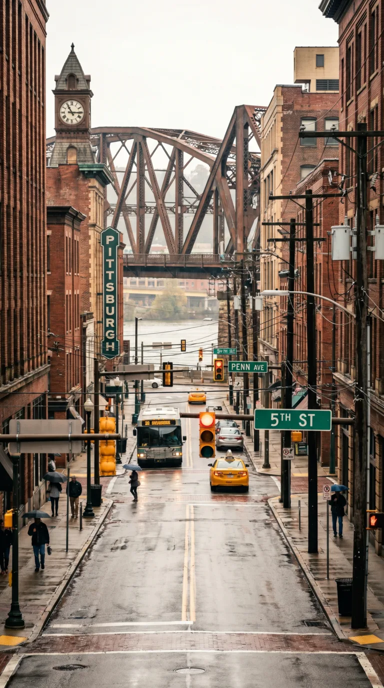
Pittsburgh sits in the Eastern Time Zone. Standard time runs UTC-5. Daylight saving time shifts to UTC-4 from mid-March through early November. Your phone will adjust automatically. If you’re flying in from the West Coast, you lose three hours. Europe loses five or six depending on the season.
The city’s name honors William Pitt the Elder, British Prime Minister during the French and Indian War. Fort Pitt replaced the French Fort Duquesne in 1758. The “h” at the end got dropped in 1891 by the U.S. Board on Geographic Names, then restored in 1911 after locals fought back. Say it: PITS-burg. Two syllables. The “h” is silent but essential to locals.
Allegheny (al-uh-GAY-nee) refers to the river, the county, and the former city that merged with Pittsburgh in 1907. Monongahela (muh-non-guh-HEE-luh) is the other major river. Four syllables. Don’t rush it. Duquesne (doo-KANE) shows up on bridges, universities, and inclines. French origin. Two syllables.
Downtown Pittsburgh uses zip code 15222. The Oakland neighborhood, home to the University of Pittsburgh and Carnegie Mellon, is 15213. The South Side is 15203. The North Shore (stadiums and museums) is 15212. Squirrel Hill is 15217. Lawrenceville is 15201. Most of the city falls in the 152xx range.
Area code 412 covers the city limits. Dial it for any Pittsburgh number. Suburbs use 724 or 878. Cell phones need all ten digits even for local calls. International visitors dial +1 before the area code. The U.S. country code is 1.
Need city services or permits? Check Pittsburgh City Government Contact Information for department phone numbers and office locations. Most municipal offices close by 4:30 PM on weekdays.
Pittsburgh runs on East Coast time but keeps Midwest hours. Dinner reservations at 5:30 PM are normal here. Bars close at 2 AM. The city wakes up early. Coffee shops open by 6 AM.
Frequently Asked Questions
What are the top things to do in Pittsburgh?
Top things to do in Pittsburgh include riding the Duquesne Incline up Mount Washington for skyline views, touring the Andy Warhol Museum, exploring the Strip District’s markets and eateries, visiting the Carnegie Museums of Art and Natural History, catching a Steelers, Penguins, or Pirates game, and walking the riverfront trails and bridges downtown.
How many days do you need in Pittsburgh?
Two to three days is enough to see Pittsburgh’s highlights. A weekend covers Mount Washington, the Strip District, a museum or two, and a sports game or riverfront walk. Add a third day for the neighbourhoods — Lawrenceville, Shadyside, and Squirrel Hill — or a day trip to Fallingwater and the Laurel Highlands.
What is the best time to visit Pittsburgh?
Late spring (May to June) and early fall (September to October) offer the best weather, with mild temperatures and lively festivals. Fall brings colourful foliage along the rivers and hillsides. Summers are warm and packed with outdoor events and baseball; winters are cold and snowy but cheaper, with hockey season in full swing.
What is Pittsburgh known for?
Pittsburgh is known as the “Steel City” for its industrial past, and today for its three rivers, 446 bridges, and hilltop views from Mount Washington. It is also famous for the Andy Warhol Museum, Heinz ketchup, Primanti Bros. sandwiches, the Steelers and Penguins, and its reinvention into a hub for healthcare, education, and tech.
How do you get around Pittsburgh?
Downtown Pittsburgh and the Strip District are walkable, and the transit system runs buses and a light-rail “T” that is free between downtown stations. Two historic inclines carry you up Mount Washington. A car helps for outer neighbourhoods and day trips, but expect steep hills, tunnels, and limited downtown parking; ride-shares are widely available.