This guide contains affiliate links. As an Amazon Associate we earn from qualifying purchases — at no extra cost to you.
Estimated reading time: 12 minutes
Last updated: 17 July 2026
What Is the Best Hike in the Delaware Water Gap?
Mount Tammany is the Delaware Water Gap’s best-known hike: a 3.5-mile red-dot/blue-dot loop that climbs about 1,200 feet to a rocky summit overlook framing the gorge. For a longer day, the Appalachian Trail runs to glacial Sunfish Pond, a 7-mile out-and-back, while Mount Minsi offers the classic ridge climb on the Pennsylvania side. Arrive before 9 a.m., since the trailhead lots fill fast on summer weekends.
Research & Verification
We gathered information from the Delaware Water Gap National Recreation Area, Pennsylvania tourism boards, and firsthand accounts from hikers and campers. Everything was verified as accurate when published, but conditions and details can change, we recommend confirming hours and trail status with local rangers before heading out.
Want to see the waterfalls and trails for yourself? Watch our full Delaware Water Gap documentary in 4K Ultra HD.
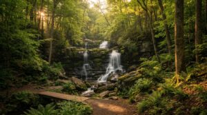
Bushkill Falls pulls in the crowds. They call it the “Niagara of Pennsylvania,” which sounds like marketing hype until you see eight separate waterfalls tumbling through a hemlock forest. It’s the anchor attraction that brings most people to this corner of the Pocono Mountains. But the real story here is the gap itself.
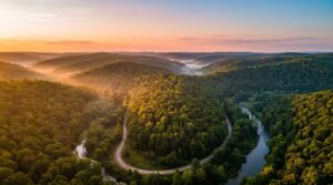
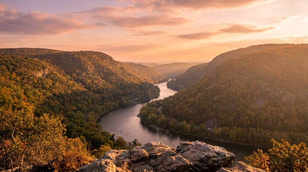
The Delaware Water Gap is exactly what it sounds like. The Delaware River sliced a path straight through the Appalachian ridge over millions of years. You get these towering forested walls on both sides, Pennsylvania to the west and New Jersey to the east. Interstate 80 crosses right through the gap, so you can see it from your car. Most people do.
The Delaware Water Gap National Recreation Area covers 70,000 acres, according to the National Park Service. That’s 40 miles of river, plus hiking trails including a stretch of the Appalachian Trail. You can camp, kayak, fish, or just drive the scenic roads. The area logged 4.1 million visitors in 2024, per NPS statistics.
People come for waterfalls and trails. The gap straddles two states, which means you get different access points and different scenery depending on which side you approach from. This guide covers the Pennsylvania side, where most of the major attractions sit.
Top Attractions and Things to Do
Bushkill Falls features 8 waterfalls connected by 2 miles of trails and wooden walkways, while the Appalachian Trail crosses the Delaware River here with Mount Tammany offering a 3.5-mile round-trip hike gaining 1,200 feet elevation.
Planning Tip
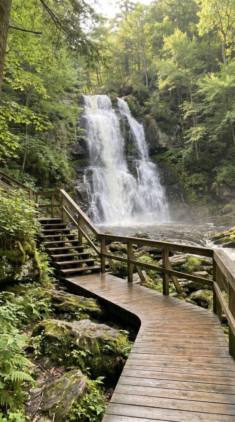
Bushkill Falls sits 20 minutes west of the main gap. People call it the Niagara of Pennsylvania. That’s marketing talk, but the eight waterfalls here are legitimately impressive. The main drop is 100 feet, according to the Bushkill Falls official website. You’ll walk two miles of trails and wooden walkways to see all the cascades. Entry costs $22 for adults. Kids under 3 get in free.
The trails split into four color-coded routes. The green trail takes 15 minutes and shows you the main falls. The red trail adds an hour and hits three more waterfalls. Yellow and blue routes extend your hike to two hours if you want the full circuit. Wear shoes with grip. The walkways get slick from mist.
Back at the Delaware Water Gap itself, waterfalls appear after heavy rain. Dingmans Falls and Silverthread Falls are the two permanent ones worth chasing. Both sit on the Pennsylvania side. Dingmans drops 130 feet and has a boardwalk that gets you close to the base. Silverthread is thinner but taller at 80 feet. The National Park Service maintains a Delaware Water Gap National Recreation Area hiking trails page with current conditions.
Mount Tammany on the New Jersey side is the most popular summit hike. The red-dot trail climbs 1,200 feet in 1.5 miles. Your knees will feel it on the way down. The blue-dot trail is gentler but longer at 2 miles. Both routes dump you at the same rocky overlook with views down the gap. Go early. The small parking lot fills by 9 AM on weekends.
Mount Minsi sits across the river in Pennsylvania. The Appalachian Trail crosses both peaks. You can hike the AT section with the gap and Sunfish Pond in New Jersey, a 7-mile out-and-back that gains 1,000 feet. The pond is glacial. No swimming allowed, but the shoreline loop is flat and quiet.
The Delaware River runs 40 miles through the recreation area, per National Park Service data. Rent a kayak in Shawnee-on-Delaware for $35 per day. Tubing is cheaper at $20 and requires zero skill. The current does the work. Launching from Kittatinny Point gives you a mellow 3-hour float to Smithfield Beach. Bring a dry bag for your phone.
Point of Gap Overlook is a roadside pullout on I-80 westbound. You can see both mountains framing the river. It’s a 30-second stop for photos. Arrow Island Overlook on Old Mine Road in New Jersey gives you a different angle without highway noise.
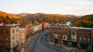
The historic town of Delaware Water Gap has two blocks of shops and cafés. The Deer Head Inn hosts live jazz on weekends. It’s been running since 1869. Parking is free along the main street.
Black bears live here. You’ll see them if you hike enough. Keep food in your car trunk, not your tent. Bald eagles fish the river in winter. Bring binoculars if you’re into birds.
What should I pack for the Delaware Water Gap?
The Gap mixes rocky ridge hikes, mist-slick waterfall walkways and a 40-mile river built for tubing and kayaking — so you’re packing for both trail and water in the same day. The essentials:
- Hiking boots with ankle support — Mount Tammany and the AT are rocky and steep
- Grippy water shoes — waterfall walkways stay slick, and you’ll want them for the river
- A waterproof rain shell — mountain weather turns fast and the falls run after rain
- A fleece layer — mornings start cool even in summer
- A daypack with hydration — carry two liters per person for a full-day hike
- A waterproof dry bag — keeps your phone and keys dry while tubing or kayaking
- A pair of binoculars — bald eagles fish the river and the gorge is full of birds
As an Amazon Associate we earn from qualifying purchases.
Where to Stay: Camping and Accommodation
Camping around the Delaware Water Gap runs from the private, hookup-equipped Dingmans Campground (133 sites, about $46 to $62 a night) to New Jersey’s Worthington State Forest and the park’s own paddle-in river and group campsites booked on Recreation.gov.
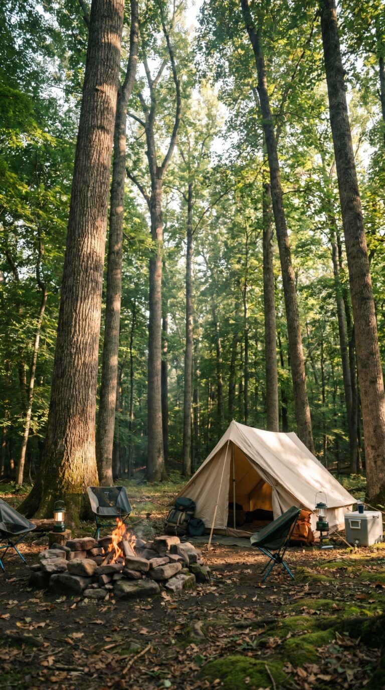
Camping is the default move here. The drive-in campgrounds in and beside the park are run by outside operators rather than the Park Service itself. Dingmans Campground, on the Pennsylvania side, has 133 sites with flush toilets, hot showers, and a mix of hookup and tent spots; you book it through the campground’s own website. Across the river in New Jersey, Worthington State Forest Campground offers around 70 riverside tent and trailer sites reserved through New Jersey’s state park system. The Park Service manages the paddle-in river campsites and group campgrounds such as Rivers Bend, which you reserve on Recreation.gov campground reservations and which require a permit.
Camping season generally runs mid-April through October, according to the NPS camping information page. Peak summer weekends (Memorial Day through Labor Day) fill up fast, so book at least two months out. Nightly rates run roughly $46 to $62 at Dingmans and less at the state-forest and park-run sites. River and backcountry camping is by permit only, arranged in advance at the park.
Not a camper? The Pocono Mountains region has motels and cabin rentals within 15 minutes of the park entrance. Deer Head Inn sits right in Delaware Water Gap town, a jazz club downstairs, rooms upstairs, walking distance to trailheads. Expect $120-180 per night for basic lodging in nearby Stroudsburg or East Stroudsburg. Airbnb cabins run $150-250.
From Dingmans Campground, you’re about 10 minutes from Dingmans Falls. Worthington puts you right at the Dunnfield Creek and Mount Tammany trailheads. Plan accordingly.
Getting There and Getting Around
Delaware Water Gap sits on Interstate 80 approximately 75 miles west of New York City and 90 miles north of Philadelphia, with the Pennsylvania Welcome Center at mile marker 310 providing maps and visitor information.
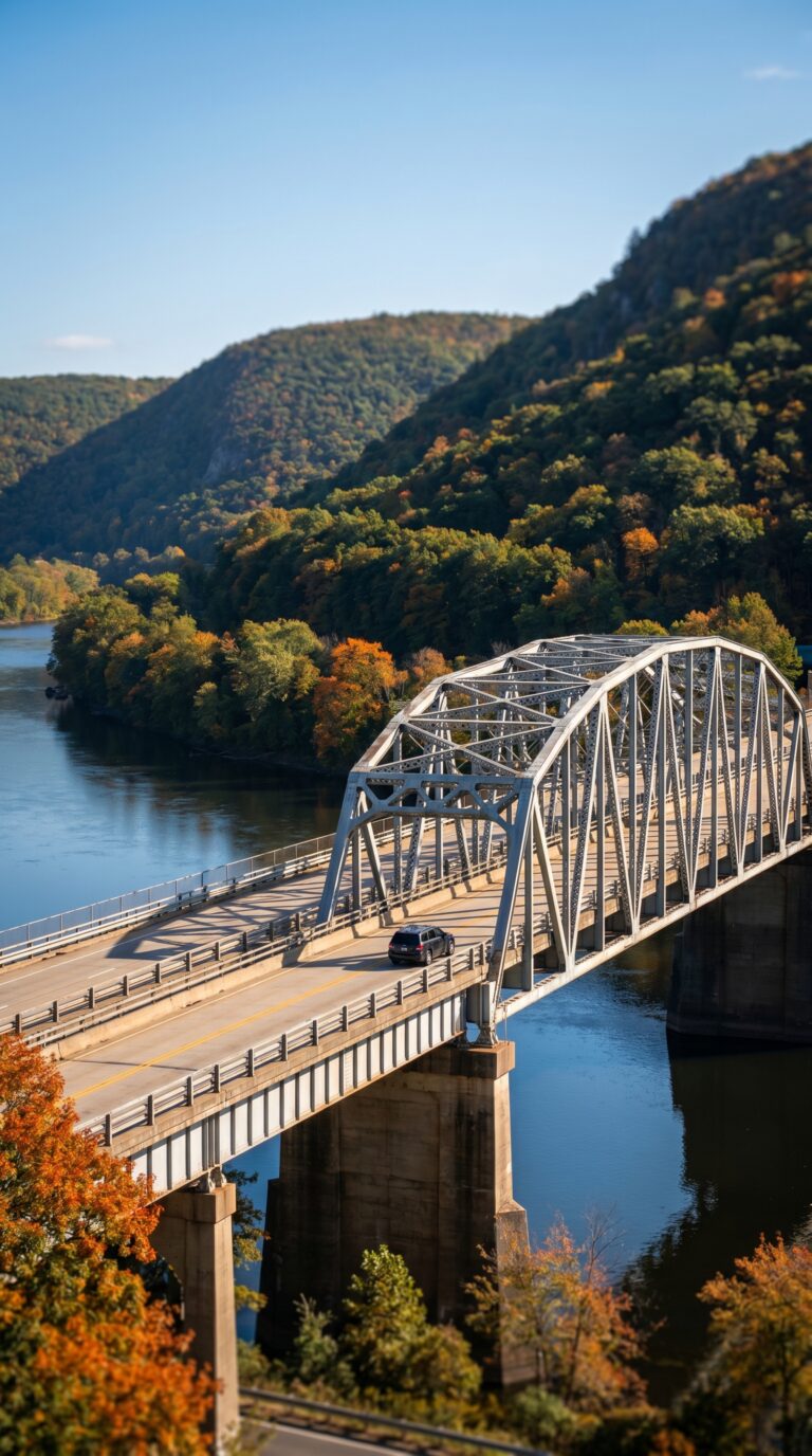
Interstate 80 cuts straight through the Water Gap. The bridge over the Delaware River is the main access point connecting Pennsylvania and New Jersey. Check 511PA Traffic Information before you go, bridge closures happen for maintenance, usually with advance notice.
From Philadelphia, it’s about 90 miles north, roughly 1 hour 45 minutes of driving. From New York City, expect 75 miles and 1 hour 30 minutes depending on traffic through New Jersey. Scranton sits 35 miles northwest, a 45-minute drive.
You need a car. Public transit doesn’t reach the trails or campgrounds. Parking lots exist at major trailheads like Dunnfield Creek and Childs Park, but they fill up on summer weekends by 9 a.m. Arrive early or pick a weekday.
The Pennsylvania Welcome Center at mile marker 310 on I-80 westbound stocks free trail maps and area guides. The National Park Service also offers Delaware Water Gap Maps as PDF downloads, print one before you leave home. Cell service is spotty once you’re on the trails.
The recreation area spans both states. Pennsylvania holds most of the dramatic ridge hikes. New Jersey has the calmer river access points and historic sites. Plan your route accordingly.
Day Trips from Delaware Water Gap
Jim Thorpe sits 35 miles southwest of Delaware Water Gap offering Victorian architecture and scenic railways, while Philadelphia lies 90 miles southeast with top-quality museums and historic sites accessible as a full-day excursion.
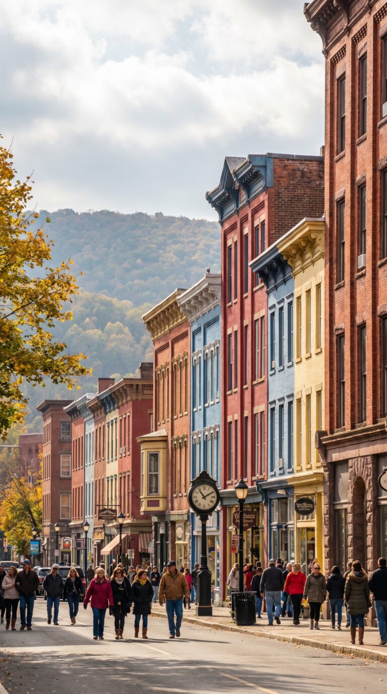
What towns are near the Delaware Water Gap? The answer depends on what you’re after. Jim Thorpe tops the list for most visitors. This Victorian-era coal town earned the nickname “Switzerland of America” for its mountain setting and 19th-century architecture. The drive takes 50 minutes via PA-209 South. Main attractions include the Lehigh Gorge Scenic Railway, which runs 16 miles along the Lehigh River Gorge, and the Asa Packer Mansion, a preserved coal baron estate. The Official Jim Thorpe tourism website lists current railway schedules and walking tour maps.
Bethlehem sits 45 miles southeast. The city built its economy on Bethlehem Steel until the plant closed in 1995. Now the SteelStacks arts campus occupies the old blast furnaces. Musikfest draws 1 million visitors each August for 10 days of live music across 16 stages. The Christmas markets run weekends from late November through December, modeled after German Christkindlmarkt traditions. Drive time runs about one hour.
Hershey lies 90 miles west, a two-hour drive. Hersheypark draws 3.4 million visitors annually according to the Themed Entertainment Association. The chocolate factory tour is free but requires advance reservations during summer. Families with kids under 12 make this the most popular day trip.
Philadelphia requires a full day. The city sits 90 miles southeast, roughly 90 minutes without traffic. Independence Hall and the Liberty Bell anchor the historic district. The Philadelphia Museum of Art holds 240,000 objects across 200 galleries. Check the Visit Philadelphia official tourism website for current museum hours and ticket prices.
Reading sits 60 miles south, a 70-minute drive. The VF Outlet Village offers 60 brand-name stores. The Pagoda, a 1908 Japanese-style building on Mount Penn, provides city views and costs nothing to visit. Harrisburg, the state capital, lies 100 miles southwest. The State Museum of Pennsylvania charges $6 admission and covers 500 million years of state history.
Longer trips include Lancaster County for Amish farmland and roadside markets (2 hours south) and Gettysburg for Civil War battlefield tours (2.5 hours southwest). Both require early starts.
Practical Tips for Your Visit
Delaware Water Gap experiences four distinct seasons with peak visitation from May through October, average summer temperatures of 75-85°F, and timber rattlesnakes present requiring hikers to stay alert on trails.
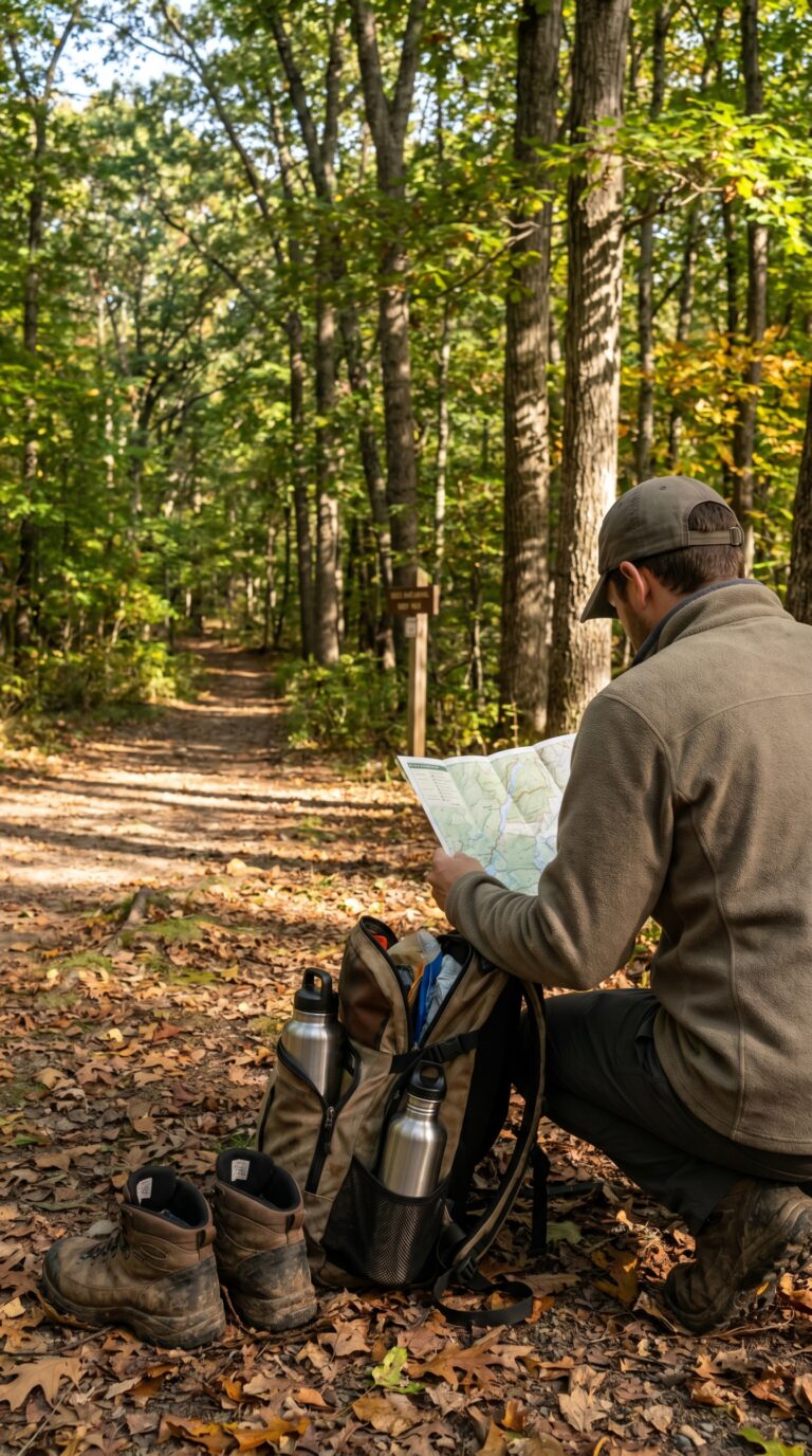
Spring through fall offers the best conditions for exploring the recreation area. October brings peak foliage, reds and golds blanket the ridges. Check the National Weather Service Forecast for the 10-day outlook before you drive out. According to National Weather Service climate data, the area receives approximately 45 inches of rain annually, with summer storms rolling through quickly.
June through August sees the heaviest crowds. Water temperatures in the Delaware River hit 70-75°F, perfect for swimming and tubing. Parking lots at popular trailheads fill by 10 a.m. on weekends.
Yes, timber rattlesnakes live here. They’re not aggressive, but they’re present. Stay on marked trails. Watch where you step, especially near rocky outcrops and fallen logs. Black bears also roam the area. Use bear-proof containers or hang food at campsites.
Pack sturdy hiking boots with ankle support. The trails are rocky. Bring layers, mornings start cool even in summer. Rain gear matters. Carry at least two liters of water per person for a full-day hike. Trail maps are essential; cell service drops to nothing once you’re deep in the woods. Insect repellent helps from May through September.
Before heading out, check the Current Conditions page on the NPS website for trail closures or road accidents. The recreation area charges no entrance fee. Leave No Trace principles apply, pack out everything you pack in.
Frequently Asked Questions
How long does it take to hike the Delaware Water Gap?
It depends on the trail. The popular Mount Tammany red-dot/blue-dot loop is about 3.5 miles and takes 3 to 4 hours with a steep climb and ridge views. Shorter waterfall walks (Dingmans, Raymondskill) take 30 minutes to an hour, while sections of the Appalachian Trail can fill a full day.
Can you swim in the Delaware Water Gap?
Yes. There are designated swimming beaches along the Delaware River, including Smithfield Beach and Milford Beach on the Pennsylvania side, plus river access for tubing, kayaking, and canoeing. Swim only in marked areas, as currents can be strong, and note that lifeguards are seasonal.
Is the Delaware Water Gap in New Jersey or Pennsylvania?
Both. The Delaware Water Gap and its National Recreation Area straddle the Delaware River along the Pennsylvania–New Jersey border, so you can explore either side. The Kittatinny Point Visitor Center is on the New Jersey side, while many waterfalls and Bushkill Falls are on the Pennsylvania side.
What towns are near the Delaware Water Gap?
Stroudsburg and East Stroudsburg, PA are the main gateway towns with lodging and dining, and the small borough of Delaware Water Gap sits right at the gap. Milford, PA is a charming base to the north, and Columbia, NJ anchors the New Jersey side.
Is there an entrance fee for the Delaware Water Gap?
There is no general entrance fee for the Delaware Water Gap National Recreation Area, but some beaches and boat launches charge seasonal parking fees, and privately run Bushkill Falls charges admission. An America the Beautiful pass covers the federal amenity fees where they apply.