
Estimated reading time: 18 minutes
Last updated: September 2026
Table of Contents
- What Caused the Cheltenham Badlands?
- Visiting the Cheltenham Badlands
- Hiking the Scarborough Bluffs
- Sudbury Basin Meteorite Crater Explained
- Exploring the Niagara Escarpment
- Prince Edward County Sand Dunes
- Frequently Asked Questions
- Conclusion
What Caused the Cheltenham Badlands?
The Cheltenham Badlands formed when soft, iron-rich Queenston shale was exposed and eroded into rippling red-and-grey hills, a process sped up by poor farming and deforestation in the early 1900s. The red colour comes from iron oxide, the greenish bands from groundwater. Today the fragile site in Caledon, Ontario is viewed from a boardwalk, about an hour northwest of Toronto. This guide also covers Ontario wonders like the Scarborough Bluffs, Niagara Escarpment, and Sandbanks dunes.
We’ll explore five great natural attractions that showcase Ontario’s geological marvels: the Mars-like terrain when visiting the Cheltenham Badlands, the dramatic experience of hiking the Scarborough Bluffs, the ancient story behind the Sudbury Basin meteorite crater, the diverse landscapes while exploring the Niagara Escarpment, and the surprising coastal beauty of Prince Edward County sand dunes.
These destinations appeal to nature enthusiasts, photographers, geology buffs, and travelers seeking authentic experiences away from the typical tourist routes. This guide provides practical information to help you make the most of your visit to these natural wonders.
Want to watch the Wonders of Ontario Travel Documentary in UHD 4K Resolution? Click here to watch on YouTube.
How This Guide Was Researched
This guide was researched using official tourism board data, government park services, and verified traveler accounts. All prices, hours, and logistics were confirmed at the time of publication. We recommend verifying details with local sources before you travel.
Visiting the Cheltenham Badlands
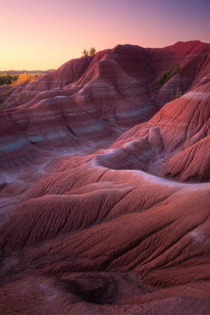
Just northwest of Toronto’s urban sprawl lies one of Ontario’s most unusual landscapes. The Cheltenham Badlands present visitors with a surreal terrain that seems transplanted from another planet. Covering 36 acres, these impressive red hills with their sharp ridges and deep gullies create a dramatic contrast to Ontario’s typically green scenery.
The landscape is composed of Queenston shale, a soft red bedrock that gives the badlands their recognizable Mars-like appearance. The lively reddish hue comes from iron oxide deposits within the rock, which glow dramatically when lit by the late afternoon sun. What makes these formations particularly fascinating is their relatively recent exposure in geological terms.
Geological Formation and History of the Cheltenham Badlands
Unlike most geological wonders that form over millions of years, the Cheltenham Badlands were revealed through human activity. In the 1930s, poor farming practices led to severe soil erosion that stripped away the protective vegetation and topsoil. This agricultural mistake exposed the underlying Queenston shale to the elements. Once exposed, natural erosion from rain and runoff quickly carved the recognizable patterns we see today.
The badlands sit within the larger Caledon region where the Niagara Escarpment creates a varied landscape of hills and valleys. The nearby Credit River runs through this terrain, supporting diverse ecosystems that stand in stark contrast to the barren badlands.
Best Photography Tips for Visiting the Cheltenham Badlands
For photographers, the badlands offer exceptional opportunities throughout the day, but certain times yield more dramatic results:
- Golden hour (one hour before sunset) provides the most impressive light, when the low sun angle intensifies the red coloration and creates defining shadows across the rippled terrain.
- Early morning offers soft light with fewer visitors, perfect for unobstructed landscape shots.
- After rainfall, the wet surface deepens the red color, creating more saturated images.
The site features a wooden observation deck that provides excellent vantage points without damaging the fragile terrain. From this platform, visitors can appreciate the full scope of the undulating patterns below.
Visitor Information for the Cheltenham Badlands in Ontario
When planning your visit, keep these important details in mind:
- Walking directly on the badlands is strictly prohibited to prevent further erosion and preserve the site for future generations.
- The site is managed by Credit Valley Conservation, and staff are often present to answer questions about the geological features.
- Parking is reservation-only through ParkPass; book online ahead, as no payment is taken on site. Fees run about $10 to $20 for ninety minutes and $18 to $35 for three hours, with weekends and holidays at the higher end.
- The site is typically open from April through October, weather permitting.
- Basic amenities include portable restrooms and informational signage.
- The Bruce Trail, Ontario’s oldest and longest marked hiking trail, passes near the badlands and offers additional exploration opportunities.
The closest town is Caledon, where you can find restaurants, accommodations, and supplies before or after your visit to the badlands. For those interested in exploring more lesser-known spots in Canada, this area makes an excellent starting point.
Hiking the Scarborough Bluffs: Trails, Safety, and Seasonal Views
Rising dramatically along Lake Ontario’s shoreline, the Scarborough Bluffs form one of the most spectacular natural features in the Toronto region. These imposing clay cliffs stretch for about 15 kilometers and reach heights of up to 90 meters (300 feet) above the lake, creating an unexpected coastal landscape within Canada’s largest city.
Geological Significance of the Scarborough Bluffs
The bluffs showcase layers of sand and clay that tell a fascinating geological story. These sediments were deposited during the last ice age, approximately 12,000 years ago, when glaciers advanced and retreated across the region. The recognizable stratification visible in the cliff face reveals this ancient process, with each horizontal layer representing different periods of glacial activity.
Today, these formations continue to evolve through natural erosion. The bluffs recede at an average rate of about 30 centimeters per year as waves from Lake Ontario undercut the base of the cliffs. This ongoing process means the landscape is constantly changing, with occasional small landslides reshaping sections of the bluffs.
Hiking the Scarborough Bluffs: Trails and Scenic Viewpoints
Several parks along the bluffs offer different perspectives and hiking experiences:
- Bluffer’s Park provides the most accessible view of the bluffs from below. A flat, paved path follows the shoreline with magnificent views of the towering cliffs.
- Scarborough Crescent Park offers views from atop the bluffs with several lookout points.
- Guild Park and Gardens combines art, history, and nature with trails leading to bluff overlooks.
- The Scarborough Bluffs Trail connects several of these parks, though sections may be closed due to erosion concerns.
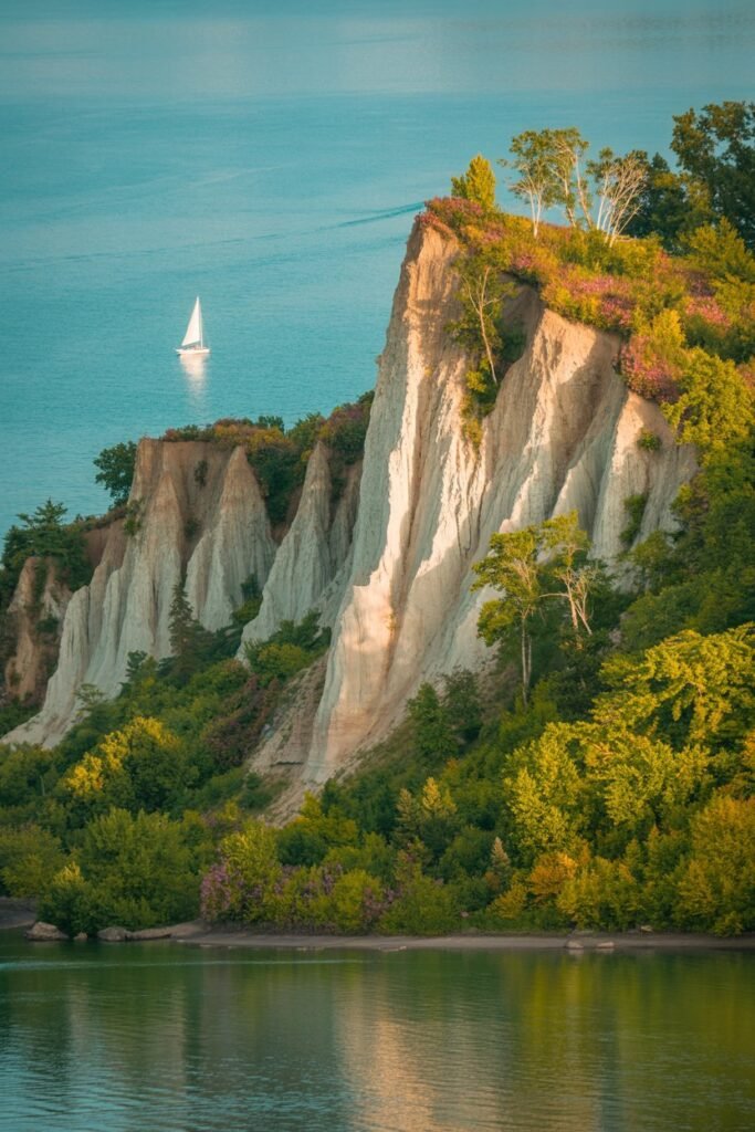
For the best hiking experience, start at Bluffer’s Park and walk eastward along the beach. As you progress, the bluffs become increasingly dramatic, with their sheer faces towering overhead. This route allows you to appreciate both the scale of the cliffs and the beautiful sandy beach below.
Safety Tips for Hiking the Scarborough Bluffs
Hiking the Scarborough Bluffs requires some careful planning and awareness:
- Stay on designated trails and observe all warning signs. The edge of the bluffs can be unstable and dangerous.
- Never climb the face of the bluffs, as they are composed of loose material prone to sudden collapse.
- Check weather conditions before visiting, as trails can become muddy and hazardous after rainfall.
- Wear proper footwear with good traction, especially when hiking the steeper sections.
- The most spectacular views typically occur in late afternoon when the western sun illuminates the eastern face of the bluffs.
Facilities vary between the different parks, but most have parking (which fills quickly on summer weekends), restrooms, and picnic areas. Bluffer’s Park also features a marina, restaurant, and a Blue Flag certified beach for swimming.
For those interested in photography, the contrast between the white cliffs, blue lake, and green vegetation creates beautiful compositions, particularly from the beach level looking upward or from designated lookout points along the top.
Sudbury Basin Meteorite Crater Explained: Impact, Mining, and Visitor Guide
In Northern Ontario lies an extraordinary geological feature that’s easily overlooked because of its massive scale. The Sudbury Basin is the third-largest known impact crater on Earth, stretching approximately 60 kilometers long and 30 kilometers wide. Unlike many famous craters that form obvious depressions in the landscape, the Sudbury Basin’s ancient origins require some understanding to fully appreciate its significance.
Sudbury Basin Meteorite Impact and its Geological Significance
Approximately 1.85 billion years ago, a meteorite estimated to be 10-15 kilometers in diameter slammed into Earth at this location. The impact was so powerful that it created an initial crater about 250 kilometers wide. To put this in perspective, the energy released would have been millions of times greater than the most powerful nuclear weapon ever detonated.
The collision melted and fractured the Earth’s crust, creating a basin that gradually filled with sediment over millions of years. The extreme heat and pressure from the impact also triggered unique geological processes that would later shape the region’s economic future.
Sudbury Basin: Mining History and Economic Impact
The Sudbury Basin owes its industrial importance directly to this ancient cosmic collision. The meteorite impact concentrated valuable metals including nickel, copper, platinum, palladium, gold, and other precious elements in the region.
When mining began in the area in the late 19th century, no one understood the basin’s meteorite origins. It wasn’t until the 1960s that scientists recognized the recognizable shock features in the rock that confirmed the impact theory. Today, Sudbury remains one of the world’s most important mining regions, with operations that have extracted billions of dollars worth of minerals from the crater.
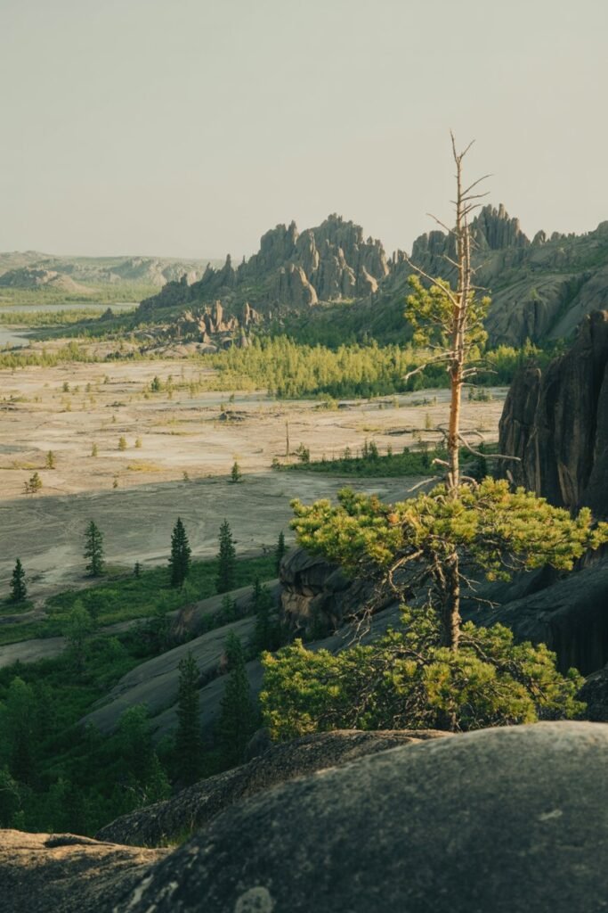
This cosmic gift came with environmental consequences, however. Decades of mining and smelting activities severely damaged the local ecosystem, creating a barren landscape often compared to the surface of the moon.
Sudbury Basin: Environmental Recovery After Mining
Since the 1970s, Sudbury has undertaken one of the world’s most successful environmental recovery programs. The city and mining companies have:
- Planted more than 10 million trees to reforest the damaged landscape
- Neutralized acidified soil with limestone applications
- Dramatically reduced smelter emissions
- Restored lakes and waterways affected by acid rain
The results have been great, with thick vegetation returning to areas that were once barren rock. Wildlife has also returned to the region, making Sudbury a model for industrial environmental rehabilitation.
Visitor Guide to Exploring the Sudbury Basin Crater
While the basin itself is too large to view in its entirety from ground level, visitors can learn about this great feature at Science North, Sudbury’s science center. Interactive exhibits explain the impact event and its geological significance.
The Dynamic Earth museum, built near an active mine, offers underground tours and extensive exhibits on mining and geology. Here, visitors can hold rocks containing shatter cones, recognizable fracture patterns that provide key evidence of the meteorite impact.
For those wanting to experience the basin landscape, numerous lookout points around Sudbury offer views across portions of this enormous geological feature. Ramsey Lake, located right in the city, sits within the basin and provides a pleasant setting to contemplate the cosmic event that shaped this region billions of years ago.
Hikers can explore sections of the basin rim on trails near Manitoulin Island, offering both geological interest and scenic views of the surrounding landscape.
Exploring the Niagara Escarpment: Waterfalls, Trails, and Ecology
The Niagara Escarpment is far the cliff that creates Niagara Falls. This massive limestone ridge stretches over 725 kilometers across Ontario, forming one of the most significant geographical features in the province. Designated as a UNESCO World Biosphere Reserve in 1990, the escarpment represents a great blend of natural history, biodiversity, and scenic beauty.
Exploring the Geological Significance of the Niagara Escarpment
The escarpment began forming over 450 million years ago during the Silurian period when this region was covered by a shallow tropical sea. Sediments from marine organisms gradually accumulated on the sea floor, eventually forming the dolostone and limestone that compose much of the escarpment today.
As the ancient sea retreated and the continent underwent geological uplift, erosion carved away softer rocks while leaving the resistant dolostone cap rock intact. This differential erosion created the recognizable cliff face or “escarpment” that defines this feature.
Today, the escarpment creates dramatic elevation changes throughout southern Ontario, with vertical cliffs rising up to 335 meters above the surrounding landscape at their highest points. These cliffs provide both scenic vistas and unique microclimates that support specialized plant communities.
Waterfalls and Unique Natural Features of the Niagara Escarpment
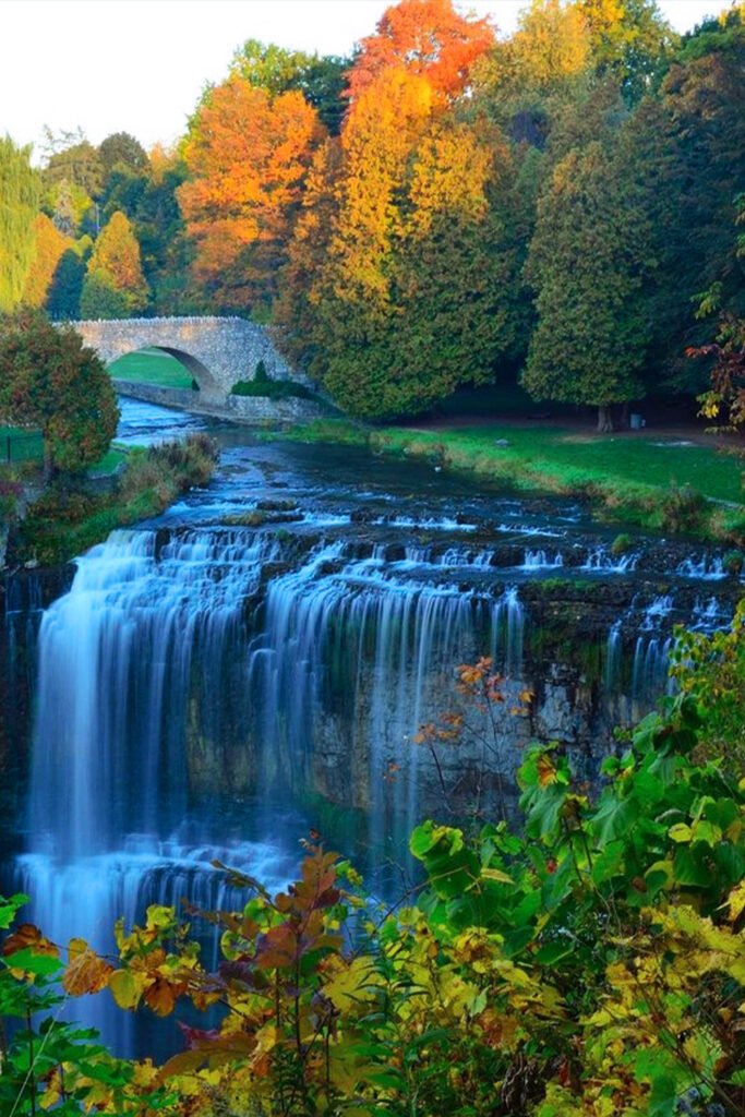
While Niagara Falls is the most famous waterfall along the escarpment, the geological formation creates numerous other cascades throughout its length. The Hamilton area alone boasts more than 100 waterfalls where streams cross the escarpment’s edge, earning it the nickname “Waterfall Capital of the World.”
Notable waterfalls include:
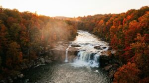
- Webster’s Falls in Spencer Gorge, featuring a classic 22-meter curtain waterfall
- Tew’s Falls, one of the tallest in the region at 41 meters
- Albion Falls, a complex terraced cascade that’s particularly photogenic
- Devil’s Punchbowl, with its recognizable ribbon of water falling 37 meters into a bowl-shaped gorge
Beyond waterfalls, the escarpment features numerous caves, crevices, and unique rock formations. The most famous is the Lion’s Head formation on the Bruce Peninsula, which resembles a lion’s profile when viewed from Georgian Bay.
Hiking the Bruce Trail: Best Sections on the Niagara Escarpment
The escarpment serves as the backbone for Canada’s oldest and longest marked footpath, the Bruce Trail. This 900-kilometer trail follows the escarpment from Niagara to Tobermory at the tip of the Bruce Peninsula, offering hikers access to some of Ontario’s most spectacular landscapes.
Some of the most striking sections include:
- Rattlesnake Point in Milton, featuring ancient cedar trees growing directly from cliff faces and wide views of the countryside
- Lion’s Head Provincial Park, where the trail follows the escarpment edge with great views over Georgian Bay
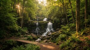
- Niagara Glen, where hikers can descend into a clean gorge filled with huge boulders and rare Carolinian forest
- Spencer Gorge, combining multiple waterfalls with outstanding vistas
The trail system is well-maintained by the Bruce Trail Conservancy and includes both challenging sections for experienced hikers and gentler routes suitable for casual day hikes.
Biodiversity and Ecology Along the Niagara Escarpment
The escarpment creates diverse habitats that support an extraordinary range of plant and animal species. Its various microclimates harbor over 300 bird species, 55 mammal species, 36 reptile and amphibian species, and more than 1,500 plant species.
Of particular ecological importance are the ancient cedar trees growing from the escarpment cliffs. Some of these trees are over 1,000 years old, making them among the oldest living organisms in eastern North America. These gnarled, stunted trees survive in almost impossible conditions, rooted in tiny cracks in vertical cliff faces.
The escarpment also protects remnants of the Carolinian forest, a rare ecosystem in Canada that contains species typically found much further south. This forest type harbors the highest biodiversity in Canada, including many species at risk.
For those interested in experiencing other historic waterways in Ontario, the Rideau Canal provides another unique experience, especially in winter when it transforms into the world’s largest skating rink.
Prince Edward County Sand Dunes: Sandbanks Provincial Park Travel Guide
In stark contrast to Ontario’s predominantly rocky and forested landscapes stands a destination that seems transported from a more tropical setting. Prince Edward County, a peninsula that juts into Lake Ontario, hosts one of the province’s most unexpected natural attractions: an extensive system of freshwater sand dunes that rivals coastal formations found along ocean shores.
Sandbanks Provincial Park and its Sand Dunes
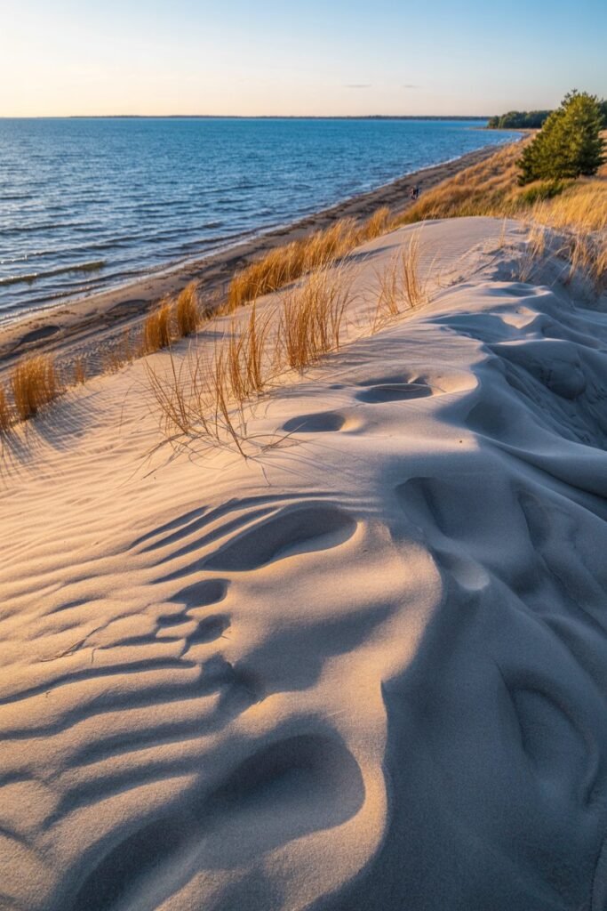
The gem of this dune system is Sandbanks Provincial Park, home to the world’s largest freshwater baymouth barrier dune formation. Here, golden sand dunes tower up to 25 meters (80 feet) high, creating a beautiful visual contrast against the blue waters of Lake Ontario.
These dunes began forming approximately 12,500 years ago as the glaciers retreated, leaving behind massive quantities of sand and gravel. Wave action along the shoreline gradually shaped these deposits into the recognizable dune formations visible today. Strong prevailing winds from the southwest continue to sculpt and reshape these dunes, making them a dynamic, ever-changing landscape.
The park encompasses three main beach areas, each with its own unique character:
- Dunes Beach features the most impressive sand dunes, with rolling hills of sand extending inland from the shoreline.
- Outlet Beach offers a more sheltered swimming area and gentler dunes.
- Sandbanks Beach stretches for kilometers along West Lake, providing plenty of space even on busy summer days.
Ecological Importance of Prince Edward County Sand Dunes
Beyond their scenic beauty, these dunes support unique ecological communities adapted to the challenging conditions of shifting sand and limited water. The dune environment transitions through several distinct zones, from the active beach to the established dune forests further inland.
Specialized plants like marram grass play a crucial role in stabilizing the dunes with their extensive root systems. This early species can withstand burial in sand and thrives in the harsh, exposed environment of active dunes. As you move away from the shoreline, the vegetation becomes increasingly diverse and eventually transitions to woodland.
The dune system also provides important habitat for birds, including the endangered Piping Plover which occasionally nests on the beaches. Migratory birds use these shorelines as resting areas during their seasonal journeys.
Fun Recreational Activities at Prince Edward County Sand Dunes
The dunes and adjacent beaches offer numerous recreational opportunities throughout the year:
- Swimming in the warm, shallow waters of Lake Ontario (typically comfortable from late June through early September)
- Sunbathing on some of Ontario’s finest sandy beaches
- Photography, especially during golden hour when the low angle of sunlight creates dramatic shadows across the dune ridges
- Hiking on designated trails through the dune environments and adjacent wetlands
- Birdwatching, particularly during spring and fall migrations
- Canoeing and kayaking in the protected waters of West Lake
Practical Visiting Tips for Prince Edward County Sand Dunes
If you’re planning to experience the Prince Edward County sand dunes, keep these tips in mind:
- The park can reach capacity during summer weekends, particularly in July and August. Arrive early or visit mid-week if possible.
- The optimal times to visit are late spring (June) and early fall (September), when the weather remains pleasant but crowds are significantly smaller.
- Day-use fees apply for park entry, with seasonal passes available for frequent visitors.
- Camping is available within the park, but sites must be reserved well in advance (up to 5 months for summer weekends).
- Stay on designated paths through the dunes to protect the fragile vegetation that stabilizes the sand.
- Bring sun protection, as there is limited natural shade on the beaches and dunes.
The surrounding Prince Edward County region offers additional attractions, including wineries, farm-to-table restaurants, and artisan shops, making it an ideal destination for a weekend getaway or longer vacation. The county’s relaxed pace and rural character provide a perfect complement to days spent exploring its unique coastal landscapes.
Many visitors combine their dune exploration with visits to nearby Kingston, which offers historical attractions and a lively downtown area just a hour’s drive away.
Frequently Asked Questions
What are the Cheltenham Badlands?
The Cheltenham Badlands are a striking expanse of rippling red-and-grey clay hills in Caledon, Ontario, about an hour northwest of Toronto. Formed from eroded iron-rich Queenston shale, they are one of southern Ontario’s most photographed natural landmarks and are protected by the Ontario Heritage Trust and Credit Valley Conservation.
Can you walk on the Cheltenham Badlands?
No. To stop erosion, walking directly on the badlands is prohibited — foot traffic was causing up to 10% of the site’s annual sediment loss. Instead you view the formations from a 60-metre boardwalk and platform, and you can hike the short Badlands Trail and a connecting stretch of the Bruce Trail.
How long is the Cheltenham Badlands hike?
The walk is short. The accessible Badlands Trail along the boardwalk is about 0.32 km, and a connecting loop on the Bruce Trail through the forest adds roughly 1.33 km. Most visitors spend 30 to 60 minutes on site, which fits the 90-minute parking reservation.
Do you need a reservation to visit the Cheltenham Badlands?
Yes. Parking is reservation-only through ParkPass during the open season (roughly May to October). Rates run about $10–20 for a 90-minute visit and $18–35 for three hours, with weekends and holidays at the higher end. Book ahead, as spots sell out on sunny weekends.
What other natural wonders are near the Cheltenham Badlands?
Plenty. Within a day’s drive you can pair the badlands with the Scarborough Bluffs on Lake Ontario, waterfalls and trails along the Niagara Escarpment, the Sandbanks dunes in Prince Edward County, and the vast Sudbury Basin meteorite crater further north.