Estimated reading time: 15 minutes
Last updated: 21 September 2026
Table of Contents
- Can You Hike the Caldeira do Faial?
- Exploring the Caldeira: Trails and Viewpoints
- Getting to Caldeira do Faial
- Beyond the Crater: Nearby Attractions
- Planning Your Visit
- Frequently Asked Questions
Can You Hike the Caldeira do Faial?
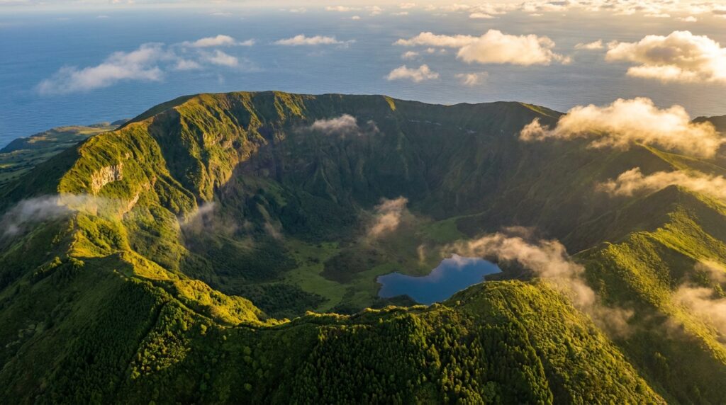
Yes — the classic way to experience the Caldeira do Faial is the Percurso da Caldeira, a roughly 7-kilometre trail that loops the entire crater rim at about 1,043 metres. It takes around 2.5 to 3 hours, is free, and delivers 360-degree views over the 2-kilometre-wide, 400-metre-deep crater and across the channel to Pico and São Jorge. The crater floor itself is a protected nature reserve.
What We Used to Write This
This guide draws from official Azores tourism data, geological surveys, and dozens of firsthand visitor reports gathered through 2024. While Gunnar hasn’t hiked Caldeira do Faial himself, the information reflects current conditions as of publication, though weather and trail access can shift, so it’s worth checking local authorities before you go.
Want to see Caldeira do Faial from above? Watch our complete Faial Island travel guide in 4K.
The caldeira do faial sits at 1,043 meters above sea level. Stand at the rim and you’re staring straight down into a geological wound that last erupted around 10,000 years ago, according to data from the Portuguese Institute for Sea and Atmosphere (IPMA). The walls drop vertically in some sections. Mist rolls in from the Atlantic without warning.
This isn’t a postcard view you glance at and move on from. The caldeira azores landscape forces you to reckon with the volcanic forces that built these islands. Faial Island sits in the central Azores group, 20 kilometers west of Pico Island. The caldeira volcano dominates the island’s interior, a collapsed magma chamber now carpeted in endemic vegetation that exists nowhere else on Earth.
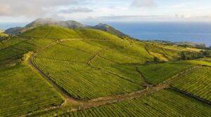
Is Faial Island worth visiting? If you want to hike the rim of a massive volcanic crater, yes. The Official Azores Natural Parks website lists the caldeira as a protected natural monument. You can walk the entire 8-kilometer perimeter trail in about four hours. The route circles the crater rim with views that shift from dense laurel forest to exposed volcanic rock to agricultural valleys dropping toward Horta, the island’s main port town.
Planning Tip
The caldeira sits 20 minutes by car from Horta. No entrance fee. No crowds except in July and August when Portuguese mainlanders arrive. The trails are well-marked but often muddy. Bring waterproof boots and layers, the summit microclimate runs 10 degrees cooler than sea level.
Exploring the Caldeira: Trails and Viewpoints
The Caldeira do Faial rim trail is a 7-kilometer circular route taking approximately 3 hours to complete, offering 360-degree views from 1,043 meters elevation.
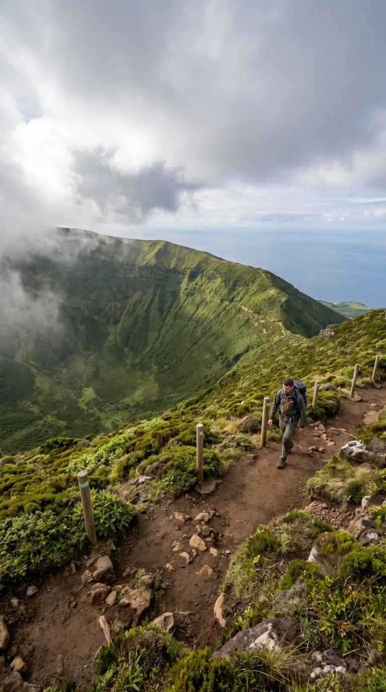
The Percurso da Caldeira circles the entire crater edge. It’s the main reason people drive up here. The trail is well-marked with wooden posts and red-and-yellow blazes. Moderate difficulty. You’ll gain about 200 meters of elevation over the loop, but nothing technical. Most hikers finish in 2.5 to 3 hours depending on how often they stop for photos.
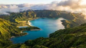
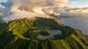
The crater drops 400 meters straight down. From the rim, you’re staring into a massive bowl lined with laurel forest and tree ferns. The floor stays wet year-round. Fog rolls in and out constantly, so the view changes every ten minutes. On clear mornings, you can see the entire crater interior, a dense tangle of green vegetation that looks prehistoric. According to the Azores Geopark official website, the caldeira formed around 10,000 years ago after a massive eruption emptied the magma chamber and the summit collapsed inward.
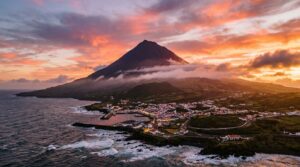
The rim trail delivers ocean views in every direction. Mount Pico dominates the eastern horizon across the channel, Portugal’s highest peak at 2,351 meters. On clear days, you can also spot São Jorge Island to the northeast. The Atlantic stretches endlessly to the west. The contrast is jarring: volcanic rock underfoot, dense forest in the crater, open ocean beyond.
Weather on the rim is unpredictable. Wind gusts hit 40 km/h regularly. Fog can roll in within minutes and reduce visibility to 20 meters. Locals say the best window is early morning before 10 AM, when the air is clearer and the wind hasn’t picked up. Afternoons tend to be mistier and windier. Bring a windbreaker even if it’s sunny at sea level.
The main miradouro sits on the northern side of the rim near the parking area. It has interpretive signage explaining the caldeira’s formation and the endemic species inside. This is where most visitors stop if they’re not hiking the full loop. The viewpoint offers a straight shot into the crater and across to Pico.
The trail passes through patches of endemic vegetation unique to the Azores. Laurel trees cling to the crater walls. Azorean holly and juniper grow along the rim. Inside the caldeira, researchers have documented over 40 endemic plant species, including rare ferns found nowhere else on Earth. The microclimate inside the crater, sheltered, humid, cool, creates conditions that allow these species to survive.
Volcanic rock formations line the trail. You’ll see layers of basalt and pumice from different eruptions. The crater walls show clear stratification, dark bands of lava flows separated by lighter ash deposits. Fumaroles no longer vent here, but the geology tells the story of repeated volcanic activity over thousands of years. The Official Trails of the Azores website provides detailed trail maps and GPS coordinates for the full loop.
Trail conditions are generally good. The path is dirt and gravel, occasionally muddy after rain. Some sections have wooden steps to prevent erosion. The route is exposed along the rim, no shade, no shelter. If weather turns bad, there’s nowhere to hide. Fitness-wise, anyone who hikes regularly can handle it. The elevation gain is gradual. The biggest challenge is wind and potential vertigo near the crater edge.
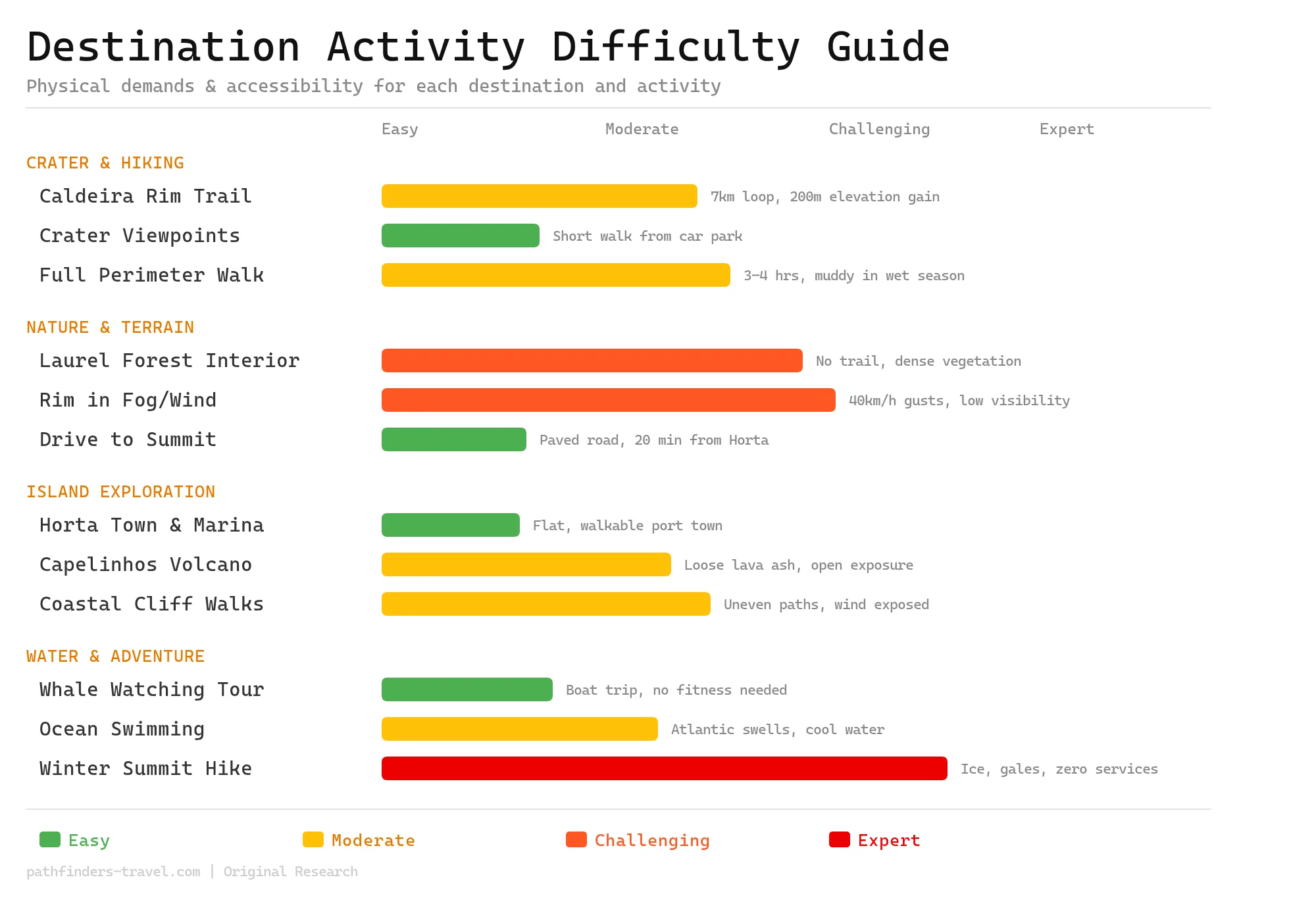
Activity Difficulty Guide
Faial Island offers a genuine spectrum of difficulty, from the paved road to the caldeira summit and easy whale-watching tours, all the way to fog-bound rim walks and the raw, trail-less interior of the crater itself. The caldeira’s unpredictable Atlantic microclimate means even moderate routes can shift into challenging territory within minutes, so preparation matters more here than on most European hiking destinations. Beginners can still enjoy the island’s highlights; experts will find enough exposed terrain and volcanic adventure to keep them engaged.
Getting to Caldeira do Faial
Caldeira do Faial is located 12 kilometers from Horta via the ER1-2ª road, with a free parking area at the main trailhead and no public transport service available.
You need to reach Faial Island first. Ferries run from Pico Island in 30 minutes. São Jorge also connects via Atlânticoline ferry company. Horta Airport receives flights from other Azores islands and mainland Portugal through Azores Airlines SATA.
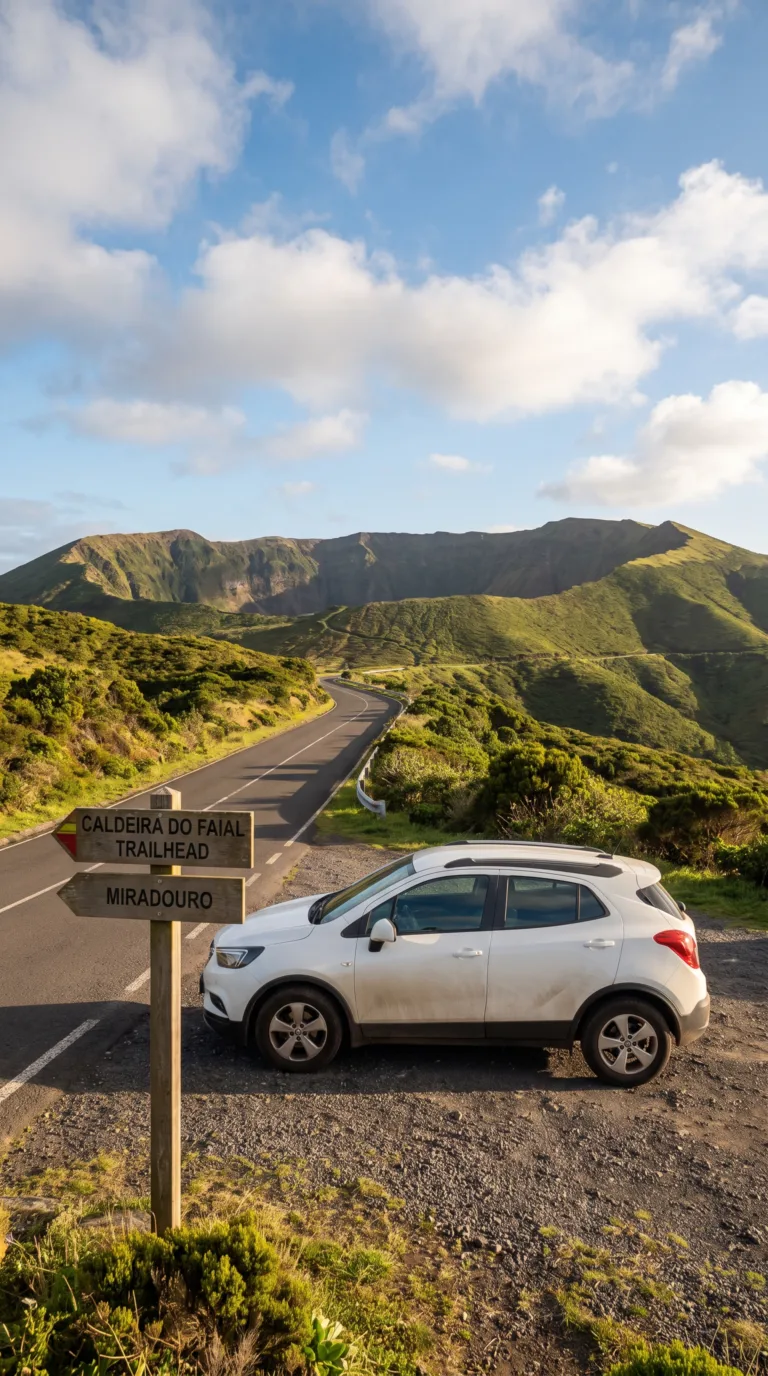
The drive from Horta to Caldeira do Faial takes 20 minutes. Follow the ER1-2ª road for exactly 12 kilometers. The route cuts through farmland and volcanic slopes. Signage is clear at every junction.
Rent a car. No buses serve the crater. The road is paved and well-maintained year-round. A small sedan handles the route without issue.
The main trailhead has free parking for 20 to 30 vehicles. Spaces fill by mid-morning in summer. Arrive before 9 AM for guaranteed parking.
Taxis from Horta cost around €25 one-way. Drivers wait at the trailhead for a fee if you arrange it beforehand. Most visitors prefer the flexibility of their own vehicle for exploring the island after the hike.
Road conditions stay reliable even in winter. Fog can reduce visibility near the crater rim. Check weather forecasts before heading up.
Travel Routes
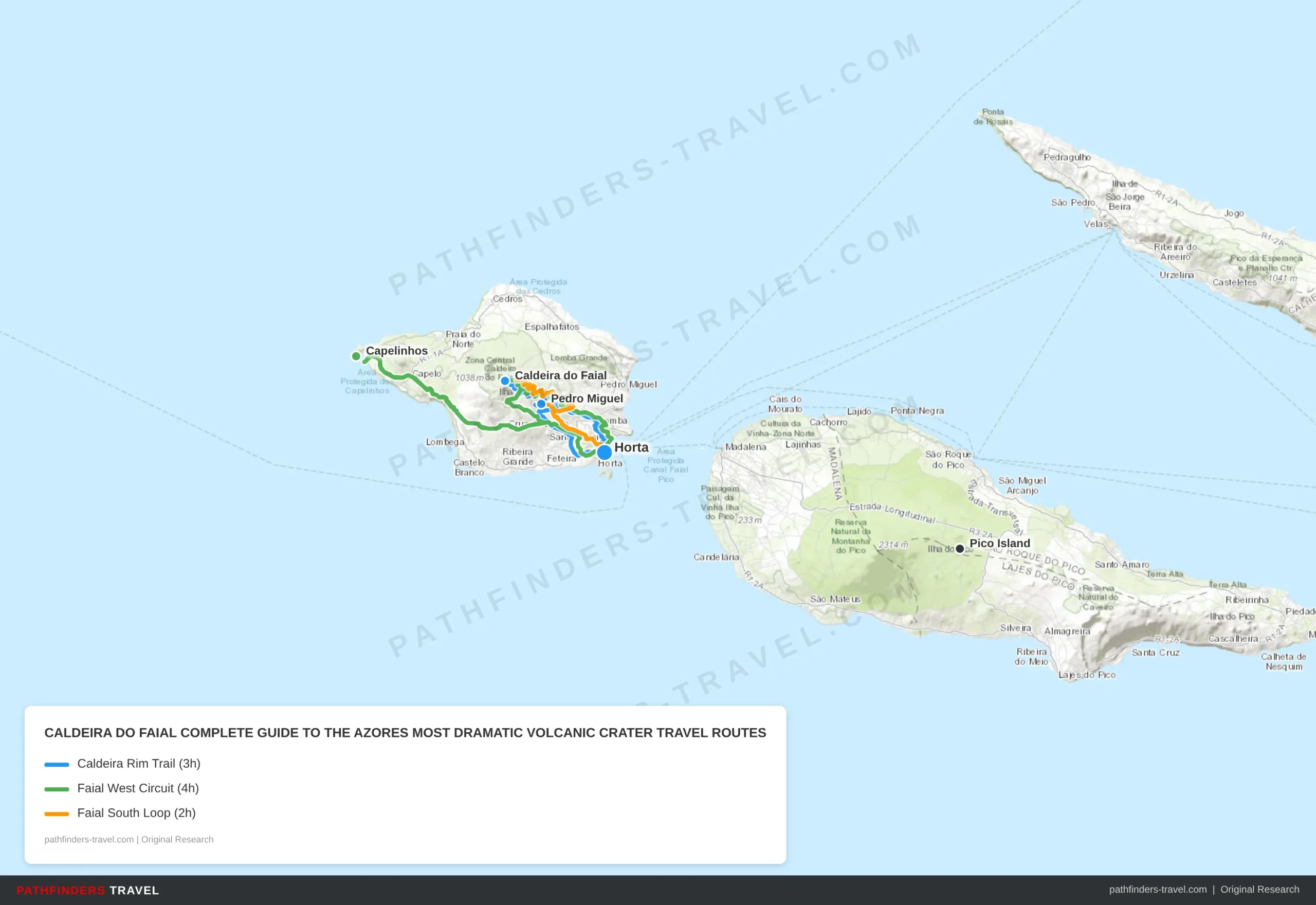
Below are recommended travel routes with key stops and estimated drive times.
| # | Stop | Highlights | Drive Time |
|---|---|---|---|
| 1 | Horta | Start at the main port town. Pick up supplies, check weather forecast at the marina. Well-connected to the caldeira by the EN1-1A road. | From ferry terminal |
| 2 | Caldeira do Faial | The 7km Percurso da Caldeira rim loop at 1,043m elevation. 400m-deep crater, endemic laurel forest, views of Pico and São Jorge Islands. Allow 2.5–3h hiking. No entrance fee. | 20 min from Horta |
| 3 | Pedro Miguel | Scenic agricultural village on the eastern slopes. Viewpoint over the crater’s outer flanks and the channel between Faial and Pico. Good roadside stops. | 15 min from Caldeira |
| 4 | Horta | Return to port. Dinner at the marina. Famous Peter’s Café Sport for whalers’ memorabilia and gin. Watch the sun set over the channel. | 20 min from Pedro Miguel |
| # | Stop | Highlights | Drive Time |
|---|---|---|---|
| 1 | Horta | Base for the full island circuit. Rent a car at the marina or join a local guided tour. Stock up on snacks for the exposed western tip. | Start point |
| 2 | Caldeira do Faial | Crater rim viewpoint and short trail section. On clear mornings before 10 AM visibility is best. Bring wind layers, gusts reach 40 km/h regularly. | 20 min from Horta |
| 3 | Capelinhos | Site of Faial’s dramatic 1957–58 volcanic eruption that added 2.4 km² of new land. Moonscape lava fields, buried lighthouse, and an excellent interpretive museum. One of the Azores’ most iconic landscapes. | 25 min from Caldeira |
| 4 | Horta | Return along the northern coastal road. Stop at Varadouro thermal pools if time allows. Late lunch or dinner at the marina waterfront. | 30 min from Capelinhos |
| # | Stop | Highlights | Drive Time |
|---|---|---|---|
| 1 | Horta | Start at the marina. Short half-day loop ideal for those with an afternoon ferry. Historic town with whale-watching heritage and colourful harbour murals. | Start point |
| 2 | Monte da Guia | Volcanic peninsula south of Horta with twin craters. Views over Horta harbour, Pico Island across the channel, and the southern coastline. Short walking path to the chapel. | 10 min from Horta |
| 3 | Pedro Miguel | Village on Faial’s eastern slope, known for hydrangea-lined roads in summer. Gateway to the caldeira from the east with agricultural valley panoramas. | 20 min from Monte da Guia |
| 4 | Caldeira do Faial | Summit crater viewpoint. Even a 30-minute stop at the rim parking area delivers dramatic 360° views on clear days. Check clouds before committing to the full loop. | 15 min from Pedro Miguel |
Beyond the Crater: Nearby Attractions
Capelinhos Volcano, site of the 1957-58 eruption that added 2.4 square kilometers to Faial Island, is located 20 kilometers west of Caldeira do Faial with an interpretation center open daily.
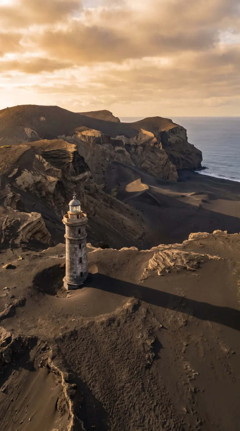
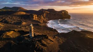
Faial Island packs multiple volcanic attractions into a compact area. The Caldeira isn’t the only geological spectacle here. When did the volcano erupt in Faial? The most recent eruption happened from September 1957 to October 1958 at Capelinhos Volcano on the island’s western tip. The eruption lasted 13 months and buried an entire lighthouse up to its mid-section in volcanic ash.
The landscape at Capelinhos looks like a lunar surface. Gray ash covers everything. The half-buried lighthouse is a monument to the eruption’s power. The Capelinhos Volcano Interpretation Centre sits underground beneath the ash fields and explains Surtseyan volcanic activity, the explosive interaction between magma and seawater. Admission costs €10. The center uses interactive displays to show how the eruption unfolded week by week. You can climb the lighthouse for wide views of the ash desert meeting the Atlantic.
Horta town serves as your base for exploring Faial. The marina draws sailors crossing the Atlantic, and they’ve painted over 3,000 murals on the harbor walls, a tradition dating back decades. Peter Café Sport has been serving gin and tonics to yachties since 1918. The historic center has cobbled streets and traditional Azorean architecture. Horta Marina recorded 1,400 visiting yachts in 2024 according to the Horta Port Authority.
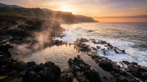
Swimming in the ocean around Faial depends on the season. Summer water temperatures hit 22-25°C from July through September. Winter drops to 16°C. Porto Pim Beach in Horta offers sheltered swimming. Natural rock pools dot the coast near Praia do Almoxarife.
Pico Island Vineyards sit 7 kilometers across the channel. Ferries run hourly from Horta and take 30 minutes. Mount Pico rises 2,351 meters, Portugal’s highest peak. The UNESCO-listed vineyards grow grapes in tiny plots protected by black lava stone walls. The landscape looks like a giant honeycomb.
Combine the Caldeira hike with Capelinhos and Horta for a full-day Faial experience. The drive from the crater rim to Capelinhos takes 35 minutes. Visit Azores lists complete Faial itineraries and current ferry schedules to Pico.
Planning Your Visit
The best time to visit Caldeira do Faial is May through September when weather is most stable, though the crater rim experiences microclimates with sudden fog and wind year-round.
May through September offers the most reliable weather. But “reliable” in the Azores is relative. The crater rim sits at 1,043 meters elevation. That’s high enough to create its own weather system.
You can leave Horta in full sunshine and arrive at the Caldeira do Faial parking area in thick fog. This happens constantly. Temperatures drop 5-10°C with sea level and the rim. According to IPMA Weather Forecasts, Faial receives an average of 1,200mm of annual rainfall at the crater elevation, with June through August seeing the driest conditions at roughly 40-60mm per month. Even in peak summer, expect 15-18 clear-weather days per month at the Caldeira, the rest bring partial cloud or fog.
Morning visits work best. The period between 7-9am typically offers the clearest views before afternoon fog rolls in from the Atlantic. By noon, clouds often blanket the rim completely.
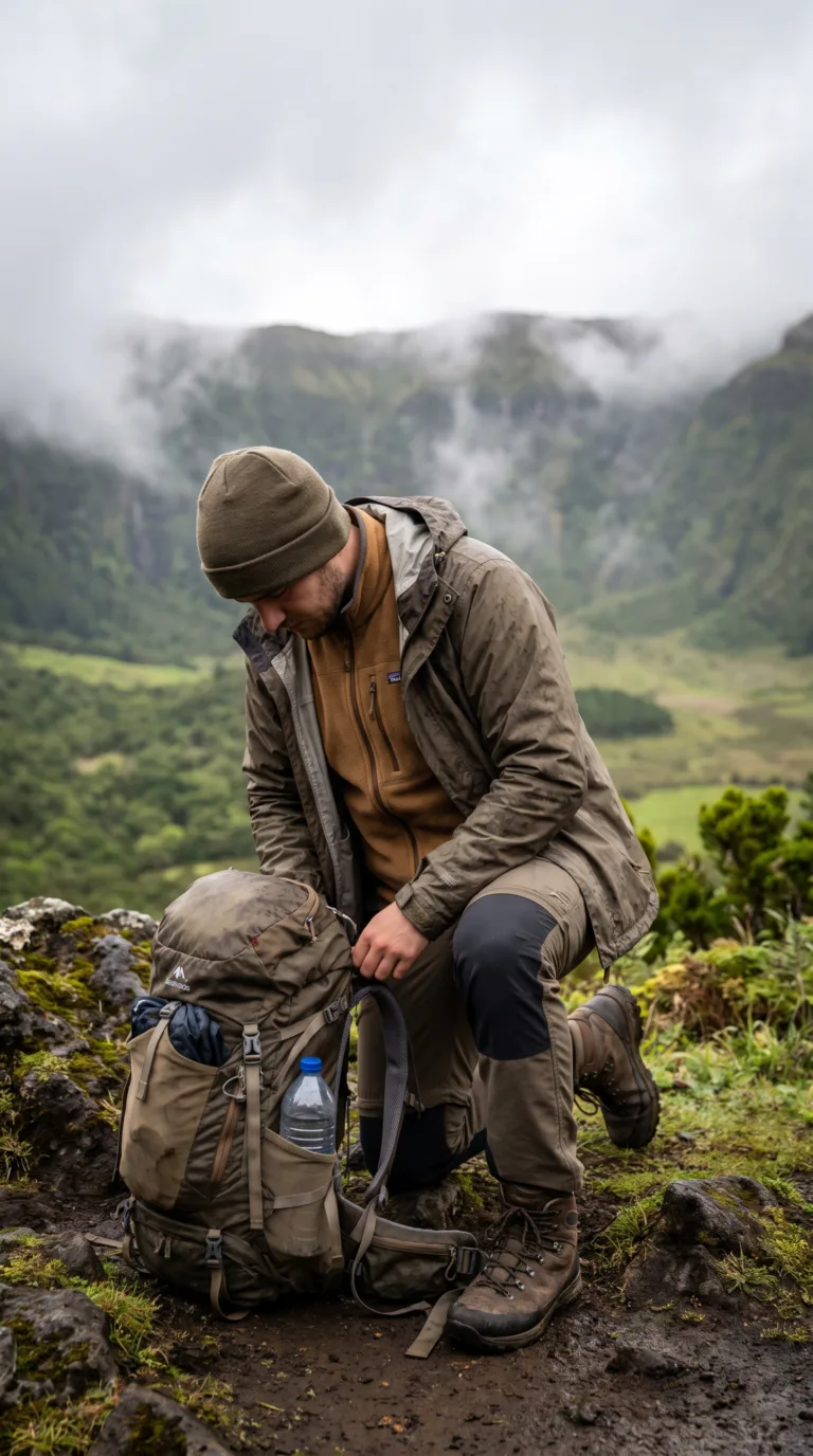
Pack layers. A windproof and waterproof jacket is non-negotiable. The rim trail exposes you to Atlantic winds with zero shelter. Bring sturdy hiking boots, the trail turns slippery when wet, which is often. Water and snacks are essential. No facilities exist beyond a basic restroom at the parking area.
Check conditions before you drive up. Weather can change in 20 minutes. Mobile phone coverage is generally good but not guaranteed on the far side of the rim. The trail can be dangerous in high winds. If gusts are strong enough to make you lean into them, turn back.
Allow 3-4 hours for the full faial caldeira hike around the rim, or just one hour if you’re only visiting the main viewpoint. Bring a lens cloth for your camera, mist coats everything. Stay on marked paths. The endemic vegetation here is protected under Azores Natural Parks Regulations. No littering. This is a protected natural park, not a scenic overlook with loose rules.
Sun protection matters even on cloudy days. UV radiation at this elevation is stronger than you expect. And if you get lucky with clear skies, the sun reflects hard off the crater walls.
Best Time to Visit
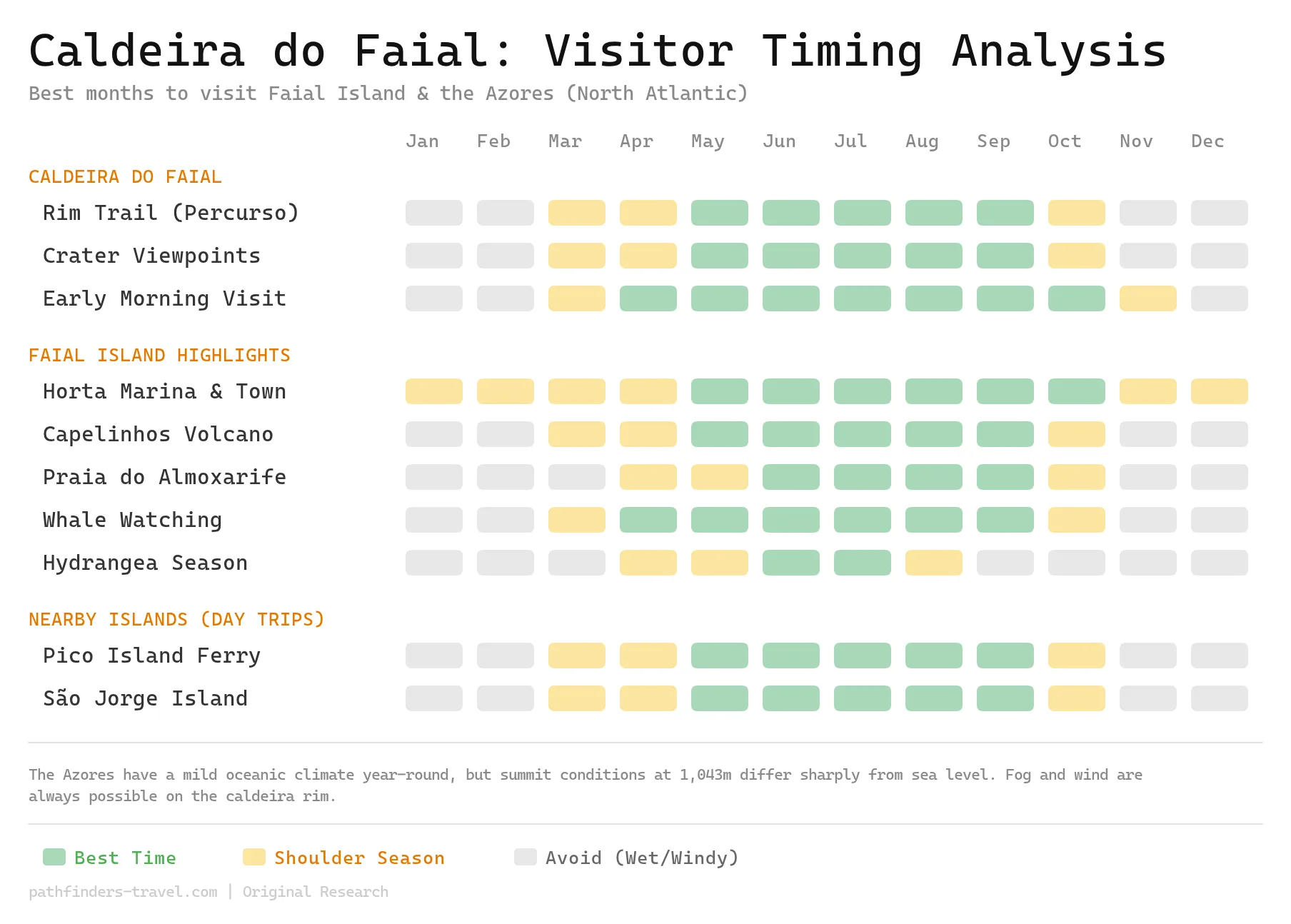
Faial Island enjoys a mild North Atlantic climate year-round, but the caldeira rim at 1,043 meters operates on its own schedule, fog, wind, and rain are possible in any month. The prime window runs May through October, when stable weather and lower precipitation give hikers the best chance of clear crater views. July and August bring the most visitors (and the most sunshine), while May, June, and September offer nearly the same conditions with far fewer crowds.
Frequently Asked Questions
Is Faial Island worth visiting?
Yes, Faial Island is absolutely worth visiting for its dramatic volcanic landscapes. Caldeira do Faial ranks among the Azores’ most impressive geological features. You get a massive crater, excellent hiking, and Capelinhos Volcano, all without the crowds that pack São Miguel. Horta’s marina town adds charm without tourist traps. Faial delivers authentic Azores experiences: active geology, empty trails, and real Portuguese island culture. Most visitors spend 2-3 days here and wish they’d planned longer.
When did the volcano erupt in Faial?
The most recent eruption was Capelinhos, which lasted from September 1957 to October 1958. This Surtseyan eruption added 2.4 square kilometers of land to Faial’s western tip. You can visit the site today, it looks like a lunar landscape. The Caldeira do Faial itself is much older, formed thousands of years ago. It’s now dormant. No volcanic activity has occurred inside the crater in recorded history.
Can you swim in the ocean on Ilha do Faial?
Yes, ocean swimming around Faial is excellent during summer months. Water temperatures hit 22°C in summer, reaching 25°C by late August and September. Winter drops to 16°C. The sea stays calm with minimal currents from June through September. Faial has natural pools and coastal swimming spots near Horta. Don’t expect sandy beaches, the volcanic coastline means rocky entries and black sand coves.
How do I get to Faial Island, Azores?
Faial connects to Pico Island by ferry in 30 minutes. Atlânticoline runs multiple daily crossings. São Jorge also has ferry service. Horta Airport receives flights from other Azores islands and mainland Portugal via SATA Air Açores. Most travelers combine Faial with Pico since they sit only 7 kilometers apart. Book ferry tickets online in summer, crossings fill up fast.
What is Faial, Azores known for?
Faial is best known for the Caldeira do Faial, a 2-kilometre-wide volcanic crater, and for Capelinhos, the volcano whose 1957–58 eruption enlarged the island’s western tip. It is also famous for Horta, the Atlantic’s great sailing harbour, where crews paint murals along the marina and gather at the historic Peter Café Sport, and for the blue hydrangeas that line its roads each summer.