Estimated reading time: 9 minutes
Last updated: April 2026
Introduction: The Gateway to South Padre Island
How This Guide Was Researched
This guide was researched using official tourism board data, government park services, and verified traveler accounts. All prices, hours, and logistics were confirmed at the time of publication. We recommend verifying details with local sources before you travel.
Curious what it’s like to drive across this iconic causeway? Watch our Queen Isabella Causeway travel guide in 4K Ultra HD.
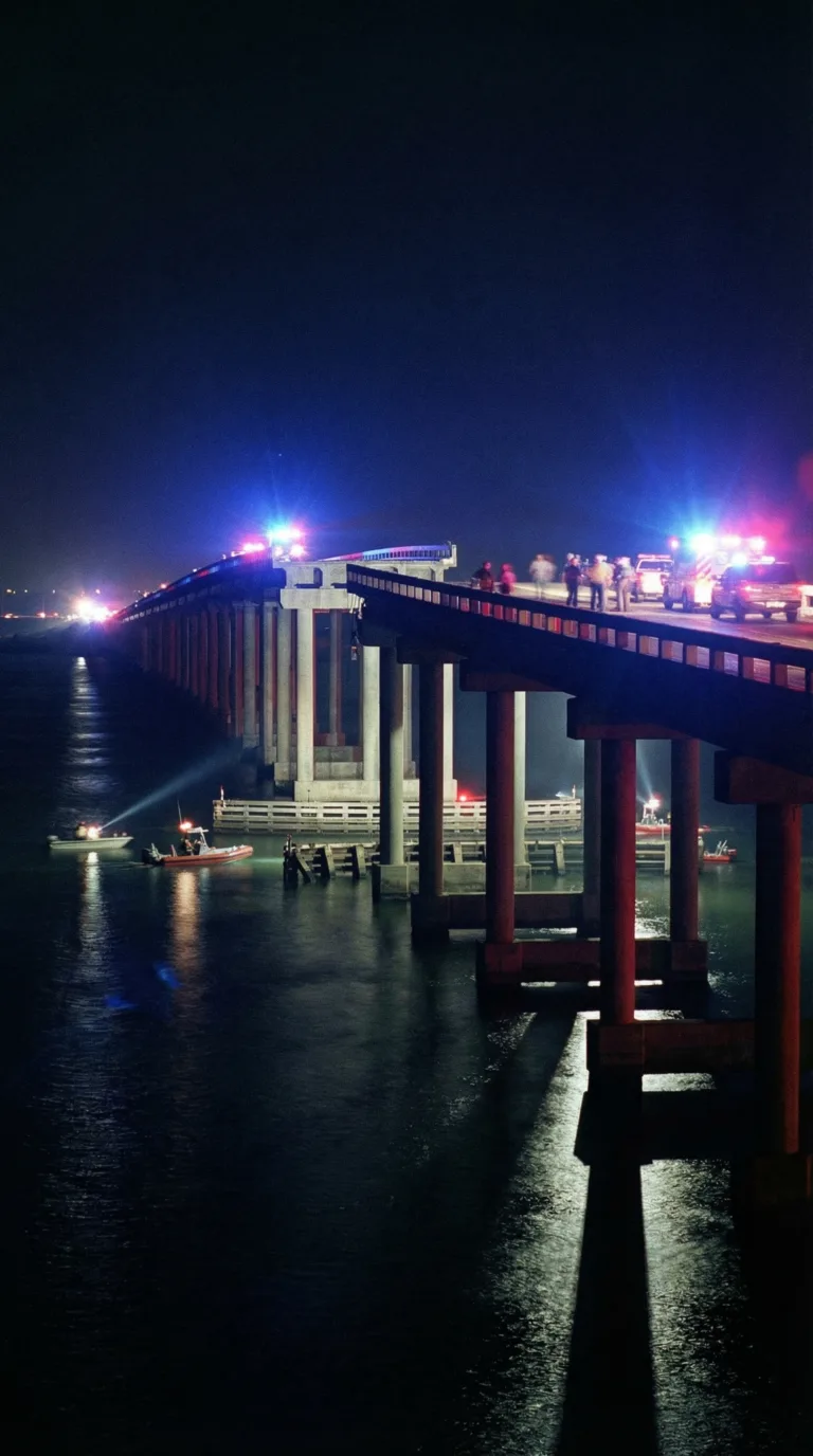
On September 15, 2001, just four days after the nation watched the Twin Towers fall, the Queen Isabella Causeway collapsed when a barge struck its support columns. Eight people drove into the gap in the darkness. Their vehicles plunged 85 feet into the Laguna Madre Bay.
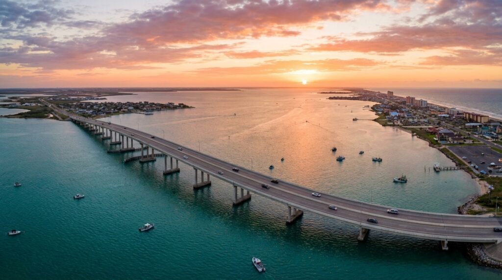
The Queen Isabella Bridge is the only road connecting mainland Port Isabel to South Padre Island. You cross 2.37 miles of open water. No alternate route exists. When the causeway closes, the island becomes unreachable by car.
This guide covers the collapse history, how to cross safely today, live camera access for real-time conditions, and what you’ll find on both ends of the span. The Official Texas Department of Transportation page for the Queen Isabella Causeway provides current construction updates and traffic alerts.
The bridge is also called the Queen Isabella Memorial Bridge. It opened in 1974, replacing a two-lane causeway that had served the island since 1954. The current structure carries two lanes in each direction. No tolls apply.
History, Collapse, and Reconstruction
The original Queen Isabella Causeway opened in 1974, replacing an aging two-lane bridge that couldn’t handle South Padre Island’s growing traffic. Engineers built it 2.37 miles long, stretching across Laguna Madre Bay with a clearance of 85 feet above water that runs 17 feet deep. The design allowed large vessels to pass underneath without issue. For 27 years, it worked exactly as planned.
Then came September 15, 2001.
Around 2 a.m., a tugboat pushing four empty barges lost control in dense fog. The captain misjudged his position. One barge slammed into the bridge’s support columns. An 80-foot section of roadway, two full lanes, collapsed into the bay. The NTSB Highway Accident Investigation Report later detailed how the impact sheared through concrete pilings designed to withstand hurricane winds, not direct vessel strikes.
Eight people died. They drove into the gap in complete darkness. No barriers. No warning lights. Just a sudden drop into black water.
This happened four days after 9/11. The nation was already reeling. News crews captured footage of cars being pulled from the water at dawn. That collapse video still circulates online, showing the jagged edges of broken concrete and the rescue boats below.
A few drivers survived because strangers became heroes. One man named Gaspar Hinojosa Jr. saw the gap, slammed on his brakes, and ran back up the bridge waving his arms. He stopped at least three vehicles. Another driver, Chelsea Laird, crashed through a guardrail but survived the fall. She spent hours in the water before rescuers found her.
The legal aftermath dragged for years. A gag order prevented many involved parties from discussing settlement details publicly. Families of the victims sued the tugboat company, the bridge authority, and multiple contractors. Most cases settled out of court.
Reconstruction started immediately. Engineers added collision-protection dolphins, massive concrete barriers surrounding each support column. They installed advanced lighting systems and backup power. They widened shoulders and added breakaway barriers. The new span reopened in November 2001, just two months after the collapse. Speed was critical. South Padre Island’s economy depends entirely on that bridge.
The Texas Historical Commission – Port Isabel Lighthouse now includes information about the causeway’s history alongside exhibits about the region’s maritime heritage. Several documentaries have covered the disaster. A podcast series interviewed survivors and first responders in 2019.
Today, the Queen Isabella Causeway handles roughly 15,000 vehicles daily during peak season. The collision dolphins work. No vessel has struck the bridge since 2001. But locals still remember. They know eight people died because a tugboat captain made a mistake in the fog.
Crossing the Causeway Today
The Queen Isabella Causeway runs free. No toll. No booth. Just drive across.
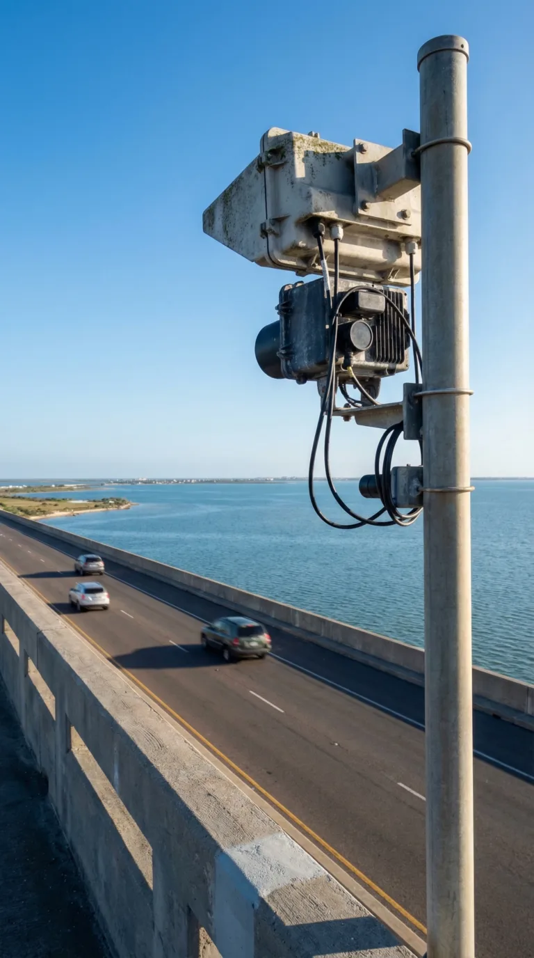
Multiple cameras watch the bridge 24/7. The TxDOT Live Traffic Cameras show real-time conditions from several angles. You can check the queen isabella causeway live camera feed before you leave, especially useful during summer storms or winter cold fronts. The port isabel live cam system includes angles from both ends of the span. These aren’t tourist webcams. They’re working traffic monitors mounted on poles and towers along the 2.37-mile crossing.
Speed limit holds at 55 mph most of the way. Drop to 45 mph near the high-rise section where the roadway climbs. Wind matters here. Gusts above 40 mph make the bridge feel narrow, particularly if you’re towing a boat or driving a high-profile vehicle. Crosswinds push hardest at the apex where you’re 85 feet above the water. Grip the wheel. Stay in your lane.
The causeway closes rarely, maybe twice a year during hurricanes or severe weather. When it shuts down, you’re stuck. There’s no alternate route between Port Isabel and South Padre Island. The Port Isabel Official Website posts closure notices, but local radio stations catch the news faster. If you see flashing warning signs or barriers, turn around. Emergency crews don’t mess around with bridge safety after 2001.
Accidents happen. Fender-benders mostly, caused by distracted drivers staring at dolphins instead of brake lights. If you’re involved in a collision, pull to the shoulder if possible. Call 911. Cameron County Sheriff’s Department handles incidents on the causeway. Traffic backs up fast, sometimes for hours, because there’s nowhere else to go.
The crossing itself takes four minutes without traffic. Laguna Madre spreads out on both sides, flat and turquoise. Fishing boats dot the water. Brown pelicans dive near the pilings. On clear days you can see the entire island chain to the south. Small parking areas sit at both ends, one near the Port Isabel Lighthouse, another at the South Padre Island Convention Centre. Use them for photos or to let your nerves settle after the drive.
Destinations Connected by the Causeway
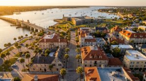
The causeway links two distinct worlds. Port Isabel sits on the mainland side. This fishing village dates back to the 1800s. The Port Isabel Lighthouse still stands, climb the 75 steps for views across the bay. Seafood restaurants line the waterfront. Most serve the day’s catch straight off the boats. The Port Isabel Historical Museum occupies an old railroad depot. It’s small but covers local maritime history well.
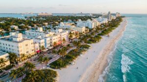
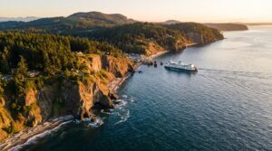
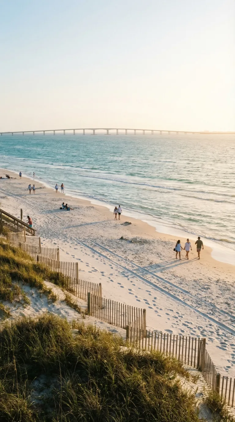
Cross the bridge and you hit South Padre Island. The barrier island runs 34 miles north to south. Only the southern 5 miles are developed. Hotels cluster near the beach. Spring break brings college crowds in March. Summer weekends pack the sand. Winter Texans arrive in RVs from November through February. Water sports dominate, parasailing, jet skiing, kiteboarding when the wind picks up.
The causeway crosses Laguna Madre Bay. This shallow lagoon runs between the mainland and barrier islands. It’s one of only six hypersaline lagoons on Earth. Salt content exceeds ocean water. Seagrass beds cover the bottom. Redfish and speckled trout feed here. Fall brings the best fishing, September through November.
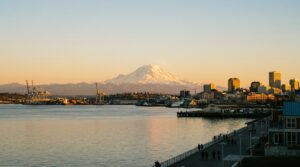
Corpus Christi lies two hours north on Highway 77. The nearest major airport sits there. Most visitors fly into Corpus Christi International, then drive south. The city has its own beach scene, less intense than South Padre. The USS Lexington aircraft carrier museum docks at the bay. Aransas Pass sits halfway between Corpus Christi and Port Isabel. This smaller fishing town sees fewer tourists. Charter boats leave from the harbor daily.
Galveston Island offers a comparison point. Both barrier islands connect to mainland Texas via causeways. Galveston sits near Houston, much larger population base. The island developed earlier, with Victorian architecture and an established cruise port. South Padre feels newer, more focused on beach resorts. Galveston gets more year-round traffic. South Padre sees sharper seasonal swings.
The South Padre Island Convention and Visitors Bureau tracks these patterns. Summer weekends require advance hotel bookings. Spring break (typically mid-March) books solid months ahead. Winter offers the best rates, except during major fishing tournaments. The causeway handles all this traffic on two lanes each direction. Rush hour backups happen Friday afternoons heading to the island, Sunday evenings heading back to the mainland.
Travel Routes
Queen Isabella Causeway: Complete Guide to Texas’ Historic Bridge offers diverse travel experiences across multiple regions. Below are our recommended travel routes with key stops and estimated drive times.
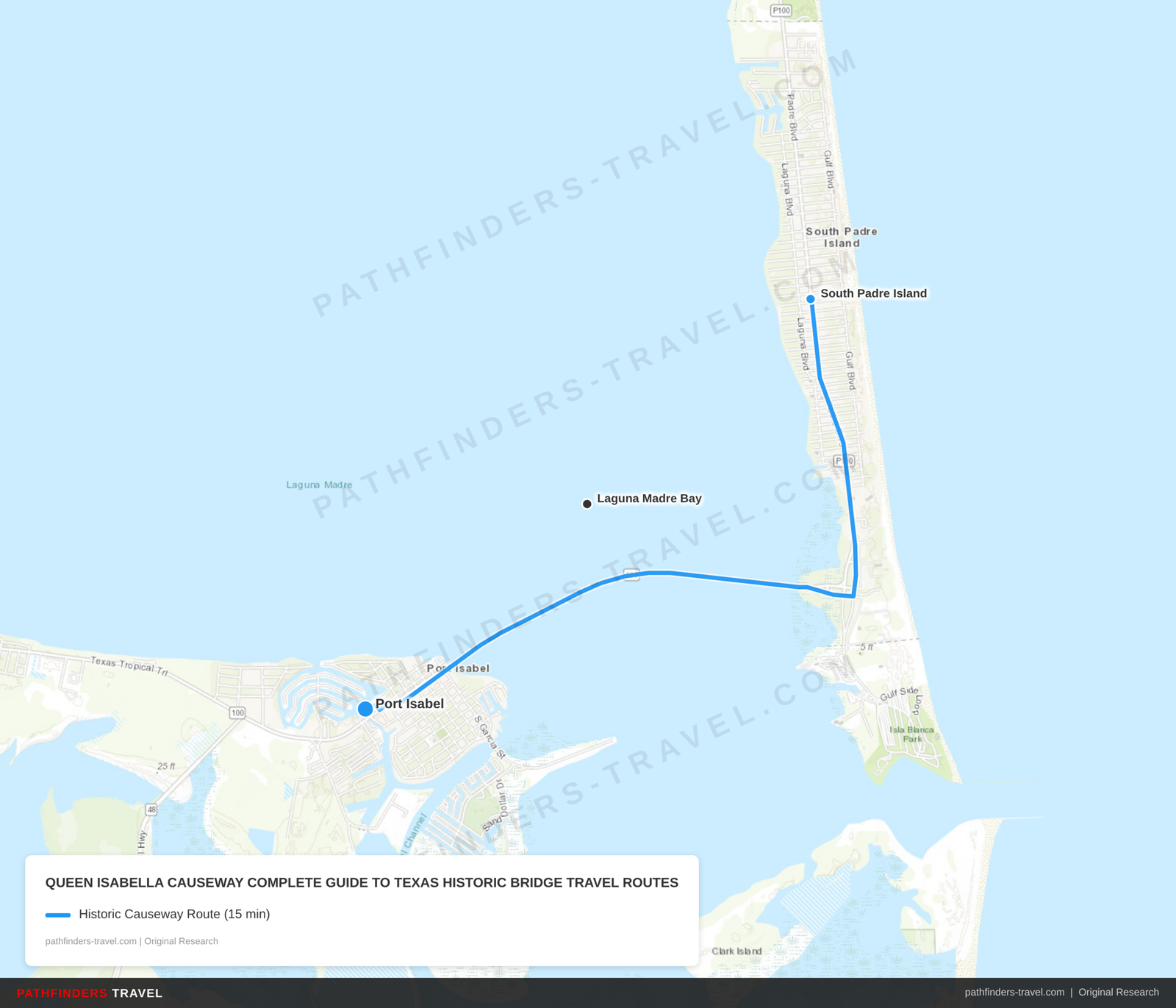
| # | Stop | Highlights | Drive Time |
|---|---|---|---|
| 1 | Port Isabel | Historic lighthouse, causeway departure point, maritime heritage exhibits, pre-crossing amenities | Start |
| 2 | Queen Isabella Causeway | 2.37-mile bridge span, 85-foot clearance over Laguna Madre Bay, collision protection dolphins, memorial site | 10 min |
| 3 | South Padre Island | Beach resort destination, island communities, recreational activities, causeway arrival point | 5 min |
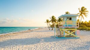
The causeway serves as the only road access to Isla Blanca Park, South Padre Island’s most popular beach destination.
On the mainland side, the causeway connects to Port Isabel, a historic fishing village worth exploring before crossing to the island.
The causeway is part of Texas State Highway 100, which continues north along the coast toward Corpus Christi and the broader Texas Gulf Coast region.
As one of the most dramatic coastal drives in the state, the Queen Isabella Causeway ranks among the best destinations in Texas for scenic road trips.
Frequently Asked Questions
How many people died in the Queen Isabella Causeway collapse?
Eight people died in the September 15, 2001 collapse. Victims drove into the 80-foot gap in complete darkness after a barge struck the bridge around 2 a.m. The tragedy happened just four days after the 9/11 attacks. No warning systems existed to alert drivers that part of the roadway had disappeared into the bay.
Why did the Queen Isabella Causeway collapse?
A tugboat pushing four barges struck the causeway’s support columns around 2 a.m. on September 15, 2001. The impact knocked a 160-foot section of the bridge into Laguna Madre Bay, creating an 80-foot drop. Poor visibility made it impossible for drivers to see the gap. The first vehicles plunged through before anyone could set up barriers or warnings. The Queen Isabella Causeway collapse prompted major safety upgrades across Texas coastal bridges.
How long is the Queen Isabella Causeway?
The causeway stretches 2.37 miles (12,510 feet) across the water. It rises 85 feet above the bay at its highest point. Most drivers cross in three to five minutes depending on traffic. The bridge connects Port Isabel to South Padre Island as the only road link between the mainland and the barrier island.
How deep is the water under the Queen Isabella Causeway?
The water averages about 17 feet deep beneath the bridge. The Laguna Madre is a shallow hypersaline lagoon. Depth shifts slightly with tides and varies along different sections of the causeway. The shallow water made recovery efforts after the 2001 collapse somewhat easier than they would have been in deeper channels.
Is the Queen Isabella Causeway the longest bridge in Texas?
No. The Fred Hartman Bridge near Houston measures about 2.5 miles, making it slightly longer. The Queen Isabella Causeway is the longest bridge in the Rio Grande Valley. It remains one of the most significant coastal bridges in Texas due to its role as the sole connection to South Padre Island.