Estimated reading time: 29 minutes
Last updated: 02 April 2026
Why Washington State Should Be Your Next Adventure
Washington State spans 71,362 square miles with Pacific coastline and alpine peaks, offering year-round outdoor recreation across five distinct geographic regions.
How We Researched This
We built this guide using Washington’s tourism authority resources, national park data, and feedback from actual travelers—without visiting ourselves. All details were accurate when written, but we recommend checking official websites before heading out, as hours and policies can shift.
You can see Washington’s landscapes in action. Watch our complete Washington State travel guide in 4K Ultra HD.
Washington State’s dramatic seasonal variations and diverse geography make timing your visit crucial. A single trip can take you from temperate rainforests to snow-capped volcanoes to high desert canyons, each with its own weather patterns and ideal visiting windows. According to the National Park Service, Washington’s three national parks alone drew over 5.8 million visitors in 2025, yet the state’s 71,362 square miles offer plenty of room to escape the crowds if you know where to look.
This Washington travel guide covers everything from Seattle’s urban energy to the moss-draped forests of the Olympic Peninsula, the glacier-carved peaks of the Cascades, and the sunny vineyards of Eastern Washington. You’ll find top-quality cities, three national parks, island getaways accessible only by ferry, award-winning wine country, and mountain wilderness that stretches for days. The Official Washington State Tourism website lists over 140 state parks and recreation areas across these varied landscapes.
The best time to travel to Washington State depends entirely on which region you plan to explore. The west side sees 150 rainy days per year, while Eastern Washington gets 300 days of sunshine. Understanding these microclimates helps you pack right and plan realistic routes. This guide breaks down when to visit each region, how to get around, which places to travel in Washington deserve your time, and what practical details you need before you arrive. this travel guide for Washington State gives you the information to make it work.
Best Time to Visit Washington State
Planning Tip
Washington State’s best weather runs June through September with average temperatures of 70-80°F, while winter (November-March) brings rain to the west and snow to mountain passes.
The best time to travel to Washington State depends on what you want to do. Summer (June through September) delivers peak conditions. Temperatures stay comfortable in the 70s and 80s, rain is rare, and all mountain passes stay open. You get 16 hours of daylight in June. Trails dry out, wildflowers bloom at high elevations, and ferries run full schedules. The trade-off is higher prices and crowds at popular spots like Mount Rainier and the San Juan Islands.

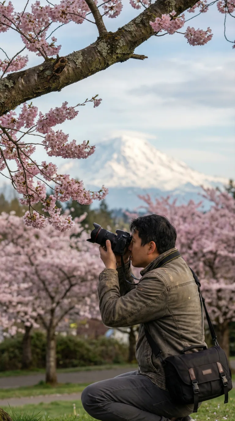
Spring (April and May) brings wildflowers and fewer tourists. The Skagit Valley Tulip Festival draws visitors in April. Weather can shift quickly. You might see sun one day and rain the next. High-elevation trails often stay snowed in until late May. Fall (October and November) offers autumn colors and harvest season in wine country. Eastern Washington vineyards host tastings and festivals. Rain picks up on the west side after mid-October.
Winter (December through March) is the low season. Seattle averages 37 inches of rain annually, with most falling between November and March. Spokane gets 171 sunny days per year compared to Seattle’s 152, according to NOAA climate data. Ski resorts in the Cascades open by December. Hotel rates drop by 30 to 40 percent. Some mountain passes close until May. Check road conditions through the National Weather Service Seattle forecast office before driving. Book campsites early through the Washington State Parks reservation system, especially for summer weekends.
Getting to Washington State
Seattle-Tacoma International Airport (SEA) handles 50 million passengers annually with direct flights from 90+ destinations across North America, Europe, and Asia.
Planning Tip
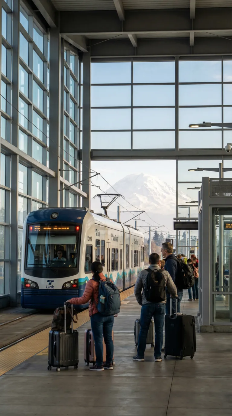
Seattle-Tacoma International Airport (SEA) sits 13 miles south of Seattle and serves as the primary gateway for visitors. All major carriers fly here, with 35 airlines operating over 400 daily flights. The Link light rail connects the airport to downtown Seattle in 38 minutes for $3, making ground transport simple.
Other regional airports include Spokane International (GEG) for Eastern Washington access, Bellingham (BLI) near the Canadian border, and Paine Field (PAE) in Everett for travelers heading north.
By train, Amtrak Cascades links Seattle to Portland and Vancouver, BC. The Coast Starlight route runs south to California. By car, Interstate 5 cuts through Seattle from Canada to Oregon, while Interstate 90 crosses from Spokane in the east. Highway 101 loops the Olympic Peninsula with coastal views.
Washington State Ferries connect Seattle to islands and the Olympic Peninsula. BC Ferries run from Victoria, Canada, for travelers arriving by sea.
Getting Around Washington State
Washington State requires a car for most destinations beyond Seattle, with I-5 connecting major cities and mountain passes requiring chains or winter tires November through April.
Renting a car is essential for exploring Washington beyond Seattle. All major rental companies operate at Seattle-Tacoma International Airport. Book early during summer months, when rates average $50 to $80 per day. The I-5 corridor connecting Seattle, Tacoma, Olympia, and Vancouver is straightforward to drive year-round.
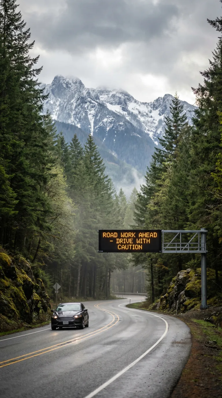
Mountain passes require more preparation. Snoqualmie Pass, Stevens Pass, Blewett Pass, and Washington Pass all demand winter tires or chains from November through April. Washington State Department of Transportation maintains over 7,000 miles of state highways, including 24 mountain passes that can close without warning during storms. Check WSDOT Traffic Alerts before any mountain drive. The website and mobile app provide real-time traffic cameras, road closure updates, and pass condition reports.
Seattle offers Link light rail, buses, and a streetcar system. Spokane has STA buses. Most other areas have limited public transit. Washington State Ferries are necessary for reaching the San Juan Islands, Whidbey Island, and some Olympic Peninsula routes. Reserve vehicle space weeks ahead for summer sailings.
Plan drive times carefully. Seattle to Mount Rainier takes 2.5 hours. Seattle to Olympic National Park requires 3 hours. Seattle to Spokane spans 4.5 hours across the Cascades.
Puget Sound Cities & Islands: Where Urban Meets Wilderness
The Puget Sound region encompasses Seattle (population 750,000), Tacoma, Bellevue, and island communities, offering urban culture within 90 minutes of mountain wilderness.
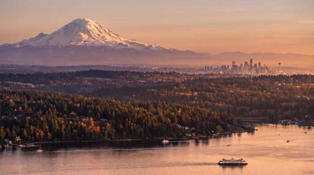
The Puget Sound sits in Washington’s northwest corner, where saltwater inlets carve deep into the land between mountain ranges. The Seattle-Tacoma-Bellevue metropolitan area holds 4.1 million people according to the US Census Bureau, making this the state’s population and cultural center. Cities here rise along the water’s edge with the Cascade Mountains filling the eastern horizon and the Olympics visible across the sound to the west.
This geography creates something rare: major cities where you can walk with a museum and a waterfront park in 15 minutes, then drive to alpine hiking trails in a hour. The region holds five of Washington’s most-visited destinations, each offering a different angle on Pacific Northwest life. Seattle brings urban energy and international flights. Tacoma provides museum-quality art at lower prices. Bellevue serves as a launching point for Cascade foothills exploration. Bellingham opens the door to the North Cascades and Canadian border crossings. Whidbey Island offers a car-free escape on Washington State Ferries.
The diversity runs from Seattle’s 10 million annual visitors to Pike Place Market (per official market statistics) down to quiet island beaches where you might see three other people all afternoon. You can drink third-wave coffee in a Capitol Hill cafe one morning and kayak past harbor seals the next. Most travelers to Seattle Washington use this region as their base, then branch out to mountains or coast for day trips.
Seattle
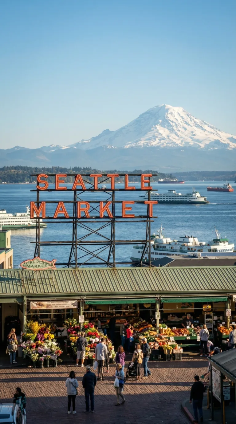
Seattle anchors the region as Washington’s largest city and main arrival point for international visitors. The Space Needle still defines the skyline from its 1962 World’s Fair origins, though the observation deck now sits 520 feet above a city that has grown far beyond its mid-century footprint. Pike Place Market operates as it has since 1907, with fishmongers throwing salmon across ice-filled stalls and flower vendors arranging dahlias in metal buckets. The Visit Seattle official tourism website lists over 150 restaurants within walking distance of the market alone.
The waterfront stretches for miles along Elliott Bay, rebuilt in the past decade after the improved highway came down. You can walk from Pioneer Square’s brick streets north to the Olympic Sculpture Park without crossing a major road. Neighborhoods each carry distinct personalities: Capitol Hill for music venues and LGBTQ+ nightlife, Fremont for quirky public art and Sunday markets, Ballard for Scandinavian heritage and craft breweries, the University District for cheap food and college energy.
Museums include the Museum of Pop Culture (MoPOP) with its Frank Gehry-designed exterior and collections spanning Nirvana to science fiction, the Seattle Art Museum downtown, and the Burke Museum of Natural History on the university campus. For outdoor access within city limits, Discovery Park covers 534 acres of forest and beach on Magnolia Bluff, while Alki Beach in West Seattle offers two miles of sand with downtown views across the water. Seattle also serves as the main gateway for travel to Seattle Washington destinations throughout the state, with Sea-Tac Airport 30 minutes south. Seattle, Full guide coming soon!
Tacoma
Tacoma sits 35 miles south of Seattle along Commencement Bay, often overlooked but offering some of Washington’s best museums at half the cost and crowds. The Museum of Glass features a 90-foot tilted cone where glassblowers work in view of visitors, with a bridge connecting to the Washington State History Museum across the street. The Tacoma Art Museum holds one of the country’s largest collections of Pacific Northwest art, including significant works by glass artist Dale Chihuly, who grew up here.
The waterfront has been transformed over the past 20 years with industrial docks and parks and restaurants, with a wooden boardwalk running along Ruston Way. Point Defiance Park covers 760 acres at the north end of the city, containing old-growth forest, five miles of saltwater shoreline, a zoo and aquarium, and Fort Nisqually, a reconstructed Hudson’s Bay Company trading post from the 1830s. Tacoma also sits just 60 miles from the Nisqually entrance to Mount Rainier National Park, making it a practical base for mountain day trips. The city’s grittier industrial character and lower hotel rates appeal to travelers who want urban access without urban prices. Tacoma, Full guide coming soon!
Bellevue
Bellevue rises on the eastern shore of Lake Washington, connected to Seattle by two floating bridges. The city built its reputation on tech industry headquarters (Microsoft sits just north in Redmond) and upscale retail, with Bellevue Square mall anchoring a downtown shopping district that includes Nordstrom’s flagship store. But the city also maintains 2,500 acres of parks, including the Bellevue Botanical Garden’s 53 acres of display gardens and natural wetlands.
Waterfront parks line Lake Washington’s eastern shore, offering beaches, boat launches, and walking paths with views back toward Seattle’s skyline. The city serves as a practical base for exploring the Cascade foothills to the east, with Snoqualmie Falls 30 minutes away and multiple trailheads within a 45-minute drive. Hotels here often cost less than equivalent properties in downtown Seattle, and the location puts you closer to mountain destinations while maintaining urban amenities. Bellevue, Full guide coming soon!
Bellingham
Bellingham sits 90 miles north of Seattle and 20 miles south of the Canadian border, serving as the gateway to the North Cascades and a jumping-off point for Vancouver, BC. Western Washington University gives the city a college-town energy, with cheap restaurants, music venues, and a craft brewery scene that includes Boundary Bay and Kulshan, both pouring beers within blocks of the historic Fairhaven district.
Fairhaven itself occupies the city’s south end, with brick streets and 1890s buildings now housing bookstores, cafes, and the Alaska Marine Highway ferry terminal. Chuckanut Drive winds south from Fairhaven along the coast, offering 20 miles of cliff-hugging curves with pullouts overlooking the San Juan Islands. The city also provides the closest major-airport access to Mount Baker ski area (58 miles east) and serves as the mainland departure point for San Juan Islands ferries. Bellingham, Full guide coming soon!
Whidbey Island
Whidbey Island stretches 55 miles north to south in Puget Sound, accessible by bridge from the north or ferry from the south. The island moves at a slower pace than mainland cities, with two-lane roads connecting small towns, state parks, and working farms. Deception Pass State Park occupies the island’s north end, where a 1935 bridge spans a narrow channel between Whidbey and Fidalgo Island, with trails dropping to rocky beaches and tide pools below.
The towns of Langley and Coupeville each offer a few blocks of galleries, restaurants, and bed-and-breakfasts in preserved 19th-century buildings. Naval Air Station Whidbey Island covers much of the central portion, bringing jet noise but also supporting the local economy. Beaches here face west across the sound toward the Olympic Mountains, with driftwood-strewn sand and cold water that rarely tops 55 degrees even in summer. Farm-to-table restaurants source from island farms and Penn Cove mussels, harvested from the island’s protected waters. The island works as an easy weekend escape from Seattle, with the Mukilteo ferry running every 30 minutes and the crossing taking 20 minutes. Whidbey Island, Full guide coming soon!
Mountain Wilderness & National Parks
Washington’s Cascade Range contains three national parks and dozens of wilderness areas spanning 700 miles from the Canadian border to Oregon, with elevations from sea level to 14,411 feet.
The Cascade Range cuts through Washington like a jagged spine, a chain of volcanic peaks and glaciated valleys that divides the state into two distinct climates. West of the mountains, rain falls year-round. East of the crest, the land turns to sagebrush and wheat fields. This rain shadow effect creates some of the most dramatic landscape contrasts in North America, all within a two-hour drive.
Washington’s Cascades hold more glaciers than any other state in the lower 48. The range includes active volcanoes like Mount Rainier and Mount St. Helens, ancient forests that have never been logged, and alpine meadows that bloom with wildflowers from July through August. According to the US Forest Service, Washington’s Cascade wilderness areas cover more than 2.6 million acres of protected land, offering everything from roadside viewpoints to multi-day backcountry routes.
Olympic National Park
Olympic National Park protects three completely different ecosystems within its 922,000 acres. The Hoh Rainforest receives 140 inches of rain per year, creating a dripping green world of moss-covered maples and Sitka spruce trees 300 feet tall. Drive two hours west from the rainforest and you reach the Pacific coastline, where sea stacks rise from the surf and tide pools fill with starfish and anemones at Rialto Beach and Ruby Beach. Head east into the park’s interior and you climb to Hurricane Ridge, where alpine meadows give way to glacier-carved peaks at 5,200 feet.
The park requires multiple days to explore properly. No roads connect the coastal, rainforest, and mountain sections, so each area demands a separate visit. Most travelers base themselves in Port Angeles and drive to Hurricane Ridge for sunrise, then spend afternoons hiking the coastal trails or walking through the temperate rainforest. The park draws 3.2 million visitors annually according to the National Park Service, but most stick to a handful of popular spots. Walk 30 minutes down any trail and you’ll have the forest to yourself.
Olympic National Park, Full guide coming soon!
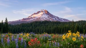
Mount Rainier National Park
Mount Rainier dominates the skyline from Seattle, a 14,411-foot volcano wrapped in 25 named glaciers. On clear days, the mountain appears to float above the city, close enough to touch. The peak holds more glacial ice than all other Cascade volcanoes combined, and its summit attracts climbers from around the world, though fewer than half who attempt the climb reach the top.
Paradise, on the mountain’s south slope, lives up to its name from mid-July through early August, when subalpine meadows explode with lupine, paintbrush, and avalanche lilies. The area receives 640 inches of snow in an average winter, more than any other regularly measured location in the United States. By late summer, the snow melts back to reveal hiking trails that wind through flower fields with the glacier-covered summit rising directly overhead. The Grove of the Patriarchs Trail, near the park’s southeast entrance, passes through old-growth forest where Douglas firs measure 25 feet around and red cedars have stood for more than 1,000 years.
The park sits 2.5 hours from Seattle via Highway 410 or Highway 706. Roads to Paradise and Sunrise, the two main high-elevation areas, close from November through May due to snow. Plan your visit between July and September for full access to trails and facilities.
Mount Rainier National Park, Full guide coming soon!
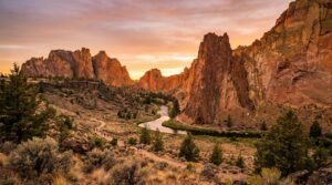
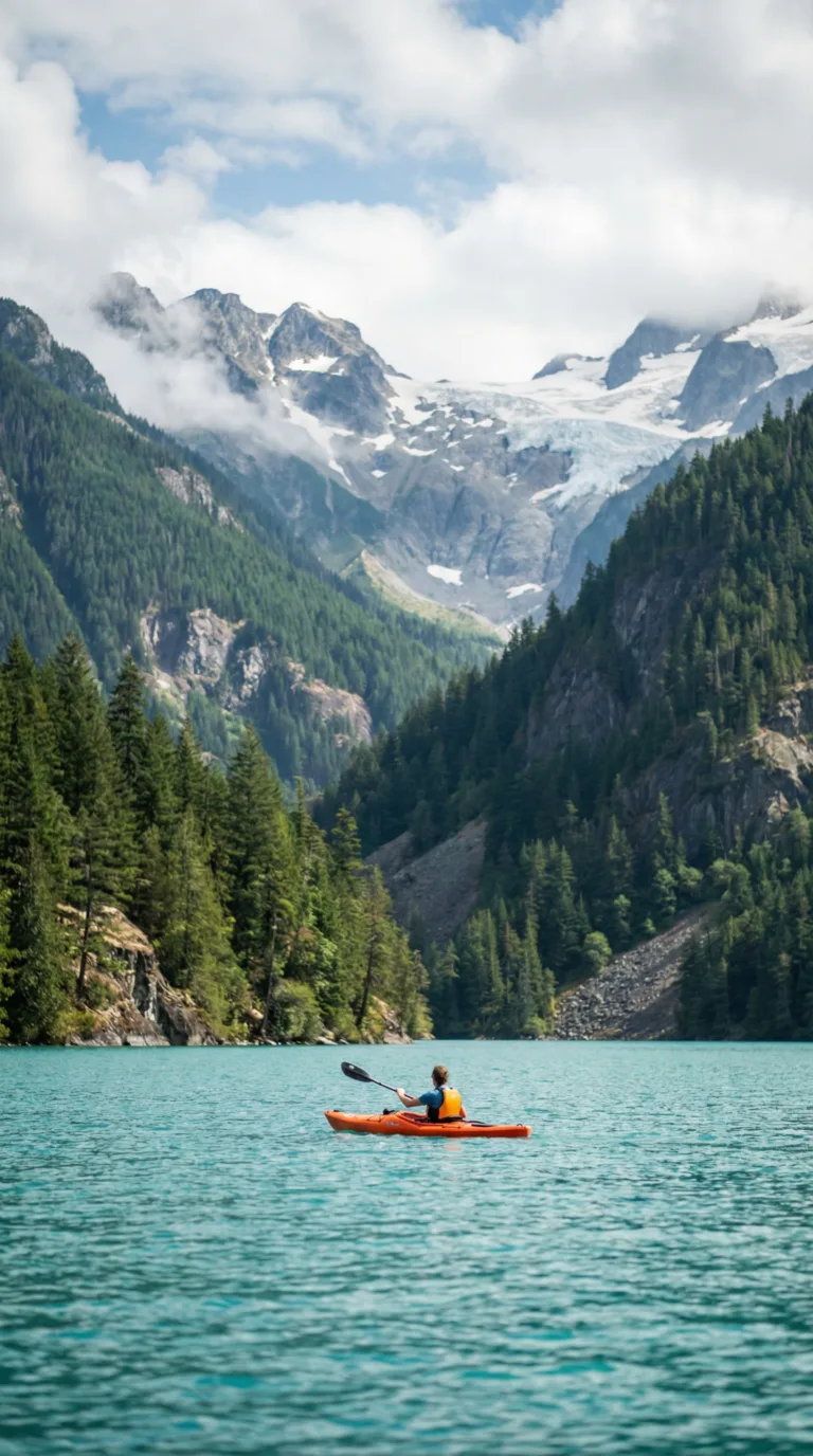
Diablo Lake
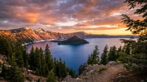
Diablo Lake looks like someone dumped turquoise paint into the water. The vivid blue-green color comes from glacial flour, rock ground to powder by glaciers and suspended in the water. When sunlight hits these fine particles, it scatters blue and green wavelengths, creating a color you’ll not see anywhere else in Washington. The lake sits in North Cascades National Park, surrounded by peaks that rise 7,000 feet straight from the shoreline.
Highway 20, the North Cascades Highway, runs along the lake’s southern shore with multiple pullouts for photos. The best view comes from the Diablo Lake Overlook, a short walk from the parking area with the entire lake spread below. Seattle City Light offers boat tours from June through September that explain the lake’s geology and the three dams that created it. Kayakers launch from the Colonial Creek Campground and paddle among the flooded valleys, with glaciers visible on the peaks above.
The North Cascades Highway closes from November through April due to snow. Summer weekends bring crowds to the overlook, but arrive before 9 AM and you’ll have the viewpoint to yourself.
North Cascades National Park, Full guide coming soon!
Cascade Range
The Cascade Range stretches the entire length of Washington, a volcanic arc that includes five major peaks above 10,000 feet. The Pacific Crest Trail follows the high ridges for 500 miles through the state, passing through wilderness areas where trails outnumber roads. Ski resorts like Crystal Mountain, Stevens Pass, and Mount Baker operate from November through April, with Mount Baker holding the world record for snowfall in a single season at 1,140 inches.
Several highways cross the Cascades, each offering different scenery. Interstate 90 crosses Snoqualmie Pass, the lowest and most reliable winter route, passing Snoqualmie Falls, a 268-foot waterfall visible from a viewing platform just off the highway. Highway 2 climbs Stevens Pass through old mining towns and alongside the Skykomish River. Highway 20, the North Cascades Highway, ranks as the most scenic but closes in winter.
The rain shadow effect becomes obvious as you drive east. Western slopes receive 80 to 100 inches of rain per year and grow thick forests of Douglas fir and western hemlock. Eastern slopes get 15 to 20 inches and support ponderosa pine and sagebrush. The transition happens in less than 20 miles.
Skagit Valley
Skagit Valley fills with tulips every April, when 300 acres of bulb fields bloom in rows of red, yellow, pink, and purple. The Skagit Valley Tulip Festival draws 500,000 visitors during the month-long event, making it one of Washington’s largest annual gatherings. Farms like Tulip Town and RoozenGaarde open their fields for walking and photos, with Mount Baker visible on clear days rising above the flowers.
The valley produces more tulip bulbs than anywhere in North America outside Holland. After the festival ends, the valley returns to its agricultural roots, with berry farms, vegetable stands, and dairy operations lining the back roads. The Skagit River runs through the center of the valley, attracting bald eagles in winter and salmon in fall. The valley sits 60 miles north of Seattle and serves as the gateway to North Cascades National Park.
Skagit Valley Tulip Festival, Full guide coming soon!
Ross Lake
Ross Lake stretches 23 miles into the North Cascades backcountry, a narrow reservoir surrounded by peaks and accessible only by boat or trail. No roads reach the lake. Visitors either hike in from Highway 20 or take a water taxi from the town of Anacortes, Washington. The lake offers backcountry camping on floating platforms, fishing for rainbow trout and Dolly Varden, and kayaking through flooded valleys where waterfalls drop from hanging glaciers.
Ross Lake receives a fraction of the visitors that stop at Diablo Lake, despite sitting just a few miles upstream. The lack of road access keeps crowds away. Paddlers who make the effort find campsites with views of glaciated peaks and water so clear you can see 30 feet down. The lake is managed by Recreation.gov, which handles reservations for the floating campsites from June through September. Book at least two months ahead for summer weekends.
Eastern Washington: Sun, Wine & Wide-Open Spaces
Eastern Washington receives 300+ days of sunshine annually and produces 99% of Washington’s wine from 1,000+ wineries across the Columbia Valley AVA.
Cross the Cascade Mountains and you enter a different world. Eastern Washington looks nothing like the rainy forests of the coast. The Cascades block Pacific storms, creating a rain shadow that leaves the east side dry, sunny, and open. Spokane gets 260 days of sunshine per year, compared to Seattle’s 152, according to National Weather Service climate data. Rolling wheat fields replace evergreen forests. Sagebrush covers the hills. Summer temperatures regularly hit the 90s.
This dry climate makes Eastern Washington the state’s wine powerhouse. The Columbia Valley produces 99% of Washington’s wine from more than 1,000 wineries, per the Washington State Wine Commission. Vineyards stretch across the Yakima Valley, Walla Walla, and the Tri-Cities region. The long summer days and cool nights create ideal conditions for Cabernet Sauvignon, Merlot, and Riesling.
Spokane
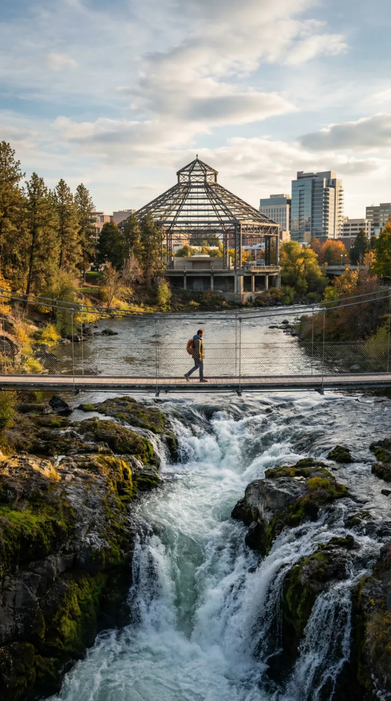
Spokane serves as the region’s urban center, home to 230,000 people. The city sits on the Spokane River, which drops over basalt ledges at Spokane Falls in the heart of downtown. Riverfront Park surrounds the falls with 100 acres of trails, bridges, and green space. The park hosted the 1974 World’s Fair and still features the historic Pavilion building. Walk the suspension bridge directly over the churning water for close-up views of the cascades.
Manito Park on the south side holds 90 acres of formal gardens, including a Japanese garden, rose garden, and conservatory with tropical plants. The historic Davenport Hotel downtown opened in 1914 and still operates as a luxury property with original marble columns and crystal chandeliers. Spokane’s craft brewery scene includes No-Li Brewhouse and Iron Goat Brewing, both within walking distance of downtown hotels.
The city sits 30 miles from Mount Spokane Ski Resort and 90 minutes from Schweitzer Mountain. Summer brings access to Lake Coeur d’Alene in Idaho, 40 miles east, and dozens of smaller lakes for swimming and boating. Visit Spokane provides current event listings and accommodation options.
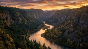
Drive 90 miles southwest to see the Channeled Scablands, a landscape of deep coulees and exposed basalt carved by massive Ice Age floods. Palouse Falls drops 198 feet into a horseshoe-shaped canyon, and Dry Falls shows where a waterfall five times wider than Niagara once flowed. These geological features make Eastern Washington unlike anywhere else in the state.
Spokane, Full guide coming soon!
Budget & Travel Costs in Washington State
Mid-range travelers should budget $150-250 per day in Washington State, with Seattle lodging averaging $180-300/night and meals $15-40 per person.

Accommodation eats the biggest chunk of your budget. In Seattle, hotels run $180-300 per night during summer, while Airbnb rentals cost $100-200. Hostels offer beds for $40-60. Smaller cities like Spokane and Bellingham charge 30-40% less. Camping in state and national parks costs $20-45 per night and gives you access to the best scenery.
Food prices vary by location. Casual meals cost $15-25 per person, while mid-range dinners run $30-50. Seattle restaurants charge more than eateries in Leavenworth or Port Townsend. Buying groceries for picnic lunches cuts costs fast.
Transportation adds up quickly. Rental cars cost $50-80 per day, and gas runs $4-5 per gallon. Ferry fares range from $9 for walk-ons to $65 for vehicles on longer routes. Parking in Seattle costs $3-8 per hour.
Activities include national park entry at $30 per vehicle for seven days, museum admission at $15-30, and guided tours at $75-150. Many hiking trails, beaches, and city parks cost nothing.
Summer prices jump 40-60% higher than winter rates, according to Visit Seattle tourism reports. Book accommodations two to three months ahead for June through August. Visit during spring or fall shoulder seasons for lower prices and smaller crowds. Camping outside Seattle and packing your own lunches saves hundreds of dollars per week.
Practical Tips & Packing for Washington
Washington State’s microclimates require layered clothing and rain gear year-round, with temperatures varying 30-40°F between coastal and mountain elevations on the same day.
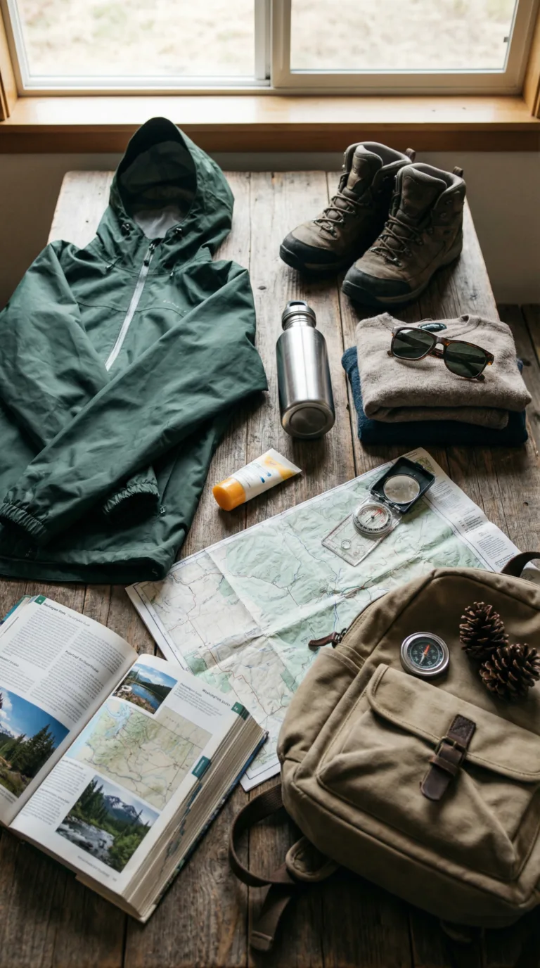
Layering is your best strategy. Pack a base layer, a fleece or insulating mid-layer, and a waterproof shell. Temperatures can shift 30 degrees between Seattle and the Cascades in the same afternoon. Even in July, mountain passes stay cool.
Rain gear isn’t optional. Bring a waterproof jacket and water-resistant shoes. An umbrella works well in cities. Seattle averages 150 rainy days per year, and sudden showers hit year-round.
For footwear, pack hiking boots if you plan to hit trails. Comfortable walking shoes work for city exploration. Sandals are useful in summer, especially near lakes and rivers.
Sun protection matters more than you think. High elevations and Eastern Washington deliver intense UV exposure. Bring sunglasses, sunscreen, and a hat.
Download offline maps before you go. Cell service drops in mountain areas and along remote stretches of the coast. A portable charger and car phone mount help with navigation.
Reusable water bottles and daypacks are essential for day hikes. A headlamp is useful if you camp. In winter, add gloves and a beanie. In summer, pack a swimsuit and insect repellent.
Reusable shopping bags are required in many Washington cities, where plastic bags are banned. Keep cash on hand for small towns and parking meters.
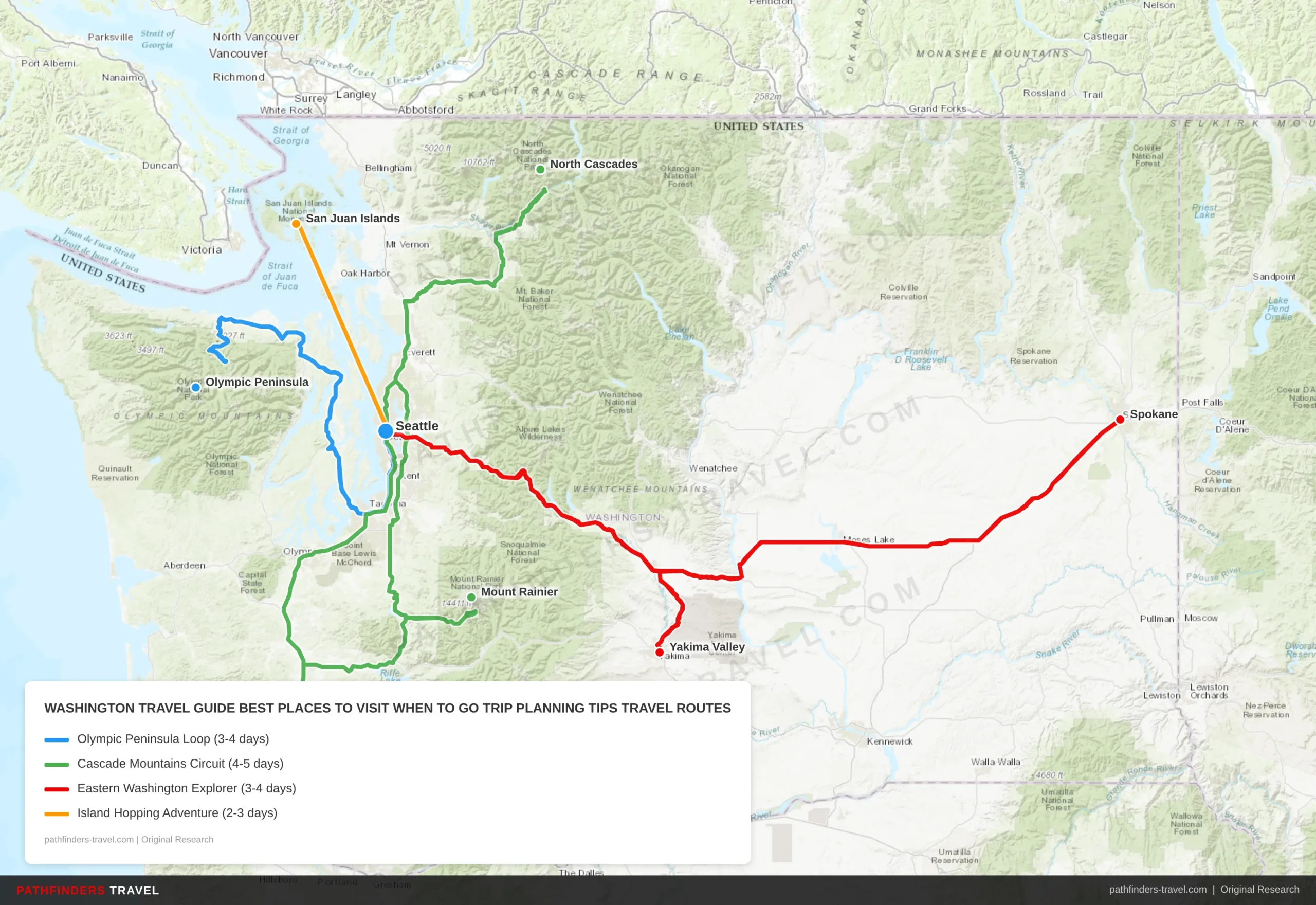
Travel Routes
Washington: Best Places to Visit, When to Go & Trip Planning Tips offers diverse travel experiences across multiple regions. Below are our recommended travel routes with key stops and estimated drive times.
| # | Stop | Highlights | Drive Time |
|---|---|---|---|
| 1 | Seattle | Urban starting point, Pike Place Market, Space Needle | Start |
| 2 | Olympic Peninsula | Temperate rainforests, hot springs, coastal beaches, Hurricane Ridge | 2h 30m |
| 3 | Seattle | Return via ferry system, waterfront dining | 2h 30m |
| # | Stop | Highlights | Drive Time |
|---|---|---|---|
| 1 | Seattle | Urban base, equipment shopping, early departure | Start |
| 2 | Mount Baker | Glacier views, alpine lakes, wildflower meadows | 2h 45m |
| 3 | Mount Rainier | National park, Paradise visitor center, hiking trails | 3h 30m |
| 4 | Seattle | Return through Enumclaw, mountain views | 2h 00m |
| # | Stop | Highlights | Drive Time |
|---|---|---|---|
| 1 | Seattle | Cross-state journey begins, Snoqualmie Pass | Start |
| 2 | Spokane | Eastern gateway, Riverfront Park, urban amenities | 4h 30m |
| 3 | Walla Walla | Award-winning wineries, harvest festivals, tasting rooms | 2h 15m |
| 4 | Columbia Gorge | River canyon, wine country, scenic drives | 1h 45m |
| # | Stop | Highlights | Drive Time |
|---|---|---|---|
| 1 | Seattle | Ferry departure point, waterfront preparation | Start |
| 2 | Skagit Valley | Tulip Festival (April), agricultural landscapes | 1h 30m |
| 3 | San Juan Islands | Ferry-accessible islands, whale watching, island hopping | 1h + ferry |
| 4 | Seattle | Return via Anacortes ferry system | 3h + ferry |
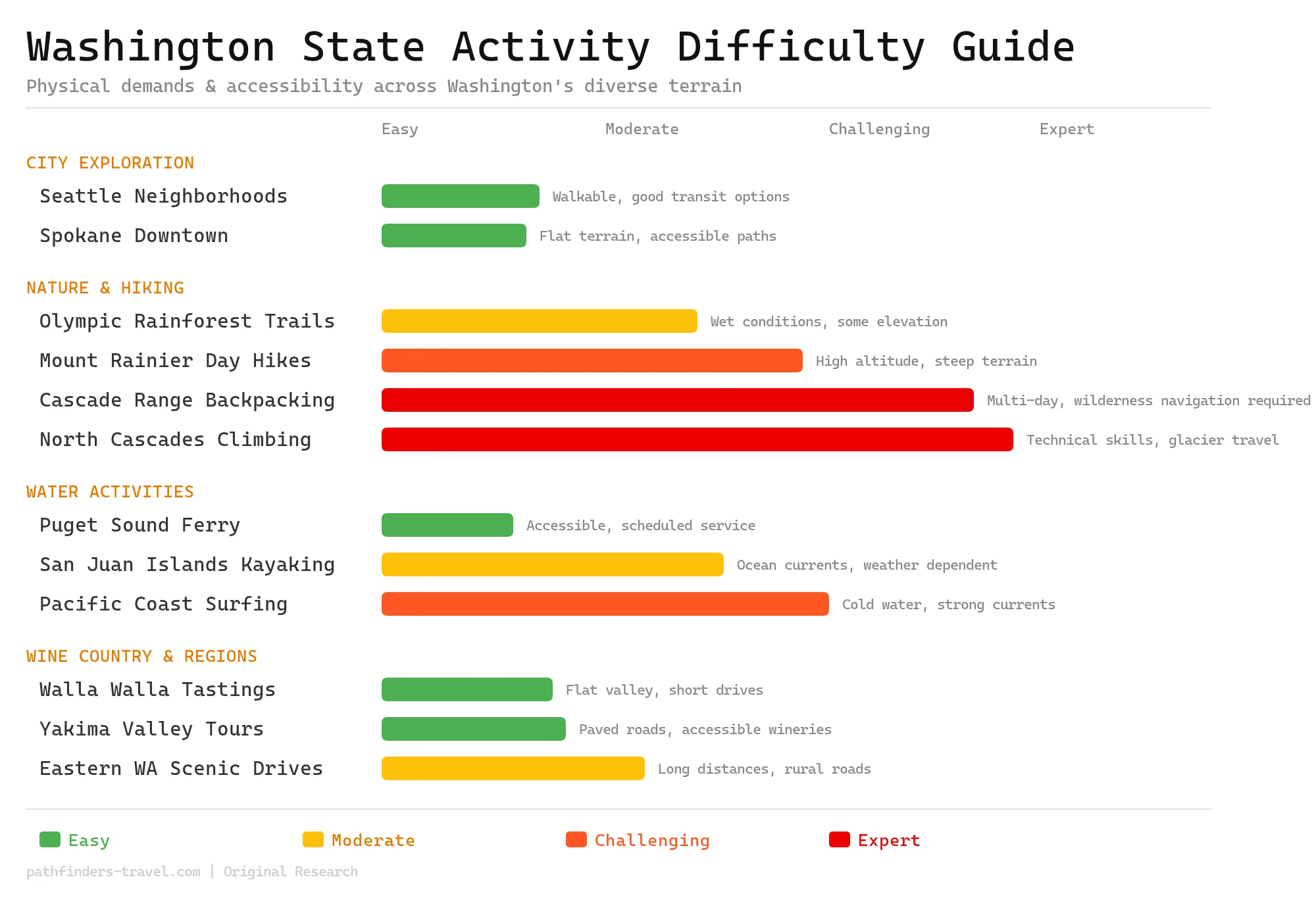
Activity Difficulty Guide
Washington State offers activities from easy urban exploration to expert-level mountaineering. The diverse terrain ranges from accessible city neighborhoods and wine valleys to challenging alpine environments requiring technical skills. Most visitors can find suitable activities, but mountain and wilderness adventures demand proper preparation and experience.
Frequently Asked Questions
Washington State’s most common travel questions involve weather timing, mountain pass conditions, national park reservations, and navigating the state’s diverse geography.
Planning a trip to Washington raises practical questions about timing, transportation, and logistics. Here are answers to the questions travelers ask most often.
What is the best time to travel to Washington State?
June through September offers the best weather, with warm, dry conditions and all mountain passes open. Spring (April-May) brings wildflowers and fewer crowds, but expect unpredictable weather and lingering snow at higher elevations. Fall (October-November) delivers autumn colors and harvest season, though rain increases as winter approaches. December through March is ideal for skiing but brings heavy rain west of the Cascades. If you want to avoid rain entirely, Eastern Washington stays sunnier year-round.
How do I check Washington road conditions and pass reports?
The WSDOT website and mobile app provide real-time traffic cameras, road closures, and pass conditions across the state. Before any mountain travel, check specific pass reports for Snoqualmie, Stevens, Blewett, and Washington Pass. Winter travelers must monitor chain requirements and weather forecasts closely. TripCheck Washington offers alternative access to the same information. Sign up for WSDOT alerts for your planned routes to get notifications about closures or delays.
Do I need a car to travel around Washington State?
A car is essential for exploring beyond Seattle and major cities. Seattle itself has good public transit, including light rail and buses, for city exploration. National parks, mountain areas, and Eastern Washington require a vehicle. Washington State Ferries connect islands and the peninsula, but you’ll need a car once you reach the other side. Rental cars cost $50-80 per day, so book early during summer months.
What are the must-see places to travel in Washington?
Seattle tops the list with Pike Place Market, the Space Needle, and the waterfront. Olympic National Park offers rainforest, mountains, and coastline in one park. Mount Rainier National Park features the iconic volcano and wildflower meadows. Diablo Lake and the North Cascades deliver turquoise waters and dramatic mountain scenery. Spokane and Eastern Washington wine country provide sunny weather and a completely different landscape. Whidbey Island and the San Juan Islands make perfect island getaways.
Is Seattle safe to travel to right now?
Seattle is generally safe for travelers who take normal urban precautions. Downtown and tourist areas like Pike Place, the waterfront, and Capitol Hill are well-patrolled. Use common sense: don’t leave valuables in cars and stay aware in crowded areas. Some neighborhoods have higher property crime rates, so research your accommodation location before booking. Public transit is safe during daytime hours. Use rideshare services at night if you feel uncomfortable.
How many days do I need to explore Washington State?
Plan a minimum of 5-7 days to see Seattle and one national park. A 10-14 day trip allows time for Seattle, Olympic National Park, Mount Rainier, and the North Cascades. Add 3-4 days if you want to explore Eastern Washington and wine country. Weekend trips work well for Seattle plus one nearby destination like Whidbey Island or Snoqualmie Falls. Each national park deserves 2-3 days minimum to explore properly.