Estimated reading time: 16 minutes
Last updated: March 2026
Explore Oregon’s Crown Jewel: Silver Falls State Park
How This Guide Was Researched
This guide was researched using official tourism board data, government park services, and verified traveler accounts. All prices, hours, and logistics were confirmed at the time of publication. We recommend verifying details with local sources before you travel.
Twilight fans know this place. The baseball scene was filmed here. That pop culture hook brings people in, but the waterfalls keep them coming back.
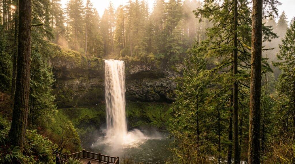
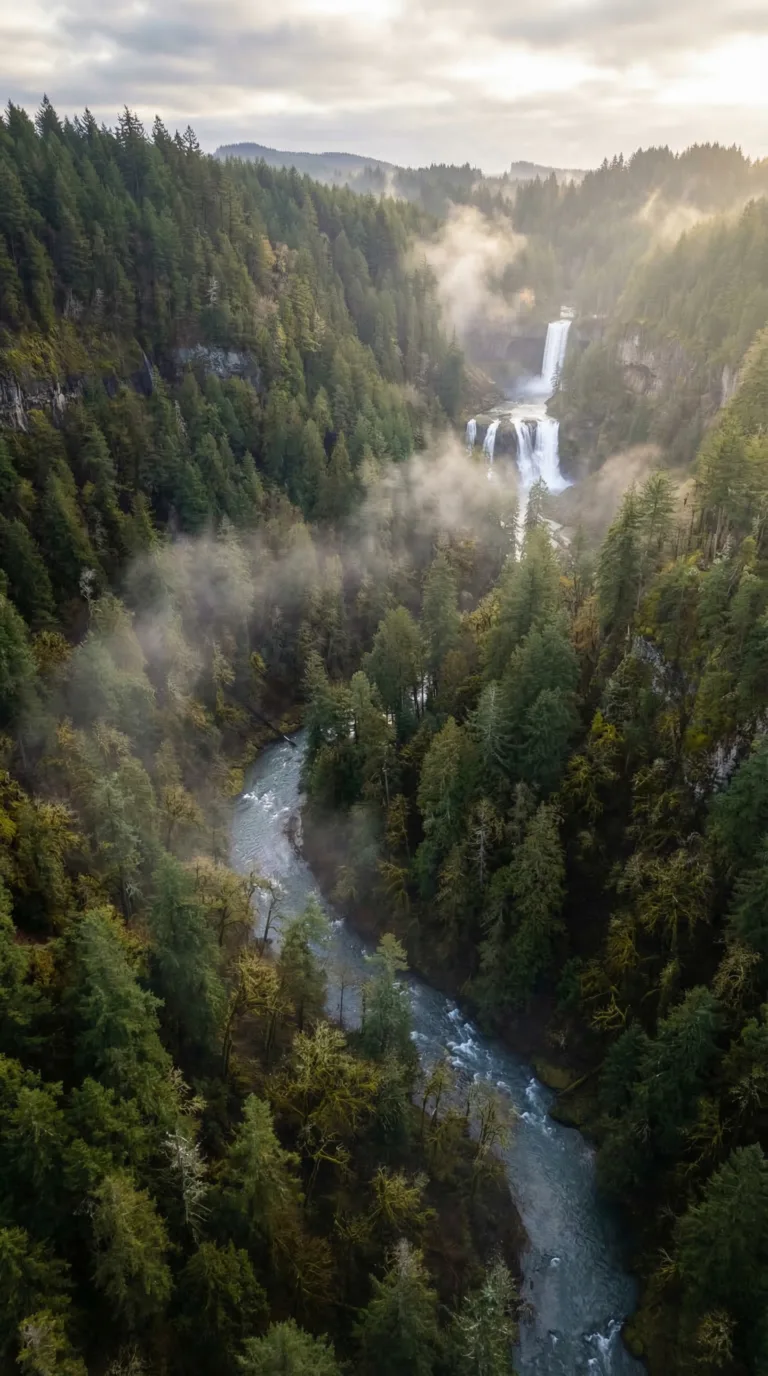
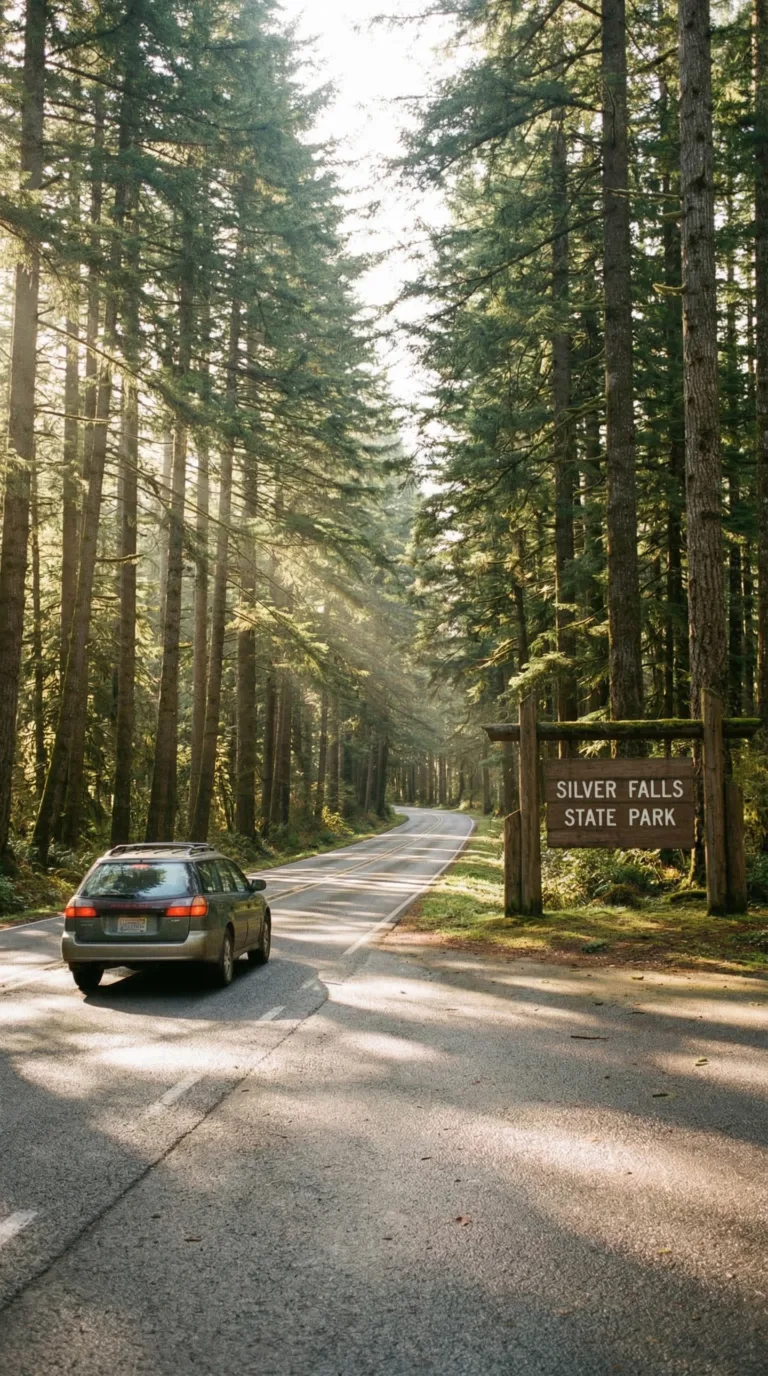
Silver Falls State Park is Oregon’s largest state park. It sits in the Cascade Mountain foothills near Silverton, about a hour east of Portland and Salem. The park sprawls across 9,000 acres of temperate rainforest. Ten waterfalls drop from basalt cliffs along Silver Creek. Heights range from 27 feet to 177 feet. Four of them let you walk behind the falling water.
The Trail of Ten Falls loops 7.2 miles through old-growth Douglas fir and western hemlock. You’ll gain 800 feet of elevation. The route works for most fitness levels. Short viewpoint walks exist for people who can’t handle the full loop. A paved quarter-mile trail leads to South Falls, the tallest drop at 177 feet.
Spring runoff makes the waterfalls roar. Fall colors the canyon. Winter brings ice and occasional closures. Summer gets crowded but stays green.
The Trail of Ten Falls and Other Attractions
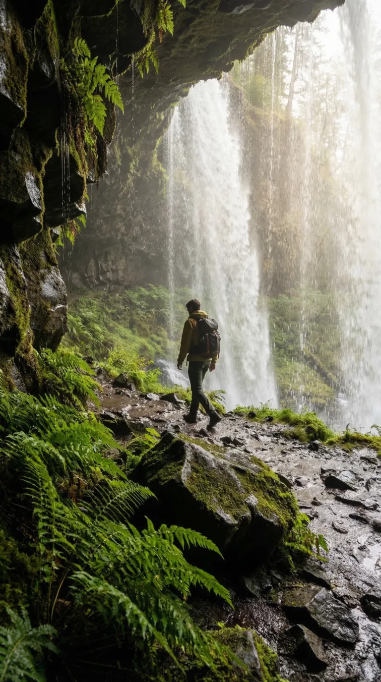
The Trail of Ten Falls is why people drive here. This 7.2-mile loop passes all ten named waterfalls in the park. Not a photo stop tour, you walk behind four of them through natural basalt caves.
Start clockwise from South Falls Lodge. The trail drops you straight to South Falls, the 177-foot headliner. A paved path leads behind the curtain of water. Moss clings to the rock ceiling. The roar fills the amphitheater. This is the shot everyone posts.
Keep going. Lower South Falls appears next, 93 feet, another walk-behind. Then Lower North Falls at 30 feet, the smallest on the loop. Double Falls hits 178 feet, the tallest drop. No walk-behind here. Just a viewpoint.
Drake Falls barely registers at 27 feet. Blink and you’ll miss it. Middle North Falls makes up for it, 106 feet with another basalt cave passage. Twin Falls splits into two channels, 31 feet total. North Falls delivers the best walk-behind experience at 136 feet. The cave goes deeper. More ferns. Better light through the water.
Upper North Falls drops 65 feet. Winter Falls closes the loop at 134 feet. Some maps list it as a seasonal flow. It runs year-round now.
The trail gains 800 feet total elevation. Oregon State Parks rates it moderate. Most people finish in 3, 4 hours. Roots cross the path. Rocks get slick near the falls. Wear boots with grip.
Don’t want the full loop? The paved South Falls viewpoint runs 0.25 miles from the parking lot. South Falls to Lower South Falls makes a 1.6-mile out-and-back. Connector trails let you cut the loop short. Download the Official Trail of Ten Falls map PDF before you go. Cell service drops in the canyon.
Check AllTrails Trail of Ten Falls for current conditions. Winter ice closes the walk-behind sections sometimes. Spring runoff makes the falls roar but muddies the trail.
Clockwise works best. You descend to most waterfalls instead of climbing up to them. The views hit better this direction too.
The rock here is Columbia River Basalt, 15 to 17 million years old. Multiple lava flows stacked up, then the creek cut through. The layers create those amphitheater caves. Geology made this place, not Instagram.
Morning light hits South Falls best. Afternoon sun reaches North Falls. Misty days make everything moody. Bring a polarizing filter if you shoot.
Beyond the waterfalls, the park has 35 miles of horse trails and 14 miles open to mountain bikes. Picnic areas dot the South Falls day-use zone. Sahalie Falls sits 90 minutes north if you want more waterfall chasing in Oregon.
The Trail of Ten Falls isn’t a secret. Summer weekends pack the parking lot by 9 AM. Go early or go late. Or come in winter when the crowds thin and the falls run heavy.
Top Picked Activities in Silver Falls State Park
Dining at Silver Falls State Park
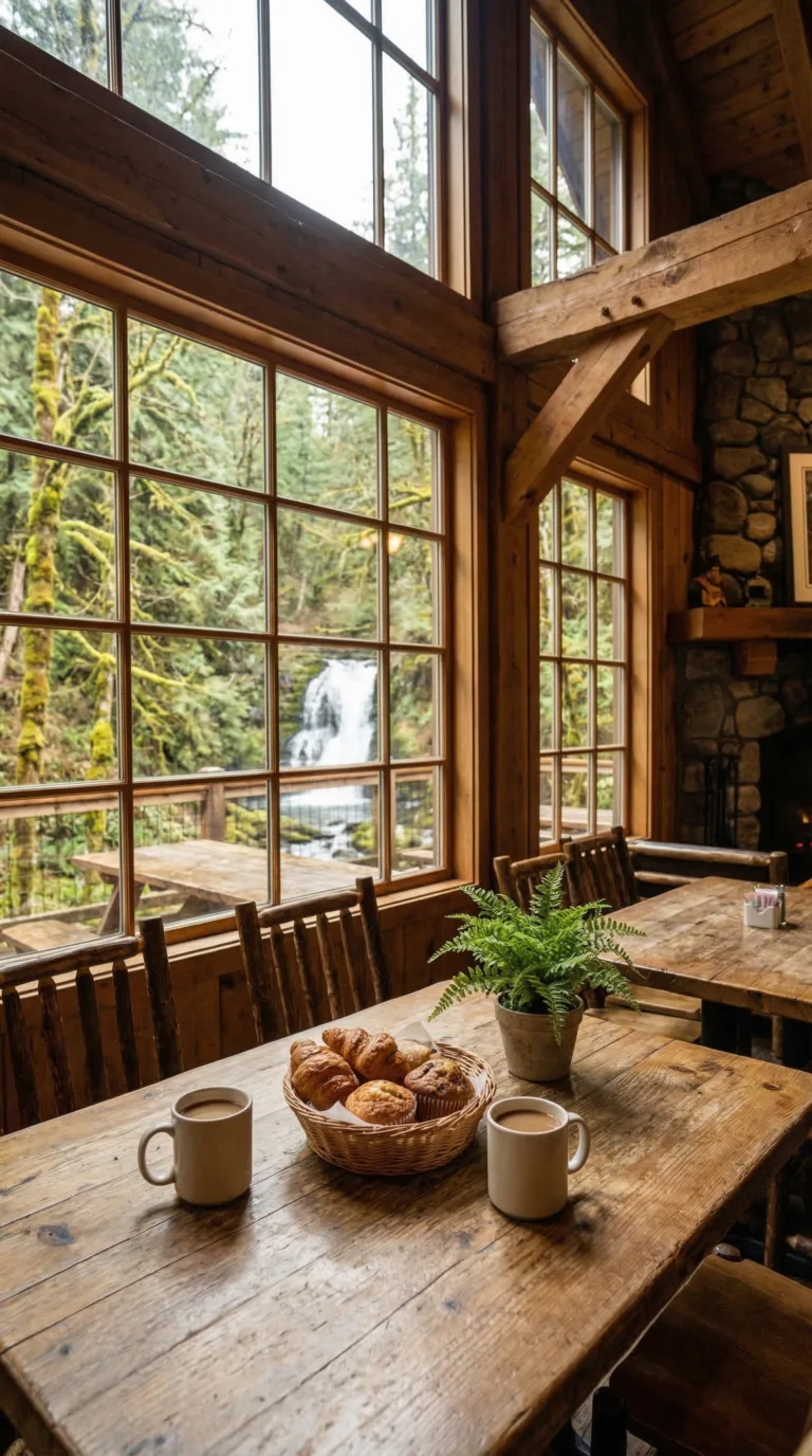
South Falls Cafe sits at the South Falls Day Use Area, right by the main trailhead. It’s the only on-site dining option in the park. The menu covers breakfast items, sandwiches, soups, salads, coffee, and trail snacks. Good for fueling up before you hike or refueling after.
The cafe operates seasonally, typically spring through fall, with weekend-only hours in winter. Check the South Falls Cafe official page for current hours before you go. The building has a rustic lodge feel. Indoor seating and outdoor tables both available.
Pack your own food if you want more control. The park has multiple picnic areas with tables and shelters scattered throughout. No alcohol sold on-site, but you can bring your own for campsite consumption.
For more dining variety, drive 20 minutes to Silverton or 30 minutes to Salem. Both towns have full restaurant options. Pack out all trash. Leave No Trace principles apply here.
Where to Stay: Camping, Cabins, and Nearby Hotels
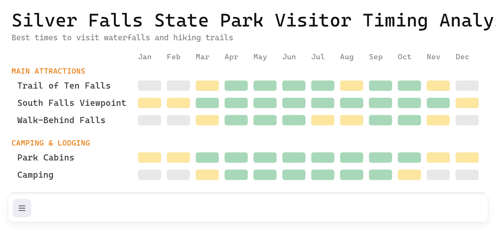
Silver Falls Campground spreads across the park with 51 electrical sites, 52 tent sites, 3 group tent areas, and 14 horse camp sites. You get restrooms with showers, a dump station, and firewood for sale. Accessible facilities are available throughout. RVs up to 60 feet fit here.
Book through the Oregon State Parks camping reservation system. May through September fills fast. Some first-come sites exist, but don’t count on them during peak season. Winter camping runs with limited services.
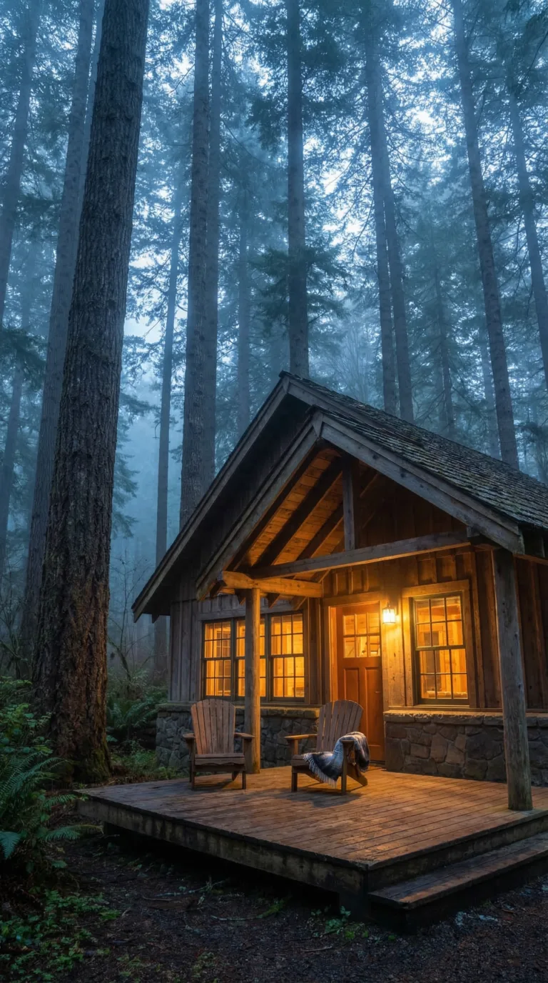
Smith Creek Village at Silver Falls State Park offers the premium on-site option. Modern cabins sleep 4-6 people with full kitchens, bathrooms, and heating. Rustic wood exteriors hide contemporary interiors. Forest surrounds every unit.
These cabins cost more than camping. Book the Smith Creek Village booking page six months ahead for summer weekends. Fall color season books even faster.
Hotels cluster in Silverton (20 minutes), Salem (30 minutes), and Sublimity. Chain hotels and B&Bs give you standard amenities. Silverton keeps you closest to the trailhead.
Silver falls state park camping reservations matter most in warm months. Silver falls state park cabins require serious advance planning. Silver falls state park lodging on-site beats the commute from hotels near silver falls state park.
Getting to Silver Falls State Park
The park address is 20024 Silver Falls Highway SE, Sublimity, OR 97385. Get directions on Google Maps for turn-by-turn navigation to the South Falls Day Use Area.
From Portland, the drive takes about an hour. Head south on I-5 for 45 miles to Salem, then exit onto Highway 214 East. The route covers 60 miles total. You’ll pass through farmland before climbing into the forest as you approach the park.
Salem to Silver Falls State Park is the shortest route. Just 26 miles east on Highway 214. Thirty minutes door-to-trailhead. Eugene sits 90 minutes south. Silverton is 20 minutes west if you’re coming from that direction.
Silver Falls State Park parking fills fast on summer weekends. The main lot at South Falls holds the most cars. Smaller lots serve North Falls and other trailheads. Arrive before 9 AM on Saturdays and Sundays from June through September. Midweek visits guarantee a spot.
No public transit runs to the park. You need a car. Highway 214 stays paved and maintained year-round, but winter ice happens. Check ODOT road conditions on TripCheck before driving in December through February. GPS coordinates for accuracy: 44.8806° N, 122.6556° W.
Silver Falls State Park Costs and Budget Tips
Planning Tip
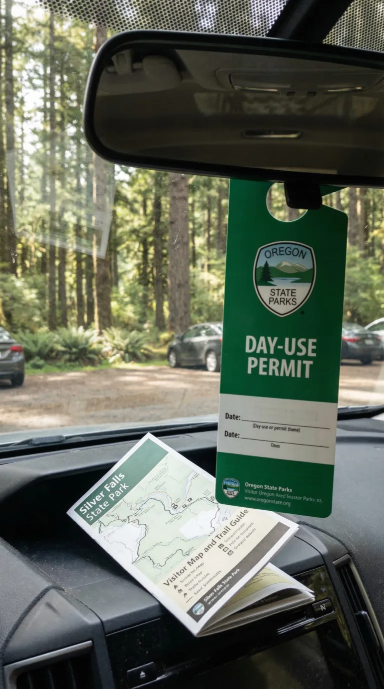
Day-use parking costs $5 per vehicle. Every trailhead and parking area requires a permit. Pay at self-service stations using cash or card. An annual Oregon State Parks pass runs $30, worth it if you visit seven times or more. Buy passes online through the Day-use parking permits and annual passes page.
Planning Tip
Camping fees range from $21 to $24 per night for tent sites. Electrical hookups cost $29 to $32. Group sites run $77 to $87 nightly. Prices shift with the season. Smith Creek Village cabins start at $99 and top out at $189 depending on size and time of year.
Hiking is free once you’ve paid for parking. No trail permits. No extra fees for waterfalls or viewpoints. Your America the Beautiful Pass won’t work here. Silver Falls is a state park, not federal land.
Pack your own snacks and water. South Falls Cafe is convenient but expensive. Midweek camping costs less than weekends. All picnic areas are included with your day-use fee.
Day Trips from Silver Falls State Park
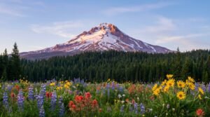
Silver Falls sits dead center in Oregon’s best road trip territory. You can hit the coast, the high desert, or the Columbia River Gorge in under two hours.
Portland is 60 miles northwest. Drive time: one hour. Powell’s Books occupies an entire city block. The food cart pods serve everything from Thai to Venezuelan. Washington Park has the Japanese Garden and the International Rose Test Garden. The craft brewery scene spans 70+ locations.
Cannon Beach sits two hours northwest on Highway 18. Haystack Rock towers 235 feet above the sand. Tide pools appear at low tide. Art galleries line Hemlock Street. The beach stretches for miles in both directions.
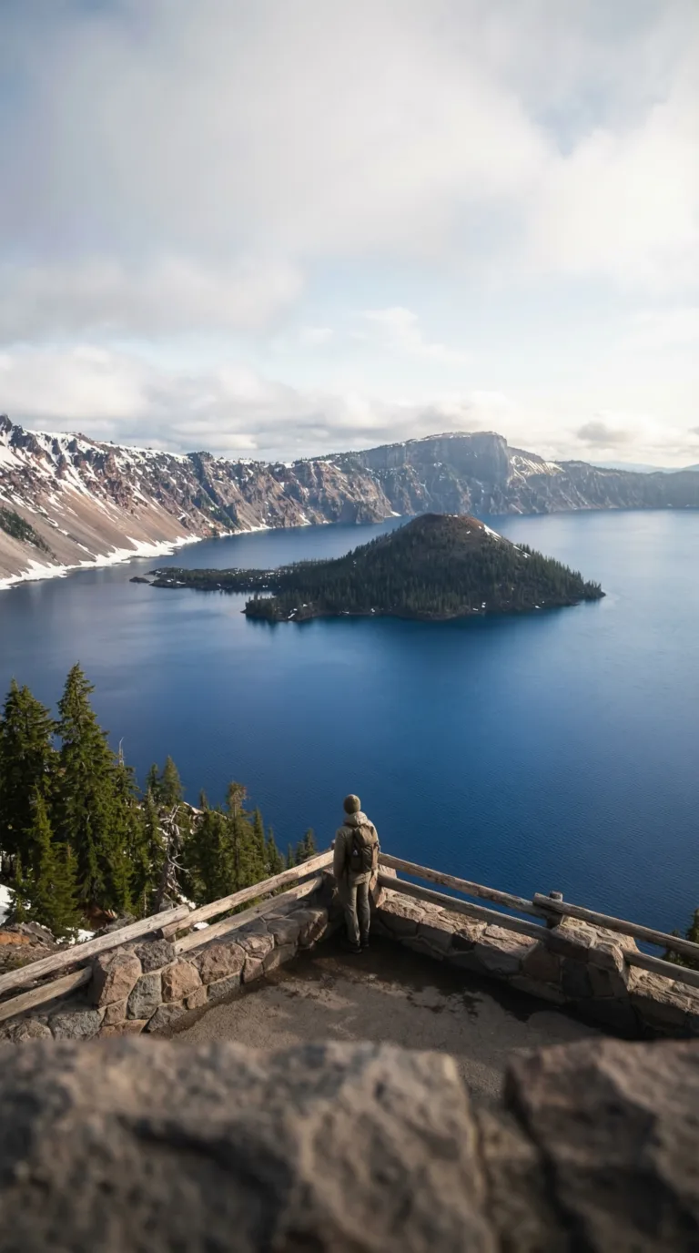
Crater Lake National Park requires three hours south through the Cascades. Oregon’s only national park. The caldera drops 1,943 feet deep. The water glows an impossible blue. Summer only, snow closes Rim Drive from October through June. Plan an overnight stay or leave at dawn for a long day trip.
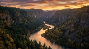
Columbia River Gorge runs 90 minutes north on I-5. Multnomah Falls drops 620 feet in two tiers. The Historic Columbia River Highway winds past dozens of waterfalls. Hiking trails range from paved walks to all-day scrambles.
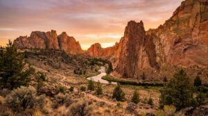
Bend sits 2.5 hours east over the Santiam Pass. The Cascade Lakes Scenic Byway loops past alpine lakes and volcanic peaks. Downtown packs 30+ breweries into ten blocks. Smith Rock State Park lies 30 minutes north of Bend, 800-foot cliffs rising from the Crooked River.
Newport anchors the central coast two hours west. The Oregon Coast Aquarium houses sea otters and jellyfish galleries. The historic bayfront smells like salt and diesel. Mount Hood National Forest spreads 1.5 hours northeast, Timberline Lodge operates year-round skiing on Palmer Glacier.
Salem sits 30 minutes west for Oregon State Capitol tours and Willamette Valley wine tasting. Check Willamette Valley attractions and itineraries for current hours and seasonal events.
Top Picked Activities around the Oregon Coast
Practical Information: Weather, Hours, and What to Pack
Silver Falls State Park weather follows classic Pacific Northwest patterns. Wet winters run November through March. Mild summers stretch June to September. Spring and fall sit in between, offering their own trade-offs.
Winter brings rain. Lots of it. Waterfalls roar at full power, but trails turn to mud. Ice shuts down sections of the loop trail some years. Check Silver Falls State Park current conditions before heading out November through March. The park doesn’t close, but portions of the trail might.
Spring (April-May) delivers high water flow and wildflowers. Crowds stay manageable. The best time to visit Silver Falls State Park for waterfalls at peak power is May through early June. You’ll see fewer people than summer and more water than fall.
Summer (June-September) means warm, dry hiking. It also means parking lots fill by 10 a.m. on weekends. The National Weather Service forecast for Silver Falls area typically shows temps in the 70s and 80s.
Fall (October-November) brings Silver Falls State Park fall colors, maples turn orange and yellow against the evergreens. September through October offers pleasant weather without summer crowds.
Silver Falls State Park hours run dawn to dusk year-round for day-use areas. South Falls Lodge operates seasonally. The campground stays open all year but cuts services in winter.
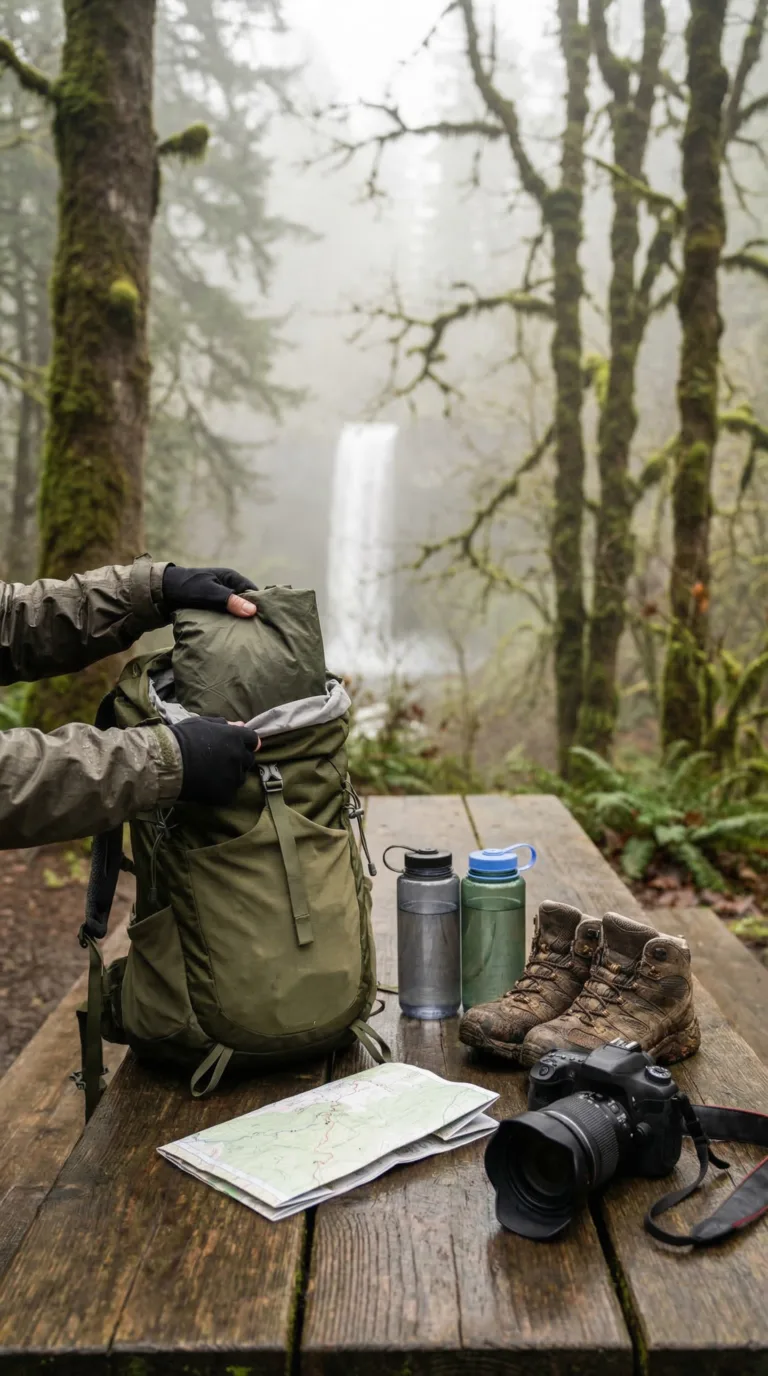
Pack a waterproof rain jacket no matter the season. Trails near waterfalls stay damp. Sturdy hiking boots with good traction prevent slips on wet bridges and stairs. Bring layers, the park sits 1,000 to 2,000 feet elevation, cooler than the valley floor. Carry water bottles (no potable water on trail), snacks, a camera, and a trail map.
Best Time to Visit
Silver Falls State Park shines brightest from spring through fall when waterfalls flow full and trails stay ice-free. Winter brings beautiful but treacherous conditions with potential ice closures on walk-behind sections, while summer crowds peak but offer the most reliable weather for the complete Trail of Ten Falls experience.
Silver Falls is one of the highlights in our comprehensive Oregon travel guide, which covers everything from the coast to the Cascades.
Waterfall enthusiasts should also explore the Columbia River Gorge, home to over 90 waterfalls including the iconic Multnomah Falls.
For more hiking adventures, Mount Hood National Forest offers year-round outdoor recreation just an hour and a half from Silver Falls.
Eastern Oregon’s Smith Rock State Park provides a dramatic contrast with its desert landscape and world-class rock climbing.
Frequently Asked Questions
How long of a hike is Silver Falls?
The full Trail of Ten Falls loop measures 7.2 miles. Most people finish in 3 to 5 hours, depending on how fast they walk and how many photo stops they make. The trail gains and loses 800 feet of elevation total. That earns it a moderate difficulty rating.
You don’t have to hike the whole thing. The South Falls viewpoint sits just 0.25 miles from the parking lot on a paved path. South Falls to Lower South Falls runs 1.6 miles round trip. Connector trails let you build custom loops if you want to see fewer waterfalls. Go clockwise for easier descents and better angles approaching the falls.
What movie was filmed in Silver Falls, Oregon?
The 2008 film Twilight shot several scenes at Silver Falls State Park. The park’s misty, moss-covered forest gave the vampire romance its moody Pacific Northwest atmosphere. This remains the most famous movie filmed here. Twilight fans still visit from around the world. The dramatic waterfalls and old-growth forest have also appeared in other film and commercial productions over the years.
How many waterfalls are there at Silver Falls?
Silver Falls State Park contains 10 waterfalls along the Trail of Ten Falls. They range from 27 to 177 feet in height. Four waterfalls have amphitheater formations that let you walk behind the falling water: South Falls, Lower South Falls, North Falls, and Middle North Falls. The waterfalls formed from 15 to 17 million-year-old Columbia River Basalt flows that created layered cliffs. All 10 falls are accessible via the 7.2-mile loop trail. Shorter hikes reach individual falls if you don’t want to do the full circuit.
Can you see Silver Falls without hiking?
Yes. South Falls, the park’s iconic 177-foot waterfall, is visible from the main parking area. No hiking required. A short 0.25-mile paved trail leads to a viewpoint platform overlooking South Falls. Wheelchairs and strollers can use this path. The South Falls Lodge area offers views of the surrounding forest and canyon without any walking. For people with limited mobility, the paved South Falls trail provides the best waterfall experience without tackling the full 7.2-mile loop.
Is Silver Falls a difficult hike?
The Trail of Ten Falls gets a moderate difficulty rating. Most people with reasonable fitness can handle it, but it’s not a casual stroll. The 7.2-mile distance and 800 feet of elevation change require stamina. The trail stays well-maintained with clear paths. Some sections get steep with stairs. Areas near waterfalls can be slippery. Hiking clockwise makes the route easier with more gradual descents. Plan for 3 to 5 hours to finish the full loop with breaks. Shorter route options exist for easier hikes to individual waterfalls.