Estimated reading time: 13 minutes
Last updated: March 2026
Table of Contents
- Explore Mount Hood National Forest
- Top Attractions and Activities
- Where to Stay: Camping and Lodging
- Getting There and Around
- Day Trips from Mount Hood
- Practical Information
- Frequently Asked Questions
Explore Mount Hood National Forest
How This Guide Was Researched
This guide was compiled from travel documentaries, verified tourism sources, and community traveler feedback. Prices and operational details were confirmed at the time of writing. We recommend checking official sources for the latest information before your trip.
Want to see Mount Hood’s alpine terrain for yourself? Watch our full Oregon travel documentary in 4K Ultra HD.
Mount Hood skiing pulls 14,800 monthly searches for good reason. This place runs lifts 12 months a year. You can carve turns in July while Portland bakes at 90 degrees.
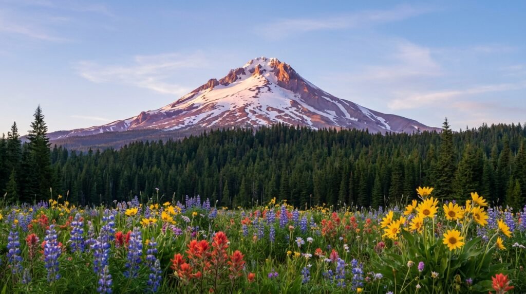
Mount Hood National Forest sprawls across 1.1 million acres of northern Oregon wilderness. People search for “mt hood national park” constantly, 9,900 times monthly, but that’s wrong. This is a National Forest, managed by the USDA Forest Service, not the National Park Service. Different rules. Different fees. Different camping options.
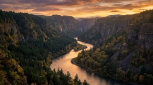
The forest sits 50 miles east of Portland. You can leave the city after breakfast and stand at a trailhead by lunch. The 11,240-foot volcanic peak dominates every view, its glaciers visible from Interstate 84 on clear days.
What draws people here? Year-round skiing at Mount Hood Meadows and Timberline Lodge. Over 1,200 miles of trails threading through old-growth Douglas fir. Alpine lakes so clear you count rocks 20 feet down. The 40-mile Timberline Trail that circles the mountain’s base.
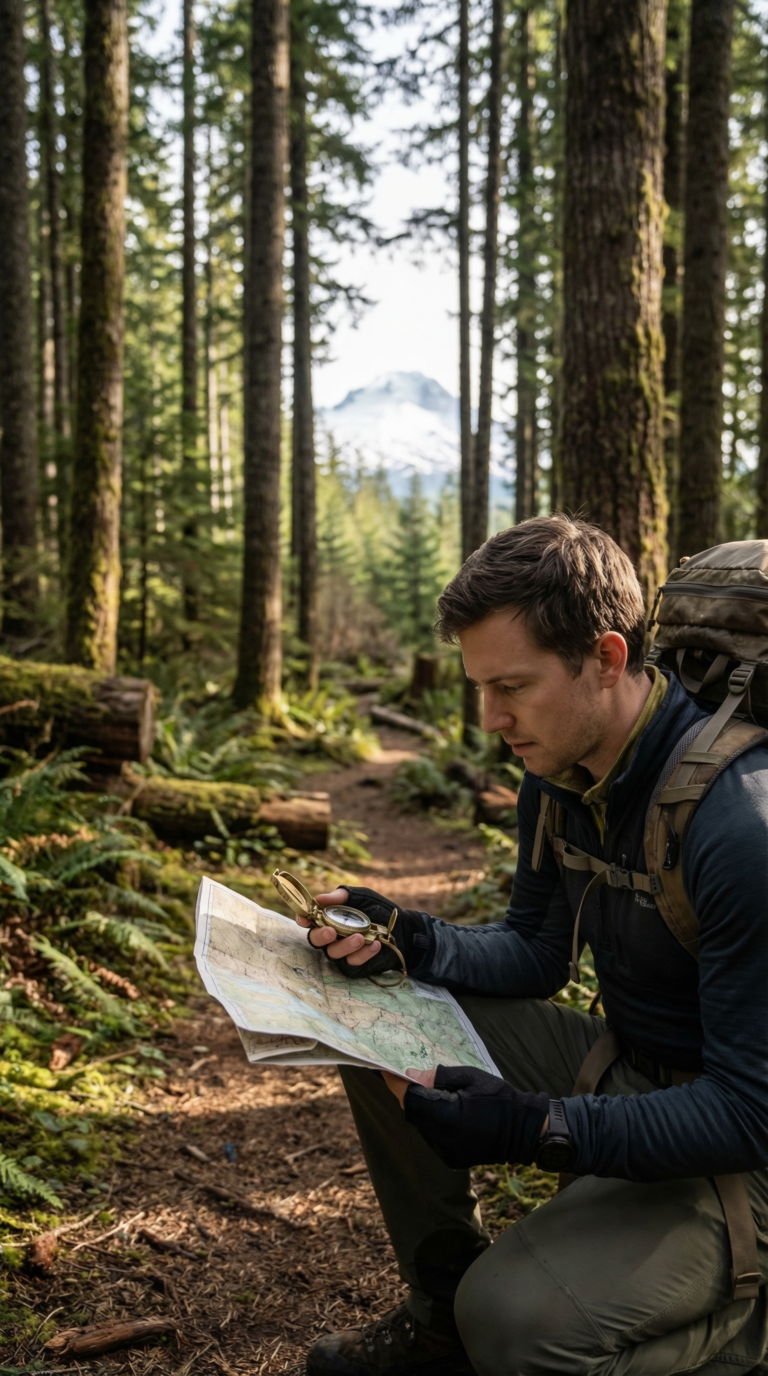
This guide covers the trails worth hiking, the campsites worth claiming, and the logistics that trip up first-timers. You’ll need a Northwest Forest Pass for most trailheads. You’ll want to know which roads close in winter. You’ll need to understand where you can camp for free and where you can’t.
Start with the Official USDA Forest Service Mount Hood National Forest website for current conditions. Check the Official Mount Hood National Forest visitor information page for maps and permit requirements before you drive out.
Top Attractions and Activities
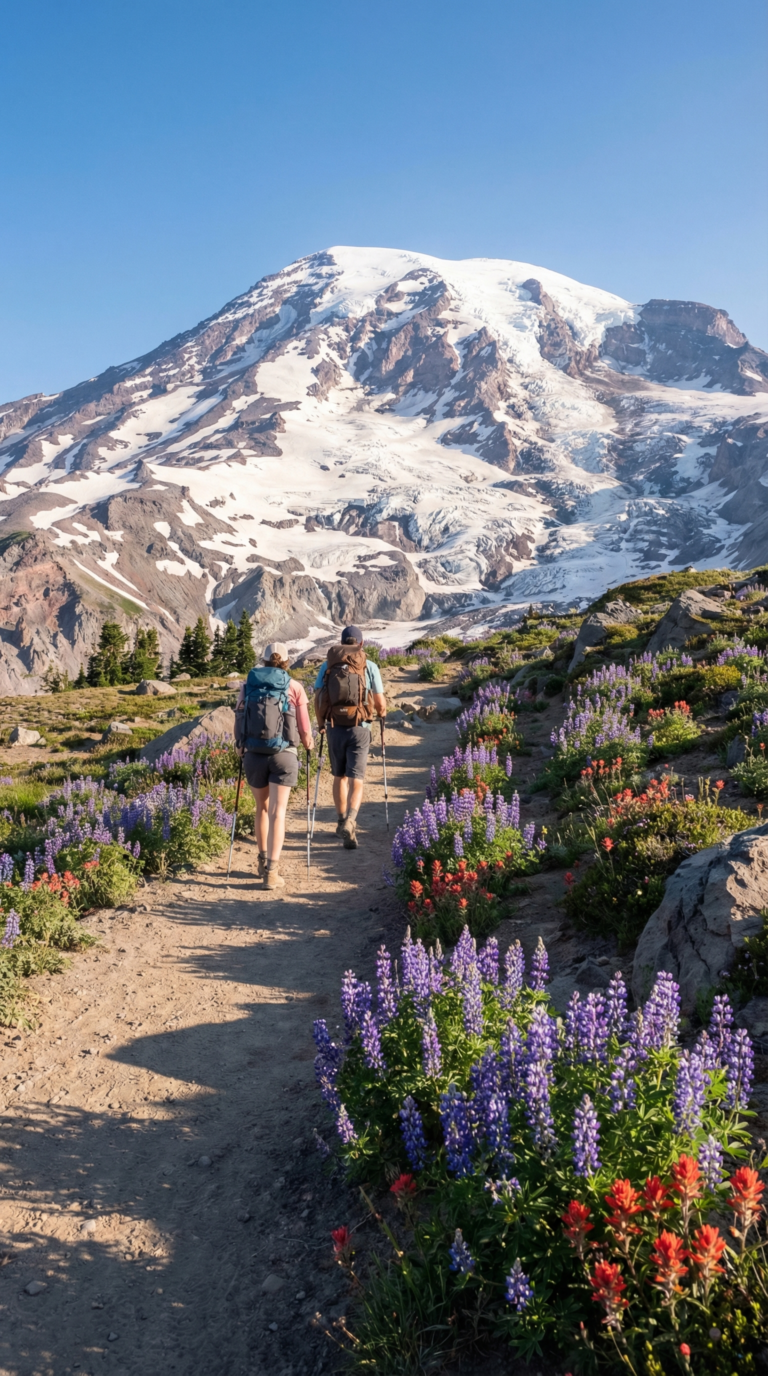
Mt Hood hiking trails sprawl across 1,200 miles of terrain. You’ll find everything from flat lakeside strolls to technical alpine scrambles. The forest holds enough trail networks to hike a different route every weekend for years.
The Timberline Trail sits at the top of every serious hiker’s list. This 40-mile loop circles the entire mountain. You’ll gain over 10,000 feet of elevation crossing glacial rivers, alpine meadows, and volcanic ridges. Most people tackle it in 3, 4 days with backcountry camping permits. The trail crosses all major drainages around Mount Hood. Water sources are plentiful but require filtration. Snowfields linger into July on north-facing slopes.
Planning Tip
You can stand on the summit. The mt hood hike to summit demands real mountaineering skills. You’ll need crampons, an ice axe, and experience with glacier travel. The south route via Hogsback Ridge sees the most traffic. Climbers start around midnight to cross the bergschrund before sunrise softens the snow. Crevasses open wider each summer. Rockfall increases after 8 a.m. Guided services run $500, 700 per person. Success rates hover around 50% depending on weather and fitness levels.
Mirror Lake offers a gentler option. This 3.2-mile round-trip hike climbs 700 feet through old-growth forest to a clean alpine lake. The water reflects Mount Hood’s peak on calm mornings. Families with young kids handle this trail easily. Arrive before 9 a.m. on summer weekends or the trailhead parking lot fills completely.
Mount Hood Lost Lake sits 15 miles from the mountain’s base. You can drive right to it. The lake stretches across 240 acres with a campground, boat rentals, and swimming areas. The view from the north shore, Mount Hood rising above the water, appears on countless postcards. Visit the Official Mount Hood Meadows ski resort website for winter access conditions.
Clear Lake Mount Hood holds spring water so transparent you can see a submerged forest 100 feet down. The trees drowned 3,000 years ago when a lava flow dammed the McKenzie River. A 5-mile loop trail circles the shoreline. Bring a mask and snorkel to peer at the ghostly trunks below.
Planning Tip
Skiing here runs 12 months a year. Mount Hood Meadows operates the largest ski area with 2,150 acres of terrain. Timberline Lodge keeps its Palmer Glacier lift spinning through summer. Check the Timberline Lodge official website for year-round skiing information. Summer skiing costs $69 for a half-day ticket. The snow gets sthicky by noon.
Waterfalls punch through the forest in dozens of locations. Ramona Falls cascades 120 feet over columnar basalt in a fan pattern. The 7.1-mile loop trail crosses the Sandy River on a log bridge. Tamanawas Falls drops 100 feet into a moss-lined amphitheater. The 3.8-mile out-and-back trail follows Cold Spring Creek through a narrow canyon.
Wildlife sightings happen regularly. Black bears forage in huckleberry patches during late summer. Elk herds graze in meadows near Government Camp. Mountain goats cling to cliffs above treeline. Deer appear along roadsides at dusk. Store food in bear canisters when camping. Make noise on blind trail corners. Most bears bolt when they hear humans approaching.
Alpine lakes dot the high country. Trillium Lake sits right off Highway 26 with a paved path around its perimeter. Frog Lake and Timothy Lake offer quieter shorelines with dispersed camping. A lakes map showing all 200+ bodies of water is available at ranger stations. Mosquitoes swarm near still water from June through August. Bring bug spray.
Pick up a hiking trail map before you start. Cell service vanishes once you leave the main highways. Paper maps cost $12 at ranger stations. Digital versions download from the Forest Service website. Trail junctions aren’t always marked clearly. Navigation apps drain phone batteries fast in cold weather.
Where to Stay: Camping and Lodging
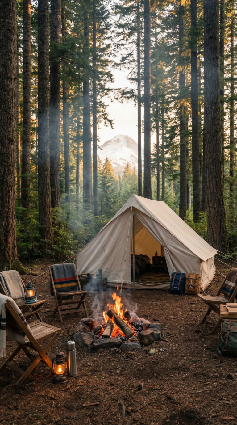
Camping in Mount Hood National Forest is the go-to option for most visitors. Over 80 developed campgrounds scatter across the forest, ranging from basic sites with vault toilets to full-service spots with water and RV hookups. Popular campgrounds like Lost Lake and Trillium Lake fill up fast during summer weekends. You need reservations through Recreation.gov for Mount Hood National Forest campground reservations if you want a guaranteed spot.
Free camping Mount Hood National Forest is allowed through dispersed camping. Park anywhere on Forest Service roads as long as you stay 200 feet from water sources. No amenities. No fees. Just you and the trees. Mount Hood National Forest dispersed camping works well for experienced campers who pack in their own water and pack out all trash.
Most campgrounds open May through September. A handful stay open year-round for winter camping enthusiasts. Grab a campground map at any ranger station. It shows every developed site plus road access points for dispersed camping.
Mount Hood National Forest lodging centers on Timberline Lodge, the historic ski resort built in 1937. Book rooms at the Timberline Lodge official reservation website. Government Camp offers hotels and vacation rentals for those wanting a roof overhead. Mount Hood National Forest cabins exist but are rare. The Forest Service rents out a limited number of historic cabins. Book months ahead.
Hotels near Mount Hood National Forest cluster in three towns: Sandy to the west, Government Camp mid-mountain, and Hood River to the north. Expect higher rates during ski season and summer weekends.
Getting There and Around
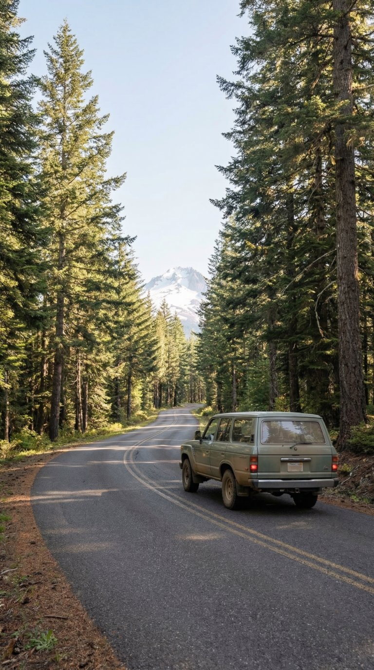
Portland sits 50 miles west of the forest boundary. Highway 26 runs straight into the wilderness. Government Camp takes 90 minutes in good weather. That timeline stretches fast when snow hits.
Mt Hood weather road conditions change by the hour in winter. Oregon TripCheck shows real-time updates. Chains become mandatory above 3,000 feet when storms roll through. Keep a set in your trunk October through May.
Most trailheads require a parking pass. The Northwest Forest Pass costs $5 for one day or $30 for the year. Ranger stations sell them. Some trailheads have self-service kiosks. You can buy online before you leave home. The America the Beautiful Pass works too, it covers all federal recreation sites.
Where to buy Mt Hood parking pass matters less than remembering to get one. Rangers ticket aggressively during summer weekends.
Mt Hood national forest road closures happen all winter. Forest Road 42 and several spur roads shut down November through June. The Forest Service website posts closure maps. Check before driving to remote trailheads.
Public transportation does not exist here. You need your own vehicle. Some backcountry roads require high clearance, sedans bottom out on rocky stretches. The Forest Service motor vehicle use map shows which roads need four-wheel drive.
Day Trips from Mount Hood
Mount Hood sits dead center in Oregon’s best geography. You can hit the Pacific Coast, high desert canyons, and volcanic lakes without spending all day in the car.
Portland is 50 miles west. The city works as a base camp for forest visits or a quick urban break between hikes. Powell’s Books fills an entire city block. Food carts line downtown streets serving $8 Thai curries and Korean tacos. Check the Travel Portland tourism website for current events and neighborhood guides.
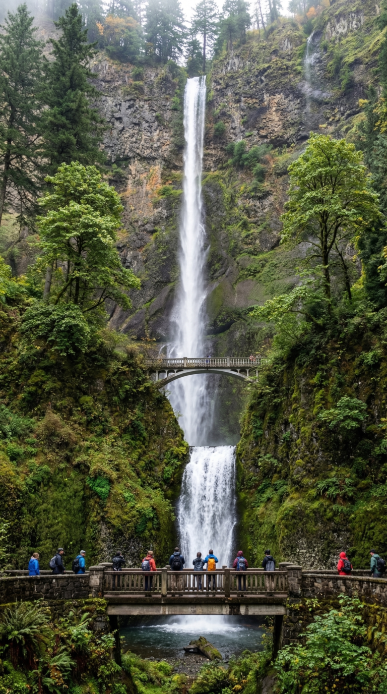
Columbia River Gorge sprawls 30 miles north. The Columbia River Gorge National Scenic Area protects 90+ waterfalls carved into basalt cliffs. Multnomah Falls drops 620 feet in two tiers. The Historic Columbia River Highway winds through the gorge with pullouts every few miles. Spring runoff makes waterfalls roar. Summer crowds pack the trails by 9 AM.
Cannon Beach lies two hours northwest. Haystack Rock juts 235 feet from the sand, tide pools circle its base at low tide. The beach stretches for miles. Parking costs $5 in summer.
Silver Falls State Park sits 90 minutes south. The Trail of Ten Falls loops 7.2 miles past ten waterfalls. You walk behind four of them. South Falls plunges 177 feet into a moss-covered amphitheater.
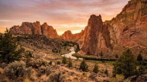
Bend sprawls 2.5 hours southeast in the high desert. The city claims 30+ craft breweries. Smith Rock State Park rises 30 minutes north of Bend, orange cliffs tower 600 feet above the Crooked River. Rock climbers from six continents show up here.
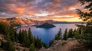
Crater Lake National Park requires 3.5 hours driving south. The volcanic caldera holds the deepest lake in the United States at 1,943 feet. Rim Drive opens July through October when snow clears.
Tillamook sits two hours west on the coast. The creamery factory pumps out 170,000 pounds of cheese daily. Tours run every 30 minutes. Newport spreads along Yaquina Bay 2.5 hours west. The Oregon Coast Aquarium houses the largest octopus exhibit in North America.
Practical Information
Weather changes fast here. Mount Hood meadows weather swings wildly depending on elevation. A sunny 70°F day at Zigzag becomes a 45°F drizzle at 5,000 feet. Check the NOAA weather forecast for Mount Hood area before you leave home.
Multiple webcams show live conditions. The mt hood weather cam at Timberline Lodge updates every few minutes. Mount Hood Meadows runs its own cam too. Both help you decide if that hike’s still a good idea.
May through October works best for hiking. Trails stay buried in snow until late June most years. July to September gives you the clearest windows. Skiing runs November to May at most resorts. Timberline operates lifts year-round when snow allows.
Pack layers. Temperatures drop 3 to 5 degrees for every 1,000 feet you climb. Rain gear belongs in your pack every month. Summer afternoon thunderstorms roll in without warning.
Grab a mount hood national forest map at any ranger station or download one before you lose cell service. GPS helps, but paper maps don’t need batteries. Service cuts out once you leave Highway 26.
Fire restrictions change by season. Check the Mount Hood National Forest current fire restrictions and alerts page before lighting any campfire. Bans typically run July through September during dry spells.
Wilderness permits are free. Pick one up at trailheads for overnight trips in designated wilderness areas. Summit climbers need a separate climbing permit.
Zigzag Ranger Station serves as the main information hub. Open weekdays year-round. Staff know current trail conditions better than any website.
Frequently Asked Questions
Is Mount Hood worth a visit?
Absolutely. Mount Hood National Forest delivers outstanding diversity of outdoor recreation within easy reach of Portland. Year-round skiing, 1,200+ miles of trails, clean alpine lakes, and beautiful mountain scenery make it one of the Pacific Northwest’s premier destinations. casual day hiker, or family camper, the forest has something for every skill level and interest. You can ski in the morning and hike through wildflower meadows in the afternoon. Few places offer this kind of variety in a single day.
Why is Mount Hood so famous?
Mount Hood is Oregon’s highest peak at 11,249 feet and the state’s most iconic natural landmark. It’s one of the most climbed glaciated peaks in North America. Year-round skiing here is possible, one of only a few places in the continental US where this happens. The mountain has appeared in numerous films. On clear days, you can see it from Portland, making it a symbol of the Pacific Northwest. Timberline Lodge, built in 1937, is a National Historic Landmark. It served as the exterior for the Overlook Hotel in “The Shining.”
Are there bears in the Mt. Hood Forest?
Yes. Black bears inhabit Mount Hood National Forest, though encounters are relatively rare. Practice proper food storage: use bear canisters or hang food at least 12 feet high and 6 feet from tree trunks. Never approach bears. Make noise while hiking to avoid surprising them. Carry bear spray in remote areas. Most bears are more interested in avoiding humans than confronting them. Attacks are extremely rare with proper precautions. Store food in your car trunk overnight if you’re car camping.
Does Mount Hood have waterfalls?
Yes. Mount Hood National Forest features numerous spectacular waterfalls throughout its boundaries. Ramona Falls is one of the most popular: a 120-foot cascade over columnar basalt reached via a 7-mile round-trip hike. Tamanawas Falls drops 100 feet into a natural amphitheater. It’s accessible via a moderate 3.8-mile round-trip trail. Other notable falls include Umbrella Falls, Sahalie Falls (nearby), and numerous unnamed cascades along mountain streams. Spring runoff makes May and June the best months for waterfall viewing.
What movie was filmed at Mount Hood?
The exterior shots of the Overlook Hotel in Stanley Kubrick’s “The Shining” (1980) were filmed at Timberline Lodge on Mount Hood. The lodge has since become a pilgrimage site for horror film fans, though the interior scenes were shot on soundstages. Other films featuring Mount Hood include “Wild” (2014) with Reese Witherspoon and various outdoor adventure documentaries. The mountain’s dramatic scenery and accessibility from Portland make it a popular filming location for commercials and outdoor content. You’ll recognize the lodge’s recognizable timber frame architecture instantly.