Estimated reading time: 12 minutes
Last updated: March 2026
Planning Tip
Key Takeaways Franklin Mountains State Park is America’s largest urban park at 24,000+ acres in El Paso, Texas Day use fee is $5 per person ages 13 and older The park offers 100+ miles of hiking and biking trails, camping, and rock climbing Tom Mays Unit provides the main camping area and visitor amenities Best visited October through April to avoid extreme summer heat Multiple trail options range from easy nature walks to challenging summit hikes
Table of Contents
- Exploring America’s Largest Urban Park
- Top Trails and Activities
- Getting There and Park Hours
- Fees and Passes
- Day Trips from Franklin Mountains
- When to Visit and What to Bring
- Frequently Asked Questions
Exploring America’s Largest Urban Park
How This Guide Was Researched
This guide was compiled from travel documentaries, verified tourism sources, and community traveler feedback. Prices and operational details were confirmed at the time of writing. We recommend checking official sources for the latest information before your trip.
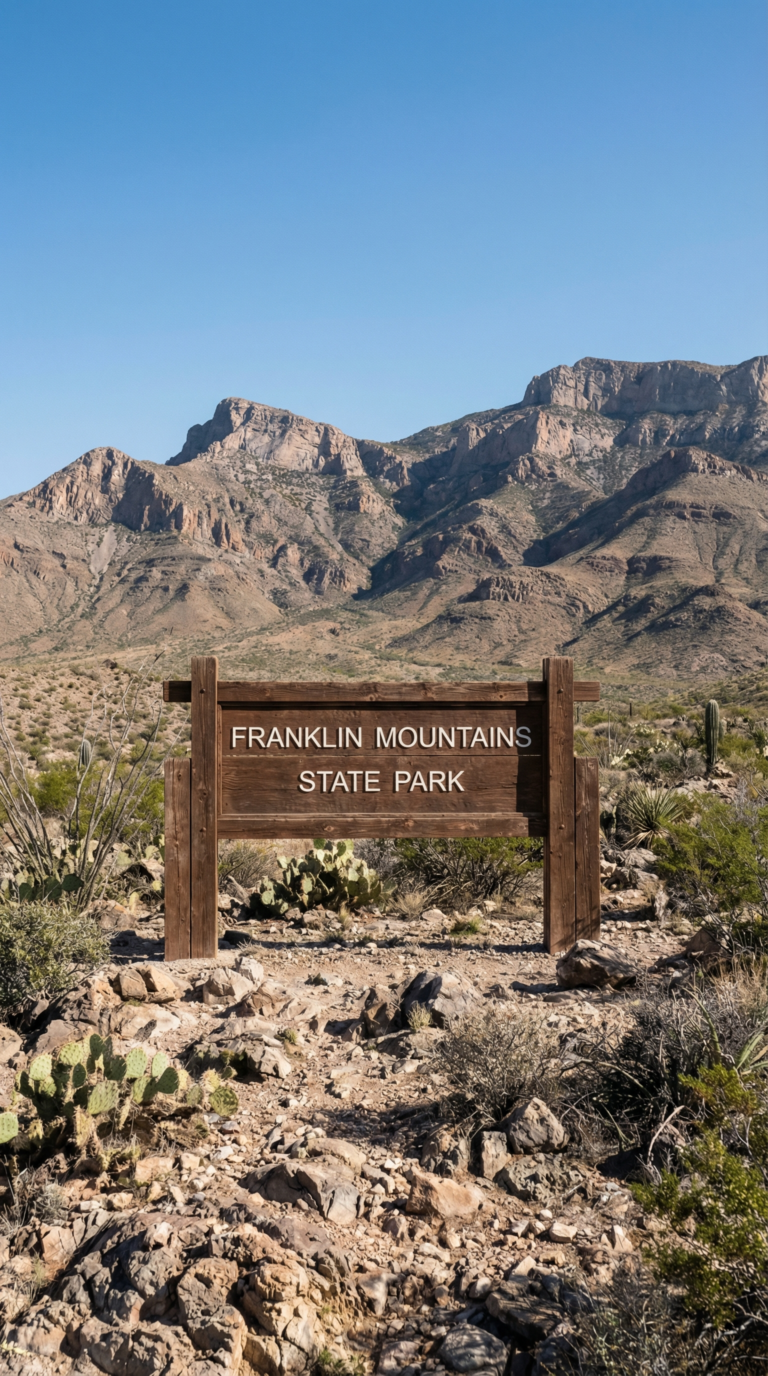
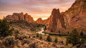
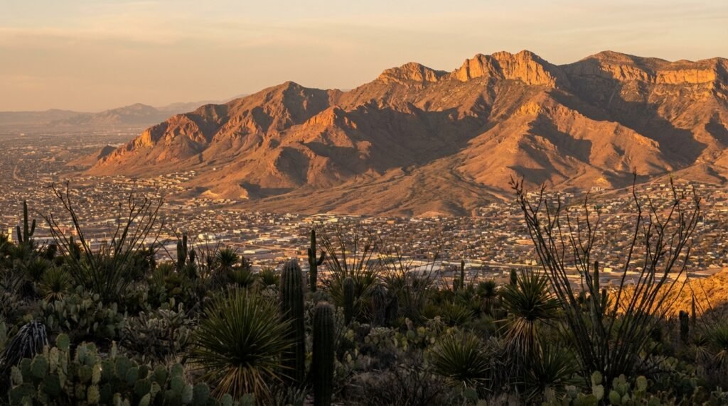
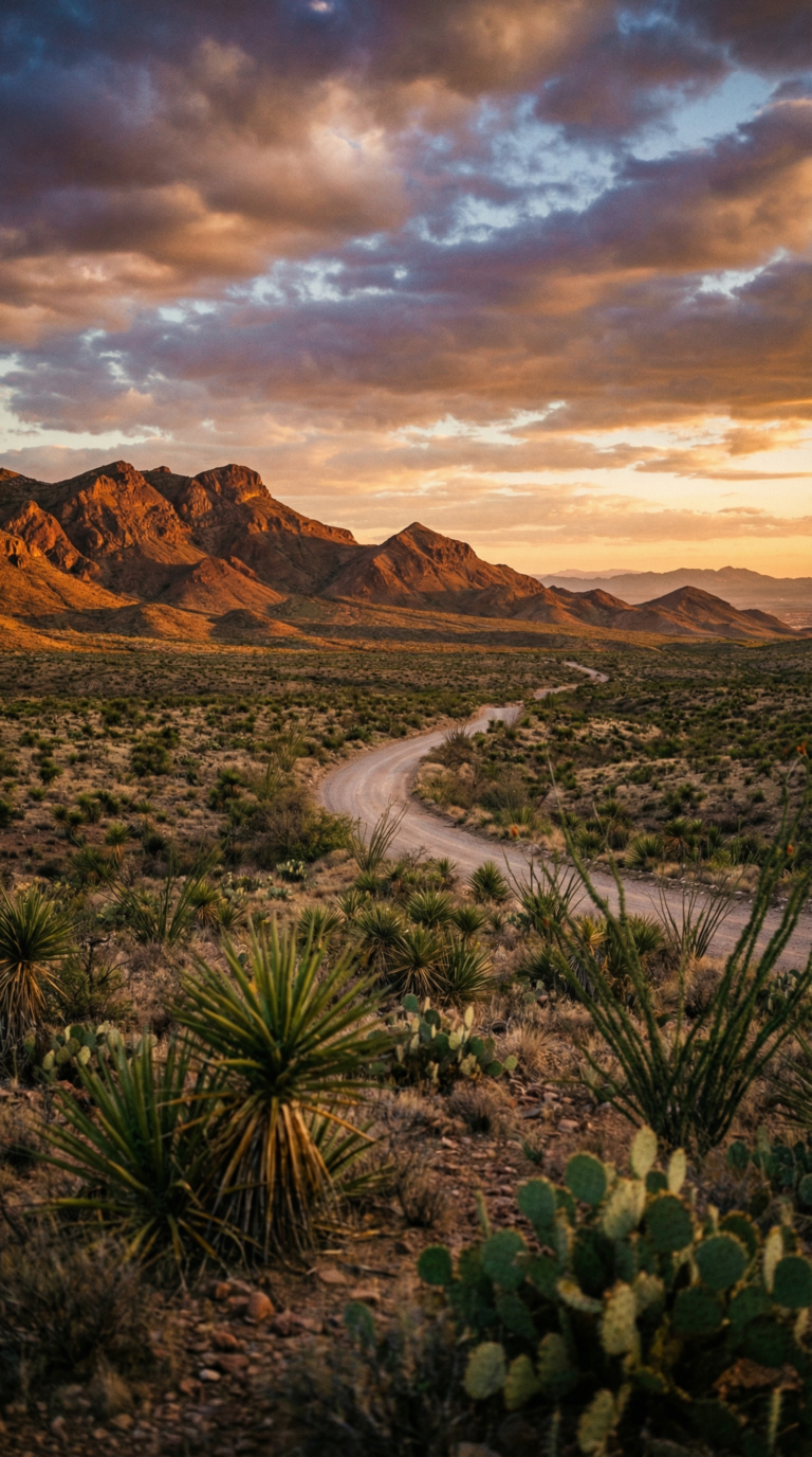
Franklin Mountains State Park sprawls across 24,247 acres. That makes it the largest urban park in the United States. Not just in Texas. The whole country.
The park sits inside El Paso city limits, which sounds impossible until you drive through it. You’re surrounded by desert peaks, creosote flats, and rocky arroyos while strip malls and residential neighborhoods press against the boundaries. The Franklin Mountains themselves run north-south through the city like a spine, splitting El Paso into east and west halves.
This is pure Chihuahuan Desert. Elevation swings from 4,500 feet at the base to 7,192 feet at North Franklin Peak. You’ll see ocotillo, prickly pear, lechuguilla, and if you’re lucky in spring, desert marigolds turning entire hillsides yellow. Mule deer show up at dawn. Roadrunners dart across trails. The ecosystem here doesn’t care that a city of 680,000 people lives next door.
People search for Franklin Mountains State Park El Paso Texas over 27,000 times per month. They’re looking for trails, camping spots, climbing routes, and a break from concrete. The park delivers all of it. Hikers use the 100-plus miles of trails. Climbers tackle limestone cliffs. Campers pitch tents at Tom Mays Unit. Mountain bikers ride technical singletrack.
This guide covers the trails you actually want to hike, how to get there, what you’ll pay, where to camp, and what to pack. No fluff. Just the details you need to plan a trip.
Top Trails and Activities
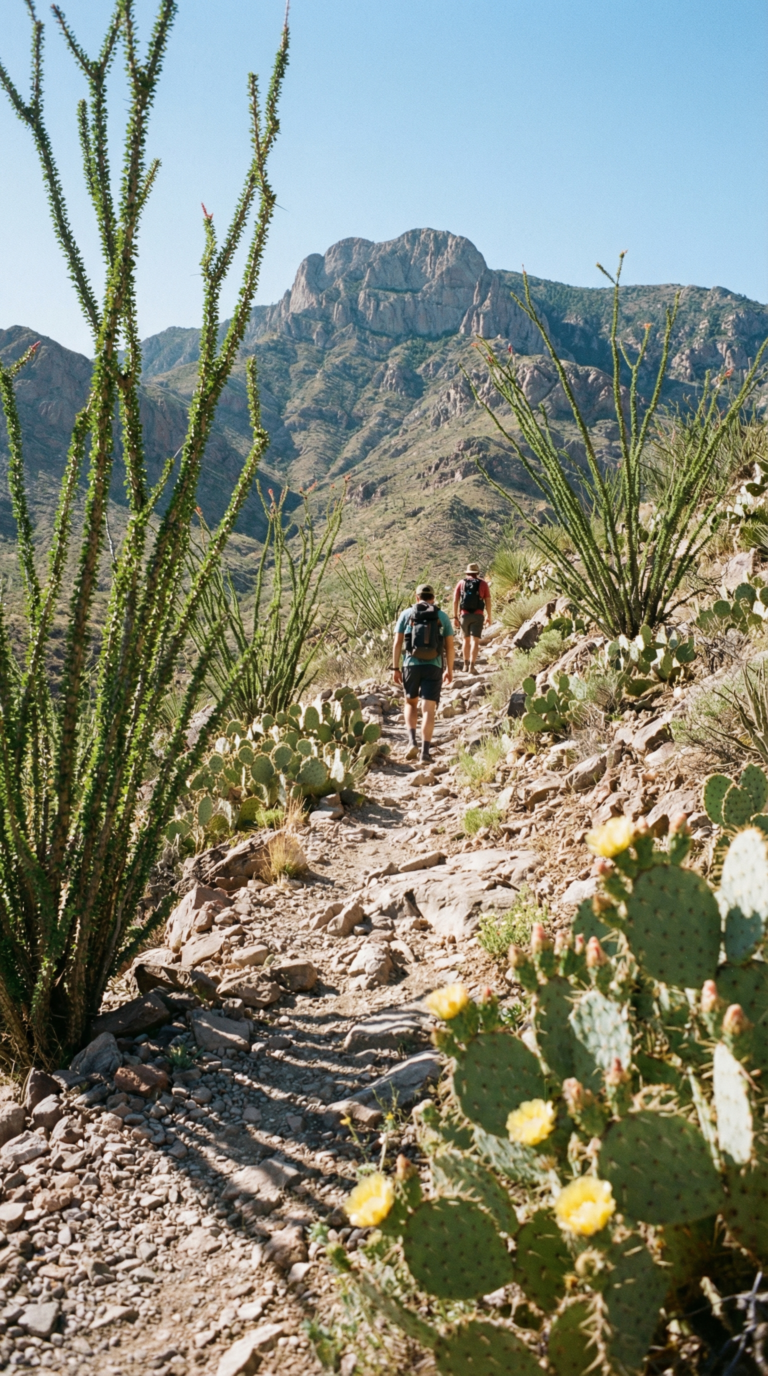
Franklin Mountains State Park spreads across 24,000 acres with over 100 miles of Franklin Mountains State Park hiking trails cutting through the Chihuahuan Desert. The trail network splits between single-track paths for hikers and wider routes open to mountain bikes. You’ll find everything from flat nature walks to technical scrambles that require hands-on rock work.
Planning Tip
The North Franklin Mountain Summit Trail ranks as the park’s toughest hike. This 7.4-mile round trip climbs 2,800 feet to the highest point in the range. The summit sits at 7,192 feet. On clear days, you can see downtown El Paso, the Rio Grande snaking through the valley, and Ciudad Juárez spreading across the Mexican side. Start early. Summer temperatures on exposed ridges hit 100°F by noon.
Easier options exist. Ron Coleman Trail runs 3.3 miles one-way with moderate elevation gain. Families stick to Cottonwood Canyon Trail, a 1.5-mile loop near the visitor center that stays relatively flat. Mundy’s Gap Trail offers a middle-ground option at 4 miles round trip with steady but manageable climbing.
Pick up a Franklin Mountains State Park trail map PDF before you start. The Franklin Mountains State Park Visitor Center stocks printed copies and sells water bottles. Rangers here answer questions about current trail conditions and recent wildlife sightings. The center opens at 8 AM daily. Get there when it opens to beat the heat and claim parking spots.
Franklin Mountains State Park camping operates out of the Tom Mays Unit on the west side of the range. The campground has 20 sites with picnic tables and fire rings. Five sites accommodate RVs up to 30 feet. No hookups exist, but vault toilets and potable water are available. Sites cost $15 per night. Reserve through the Texas Parks and Wildlife website during peak season (October through April).
Franklin Mountains State Park mountain biking follows designated multi-use trails. Bikes share routes with hikers on about 30 miles of the trail system. Technical riders head to the western slopes where rocky descents and tight switchbacks dominate. The park prohibits bikes on hiking-only trails. Check trail markers.
Rock climbers use the park year-round. McKelligon Canyon on the east side has established routes ranging from 5.6 to 5.12. Bring your own gear. No rentals or guide services operate inside the park boundaries.
The Wyler Aerial Tramway lifts visitors 940 vertical feet up Ranger Peak in four minutes. The gondola runs Thursday through Sunday. Tickets cost $9 for adults. At the top, a viewing platform overlooks three states and two countries. The tramway operates independently from the main park entrance.
Aztec Caves sit on the northeast side of the mountains, accessible via a short but steep trail from the McKelligon Canyon parking area. These aren’t true caves but rock shelters where prehistoric people left behind pictographs and tool fragments. The “caves” are shallow overhangs. The hike takes 30 minutes one-way.
Wildlife watching works best at dawn and dusk. Mule deer graze near water sources. Roadrunners dart across trails. Birdwatchers log sightings of golden eagles, ladder-backed woodpeckers, and canyon towhees. Geocachers have hidden 15 caches throughout the park. Download coordinates before you arrive since cell service drops in the canyons.
Stay on marked trails. The desert here looks uniform, but getting turned around happens fast once you leave the path. Carry your Franklin Mountains State Park map in a waterproof case. Download offline maps to your phone as backup.
Getting There and Park Hours
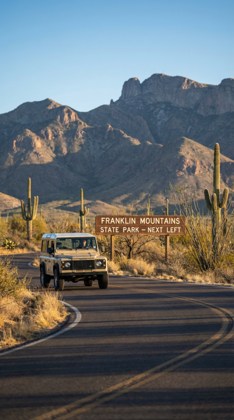
The park sprawls across multiple access points throughout El Paso. The main entrance and visitor center sit on Trans Mountain Road. From downtown, take US-54 North for about 10 miles, then exit at Trans Mountain Road heading west. The drive takes 20 minutes without traffic.
I-10 travelers should exit at Canutillo or Mesa Street, then follow signs toward Trans Mountain Road. The Tom Mays Unit sits on the west side via Transmountain Road, a separate entrance with its own trailhead parking.
Franklin Mountains State Park hours run daily from 8 AM to 5 PM. Summer heat sometimes forces adjusted schedules. Call ahead or check the Franklin Mountains State Park – Plan Your Visit page before you drive out. Gates close at 5 PM, but hikers already on trails can finish after hours. Just know that restrooms and the visitor center lock up at closing time.
Parking fills fast at popular trailheads on weekend mornings. The visitor center lot holds about 30 vehicles. Overflow parking exists at Tom Mays, but it’s a 15-minute drive from the main entrance. Arrive before 9 AM or after 3 PM to guarantee a spot.
Fees and Passes
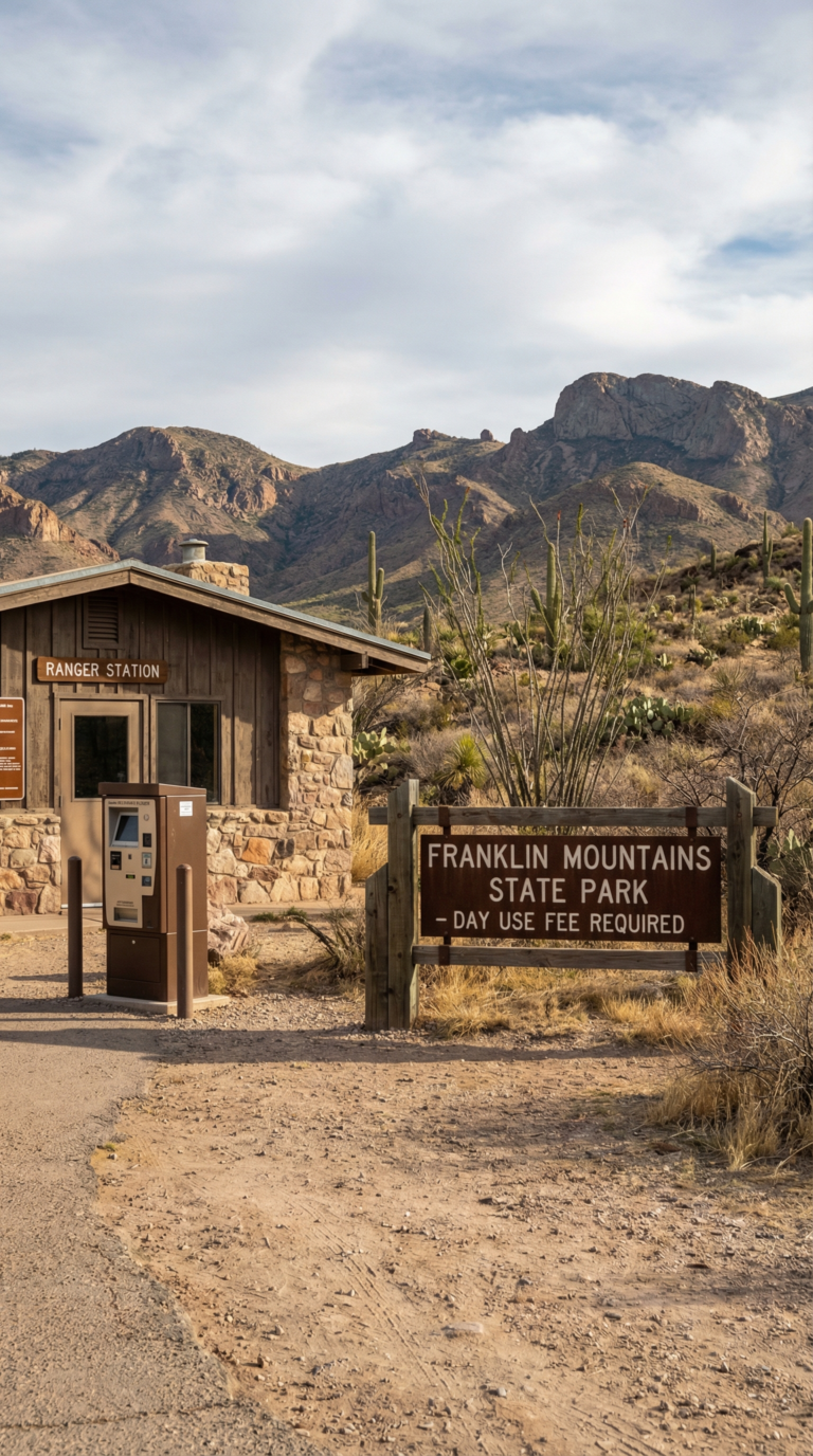
Day use costs $5 per person for anyone 13 and older. Kids 12 and under get in free. That’s it. No vehicle fees, no per-car charges, just a flat rate per adult.
Check the official Franklin Mountains State Park entrance fees page before you go. Fee structures occasionally change.
Camping at Tom Mays Unit runs separate from day use fees. Primitive sites start around $12 per night. RV sites with hookups cost more. Reserve ahead during peak season.
The Texas State Parks Pass covers entrance fees at all state parks for a year. If you plan to visit multiple Texas parks, the pass pays for itself fast. Annual passes cost around $70 for an individual.
Senior citizens 65 and older qualify for discounted rates at most Texas state parks. Ask at the entrance station. Some discounts apply to day use, others to camping.
Your fees fund trail maintenance, restroom upkeep, and ranger services. This park gets no federal money, it runs entirely on state funding and visitor fees.
Entrance stations accept credit cards and cash. Bring cash as backup. Cell service drops in some areas, and card readers occasionally fail. The visitor center also processes payments if the entrance kiosk is unstaffed.
Day Trips from Franklin Mountains
Franklin Mountains State Park sits at the edge of West Texas. Perfect for exploring the region’s wildest corners. El Paso’s border location means you can reach desert canyons, mountain peaks, and even Gulf Coast beaches within a day’s drive.
Guadalupe Mountains National Park lies 110 miles east. Takes about two hours. The park contains Guadalupe Peak, Texas’s highest point at 8,751 feet. Trails cut through limestone cliffs and pine forests that feel nothing like the Chihuahuan Desert around El Paso. Check the Official National Park Service page for Guadalupe Mountains National Park for current trail conditions before you go.
Big Bend National Park requires more commitment. Five hours south along the Rio Grande. The drive is brutal but the payoff is massive: 800,000 acres of desert mountains, river canyons, and zero light pollution. Visit the Official National Park Service page for Big Bend National Park to plan overnight camping. Day trips from El Paso are technically possible but exhausting.
Palo Duro Canyon in the Texas Panhandle offers another desert canyon experience. Six hours northeast. The second-largest canyon system in the United States. Red rock walls drop 800 feet. Most visitors combine it with an overnight in Amarillo.
Major Texas cities fan out in every direction. San Antonio sits eight hours east with the Alamo and River Walk. Austin is nine hours away. Houston takes eleven hours. Dallas and Fort Worth require ten hours of driving through flat ranch country. Waco splits the difference at nine hours.
Gulf Coast destinations like Corpus Christi, Galveston Island, Port Isabel, and Aransas Pass all sit twelve to fourteen hours away. Isla Blanca Park and the Queen Isabella Causeway mark the southern tip of Texas near the Mexican border. These require weekend trips, not day excursions.
Possum Kingdom Lake in central Texas offers reservoir recreation eight hours from El Paso. Bass fishing and cliff jumping.
El Paso’s border location means you can cross into Mexico in fifteen minutes. Ciudad Juárez sits right there. Franklin Mountains becomes your base camp for exploring two countries, not just one state.
When to Visit and What to Bring
October through April. That’s your window. Franklin Mountains State Park weather stays tolerable during these months, with daytime highs in the 60s and 70s. Summer turns brutal, temperatures crack 100°F (38°C) regularly from June through August. Winter brings its own surprises. Snow dusts the higher peaks occasionally, and mornings can drop below freezing.
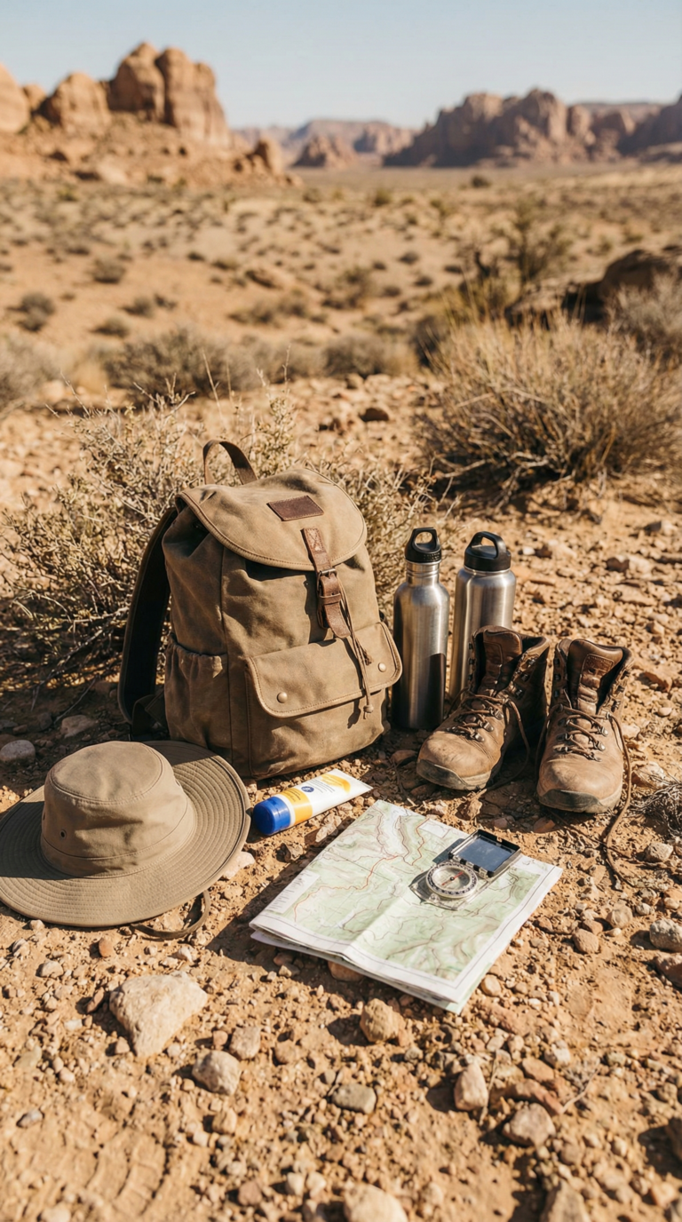
Water is non-negotiable. Carry at least one liter per hour of hiking when it’s warm. The desert doesn’t forgive dehydration. Your body loses moisture faster than you realize at elevations between 4,000 and 7,192 feet. That altitude hits harder if you’re visiting from sea level.
Pack a wide-brimmed hat, SPF 50 sunscreen, and polarized sunglasses. The sun reflects off rocks and sand. Wear broken-in hiking boots with ankle support, loose gravel and sharp limestone shred running shoes. Throw in a basic first aid kit, high-protein snacks, and a paper trail map. Cell service drops in several areas of the park.
Dogs can join you, but keep them leashed. Bring a collapsible bowl and extra water for them. Rattlesnakes hunt in cooler morning and evening hours. Stay on marked trails. Hiking solo increases risk, bring a partner.
Check the National Weather Service El Paso before you drive out. Weather shifts fast in the mountains. Afternoon thunderstorms materialize without warning during monsoon season (July through September).
Bring a camera. The Franklin Mountains State Park photos you’ll capture, jagged peaks against blue sky, ocotillo backlit at sunset, justify the gear weight. Franklin Mountains State Park reviews consistently mention one thing: visitors who prepare properly have better experiences. Those who don’t cut their trips short.
Frequently Asked Questions
How much does it cost to go to Franklin Mountains State Park?
Day use costs $5 per person for anyone 13 and older. Kids 12 and under get in free. That’s it for basic access. Camping at Tom Mays Unit runs extra, those fees are separate from the day use charge. If you visit Texas state parks regularly, the Texas State Parks Pass makes financial sense. It covers entry for a year.
What is there to do in Franklin Mountains State Park?
The park maintains over 100 miles of trails for hiking and mountain biking. Rock climbers use the granite faces throughout the range. Tom Mays Unit offers camping if you want to stay overnight. Wildlife viewing works year-round, mule deer, roadrunners, and golden eagles all live here. Bird watchers track desert species. Geocachers hunt coordinates across the terrain. Photographers shoot sunrise and sunset from the ridges. The Wyler Aerial Tramway gives you views without the climb. Aztec Caves and other rock formations reward exploration.
What is the most visited state park in Texas?
Palo Duro Canyon State Park holds that title. Franklin Mountains State Park claims a different distinction, it’s the largest urban park in the United States. The visitor count here doesn’t match Palo Duro, but no other park in Texas lets you hike desert mountains inside city limits. You can leave downtown El Paso and reach a trailhead in 15 minutes.
Do senior citizens get in free to Texas state parks?
Texas offers discounted rates for seniors 65 and older, but it’s not free entry. The exact discount changes based on current Texas Parks and Wildlife policies. The Texas Parklands Passport program may provide benefits to seniors. Call the park directly or check the official Texas Parks and Wildlife website for current senior rates before you visit.