This guide contains affiliate links. As an Amazon Associate we earn from qualifying purchases — at no extra cost to you.
Estimated reading time: 11 minutes
Last updated: July 2026
Table of Contents
- What Are the Best Hikes in Jotunheimen National Park?
- Discovering Jotunheimen National Park Hiking
- Conquering Galdhøpiggen, Norway’s Tallest Peak
- Essential Hiking Tips for Norway
What Are the Best Hikes in Jotunheimen National Park?
Jotunheimen’s best hikes range from Norway’s most famous day hike, the Besseggen Ridge above two differently coloured lakes, to the climb of Galdhøpiggen, the country’s tallest peak at 2,469 metres. Other favourites include the neighbouring summit of Glittertind, the airy Knutshøe ridge, and multi-day hut-to-hut treks on the DNT trail network. Routes range from half-day walks to glacier expeditions.
In the heart of Norway lies a realm that really lives up to its name: Jotunheimen, “Home of the Giants.” This magnificent national park represents the pinnacle of Norwegian mountain hiking, where dramatic peaks pierce the sky and ancient glaciers carve valleys of natural beauty. For hiking enthusiasts seeking the ultimate Norwegian adventure, Jotunheimen National Park hiking experiences offer some of the most spectacular and challenging terrain in all of Scandinavia.
At the center of this mountain destination stands Galdhøpiggen, Norway’s tallest peak at 2,469 meters, beckoning adventurous souls to test themselves against its rocky slopes. This iconic summit is more than a hiking destination; it’s a pilgrimage site for mountaineers and nature lovers who dream of standing atop Northern Europe’s highest point.
Whether you tackle the challenging glacier routes or use the extensive network of mountain huts that make multi-day treks accessible, Jotunheimen delivers experiences that define what Norwegian hiking is all about. Here, visitors learn why this region has inspired generations of explorers, poets, and adventurers who found something magical in these towering peaks and pristine alpine landscapes.
You can see this for yourself. Click here to watch the video from this point.
How This Guide Was Researched
The information in this guide was gathered from official destination websites, national park services, and experienced traveler reports. Costs, schedules, and conditions were verified at publication. We recommend confirming details directly before your visit.
Discovering Jotunheimen National Park Hiking
Jotunheimen National Park, whose name translates to “Home of the Giants,” lives up to its name with some of the most rugged and beautiful terrain in Northern Europe. This mountain range contains Norway’s highest concentration of peaks over 2,000 meters, creating a dramatic landscape of valleys, glaciers, and crystal-clear lakes that has drawn hikers for generations.
The park’s reputation as a hiking destination is well-earned, with trails that range from accessible day hikes to challenging multi-day treks. Norwegian poets and explorers have long found inspiration in these mountains, establishing a rich tradition of hiking in Norway that continues to this day.
Popular Trails in Jotunheimen National Park
Several trails have become legendary among hikers visiting Jotunheimen:
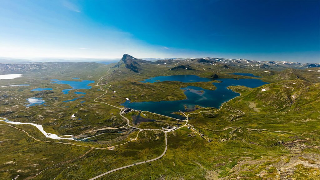
- Besseggen Ridge, Perhaps Norway’s most famous day hike, this trail begins with a boat ride across the emerald-green Lake Gjende. The ridge walk offers great views of lakes on either side, with dramatic drops that test your nerve but reward you with memorable vistas.
- Svartdalen (Black Valley), This scenic valley is surrounded by impressive peaks yet offers a somewhat less steep hiking option. The deep valley’s stark beauty makes it popular with photographers and nature lovers.
- Uranostind, If you want more adventure, this glacier hike requires proper equipment and preferably a guide. The reward is accessing one of Jotunheimen’s most spectacular viewpoints.
- The Historical Route from Gjendesheim to Eidsbugarden follows the paths of early mountaineers, offering a blend of natural beauty and cultural significance.
When to Hike Jotunheimen
The main hiking season runs with late June and early September, when snow typically clears from the major trails. July and August offer the most reliable weather, though these months also bring the most visitors. Early June and late September can provide more solitude but may require navigation of some snow patches on higher routes.
Weather in the Norwegian mountains can change rapidly, so hikers should always be prepared with proper gear regardless of when they visit. Even summer days can turn cold and wet with little warning.
Why Jotunheimen Suits All Hikers
What makes Jotunheimen National Park special is how it accommodates hikers of all levels:
- Beginners can enjoy well-marked trails like the path around Lake Gjende or shorter routes from mountain lodges.
- Intermediate hikers find perfect challenges in day hikes like Besseggen or parts of the Historical Route.
- Experienced trekkers can test themselves on summit attempts, multi-day traverses, or technical routes requiring scrambling and glacier crossings.
The park’s extensive network of DNT cabins (Norwegian Trekking Association huts) means hikers can travel light and find comfortable accommodation along many routes, making multi-day treks more accessible even to those new to backpacking.
What should I pack for hiking Jotunheimen?
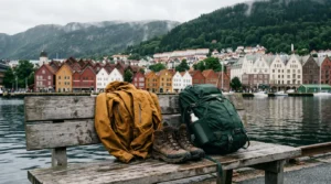
Jotunheimen is high alpine terrain — Norway’s tallest peaks, glaciers and Galdhøpiggen at 2,469 m, where even a sunny summer day can turn cold and wet fast. Norwegians say there’s no bad weather, only bad clothing. Layer up with the three-layer system:
- A merino base layer — moisture-wicking foundation against the skin
- A fleece insulating layer — traps warmth at altitude and on the summit
- A waterproof, windproof shell — mountain weather turns cold and wet with no warning
- Waterproof hiking boots — rocky, wet, often snow-streaked alpine trails
- Trekking poles — steep descents and glacier-fed stream crossings
- A daypack with hydration — long exposed days between DNT huts
- A headlamp — daylight shortens fast in late season
- A neck gaiter — wind and sun on exposed alpine ridges
- Moleskin blister pads — stop hotspots on the long Galdhøpiggen climb
As an Amazon Associate we earn from qualifying purchases.
Conquering Galdhøpiggen, Norway’s Tallest Peak
Standing proud at 2,469 meters (8,100 feet), Galdhøpiggen holds the title of tallest peak in Norway, Scandinavia, and Northern Europe. Found the heart of Jotunheimen National Park, this mountain represents the ultimate hiking achievement for many visitors to Norway. Despite its impressive height, Galdhøpiggen is remarkably accessible compared to other major European peaks.
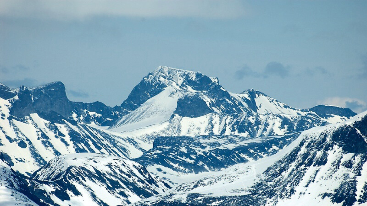
By Håvard Berland, Own work, CC BY 2.5, Link
Two Routes to the Summit
Hikers can choose between two main approaches to reach the summit of Galdhøpiggen:
The Spiterstulen Route
This is the classic and most straightforward path to the top:
- Starts from Spiterstulen Lodge at 1,100 meters elevation
- Covers about 5 km (one way) with roughly 1,400 meters of elevation gain
- Takes 4-6 hours for the round trip, depending on fitness level
- Requires no special permits or guides
- Follows well-marked trails over rocky terrain
The Spiterstulen route is suitable for most reasonably fit hikers with good footwear and proper clothing. While steep in sections, it involves no technical climbing. Many hikers completing iconic Norwegian hikes like Pulpit Rock near Stavanger find Galdhøpiggen a natural next step in their Norwegian hiking journey, as both demand solid preparation for steep, rocky terrain—and if you’re planning that Stavanger adventure, our guide to the best gear for Pulpit Rock covers exactly what to pack for Norway’s exposed clifftop trails.
The Juvasshytta Route
This alternative approach offers a different experience:
- Begins from Juvasshytta Lodge at 1,850 meters
- Involves crossing the Styggebreen glacier
- Requires joining a guided group (available daily in summer)
- Takes 5-7 hours round trip
- Offers spectacular glacier scenery
While shorter in distance, this route is not necessarily easier due to the glacier crossing, which requires ropes and guidance from professional mountain guides.
Safety Tips for Hiking Galdhøpiggen
Climbing Norway’s tallest peak requires preparation and respect for mountain conditions:
- Weather awareness, Check forecasts carefully and be prepared to turn back if conditions deteriorate
- Proper clothing, Bring waterproof outer layers, warm mid-layers, hat and gloves regardless of season
- Essential supplies, Carry adequate water (limited sources on route), high-energy food, first aid kit, and navigation tools
- Timing, Start early to allow plenty of daylight for the return journey
- Communication, Inform someone of your plans and expected return time
The Summit Experience
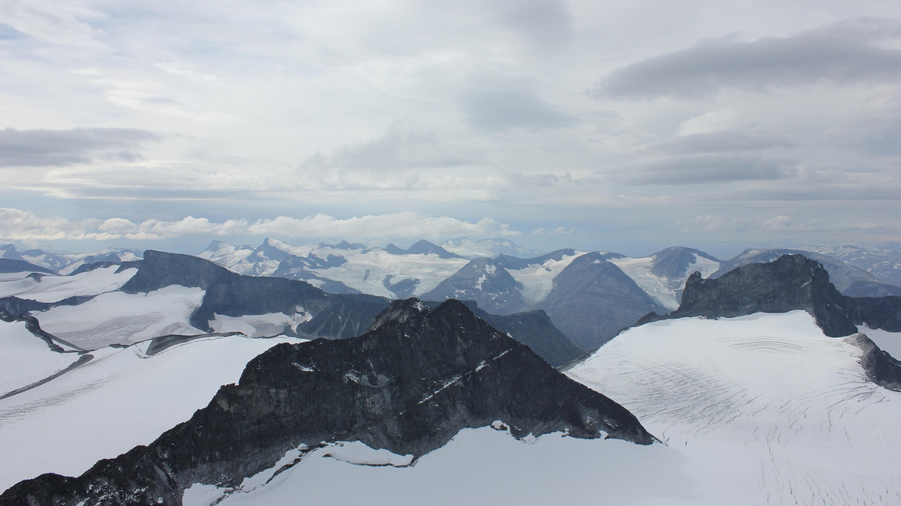
Reaching the top of Galdhøpiggen tallest peak Norway rewards hikers with really spectacular 360-degree panoramas. On clear days, the views extend across countless snow-capped peaks, glaciers, and deep valleys. The summit features a small stone shelter that provides welcome protection from the elements.
Many hikers describe standing on Galdhøpiggen as a profound experience, the feeling of being on top of Northern Europe, with nothing but sky above and a sea of mountains below, creates memories that last a lifetime. The summit is marked with the traditional Norwegian red “T” and often features a Norwegian flag fluttering in the mountain breeze.
Essential Hiking Tips for Norway
Hiking in Norway offers incredible rewards but also presents unique challenges. Following these essential guidelines will help make sure a safe and enjoyable experience in Norway’s magnificent wilderness.
Weather Preparedness
Norwegian mountain weather is notoriously changeable, requiring specific preparation:
- Layer your clothing using the three-layer principle: base layer (moisture-wicking), insulating layer (wool or fleece), and outer layer (waterproof and windproof)
- Always pack extra warm clothes, even on sunny summer days
- Check weather forecasts from reliable sources like yr.no (Norwegian Meteorological Institute)
- Be prepared to turn back if conditions deteriorate
- Start early to allow buffer time in case of weather changes
The Norwegian saying “Det finnes ikke dårlig vær, bare dårlige klær” (There’s no such thing as bad weather, only bad clothing) reflects the local approach to outdoor activities in all conditions.
Essential Gear for Jotunheimen Hiking
Beyond standard hiking equipment, consider these Norway-specific items:
- Waterproof hiking boots with good ankle support for rocky, often wet terrain
- Trekking poles to help with steep descents and stream crossings
- Mosquito repellent (essential in summer, especially in forested areas)
- Detailed topographic maps and compass (don’t rely solely on phone GPS)
- Headlamp with extra batteries (particularly important in late season when daylight shortens)
- High-energy snacks like chocolate, nuts, and dried fruits
- Water bottle or hydration system (while mountain water is often drinkable, carry water treatment if unsure)
Trail Navigation and Safety
Norway uses a specific trail marking system that hikers should understand:
- Look for red “T” marks painted on rocks and trees along DNT (Norwegian Trekking Association) routes
- Stone cairns (varder) often mark paths above the treeline
- Always stay on marked trails unless you have advanced navigation skills
- Inform someone of your planned route and expected return time
- Consider joining guided hikes for more challenging routes or if you’re new to Norwegian mountains
DNT Cabins and Resources
The Norwegian Trekking Association (DNT) maintains an extensive network of mountain cabins that hikers should know about:
- Staffed lodges (betjente hytter) offer meals and accommodation
- Self-service cabins (selvbetjente hytter) provide beds, food for purchase, and cooking facilities
- No-service cabins (ubetjente hytter) offer basic shelter
- Consider purchasing a DNT membership for discounted stays and support of trail maintenance
- The DNT route planner (UT.no) is an invaluable resource for planning hikes
Environmental Responsibility
Norway’s untouched wilderness depends on visitors following key principles:
- Practice “Leave No Trace” ethics: pack out all trash
- Respect the allemannsretten (right to roam) by following its responsibilities
- Close gates behind you when crossing farmland
- Keep distance from wildlife, especially during breeding seasons
- Use established fire sites only and check local fire restrictions
By following these guidelines, you’ll ensure your own safety and also help preserve Norway’s natural beauty for future generations of hikers.
Frequently Asked Questions about Hiking Jotunheimen
When is the best time to hike in Jotunheimen?
The main hiking season runs from late June to mid-September, when snow has cleared from most trails, the DNT huts and the Gjende ferry to Besseggen are operating, and daylight is long. July and August are the most reliable; shoulder weeks can still see snow at altitude, so always check conditions before you set out.
How difficult is hiking in Jotunheimen?
It ranges widely. There are gentle valley and lake walks suitable for most fitness levels, plus demanding routes like the Besseggen Ridge (about 6 to 8 hours with steep, exposed sections) and the climb of Galdhøpiggen. The glacier route up Galdhøpiggen requires a guide. Good boots, layers, and navigation skills are essential on the higher trails.
How do you get to Jotunheimen National Park?
Most hikers drive; Jotunheimen is roughly 4 to 5 hours from Oslo and about 4 hours from Bergen. Without a car, you can reach gateway towns like Lom, Gjendesheim, and Beitostølen by long-distance bus in summer. Lom and Gjendesheim are the usual bases for Galdhøpiggen and Besseggen.
Do you need a guide to climb Galdhøpiggen?
For the popular route from Juvasshytta you must join a guided group, because it crosses a crevassed glacier where roped travel is required. The longer route from Spiterstulen has no glacier and can be done independently by fit, well-prepared hikers, though it involves more ascent.
What is the Besseggen Ridge hike like?
Besseggen is Norway’s most famous day hike, a 6 to 8-hour traverse high above the emerald-green Gjende and deep-blue Bessvatnet lakes. Most people take the morning ferry across Gjende and hike back over the ridge, which includes steep, hands-on scrambling. Start early and watch the weather.